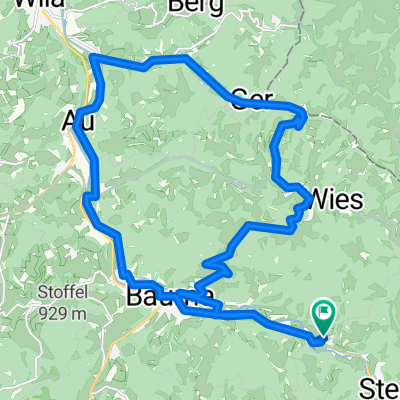
Zürioberland: Tösswald - Schnebelhorn - Hörnli
- 37,3 km
- 1695 m
- 1702 m
- Bauma, Zurych, Szwajcaria
Trasa rowerowa rozpoczynająca się w Bauma, Zurych, Szwajcaria.
Przegląd
Piękna trasa rowerowa górska w Oberlandzie zuryskim. Średni poziom trudności z częściami bardzo stromymi (15-20%).
Różnica wysokości 1100 m
Czas jazdy około 3 godziny 15 minut
Dane wysokościowe na tej mapie nie są dokładne, ponieważ linie konturowe zostały przerysowane kursorem.
Trasa szczegółowo opisana m.in. w książce 'Mountainbike-Erlebnis' V. Eggenbergera (Climbe & Bike Edition 1995)
utworzono 17 lat temu temu
Najważniejsze punkty trasy

Schnebelhorn 1291m.ü.M. Bild: Source Wikipedia.org
Kontynuuj z Bikemap
Chcesz przejechać trasę Bauma-Schnebelhorn lub dostosować ją do swojej wycieczki? Oto, co możesz zrobić z tą trasą na Bikemap:
3 dni bezpłatnej wersji próbnej lub jednorazowa opłata. Dowiedz się więcej o Bikemap Premium.
Odkryj więcej funkcji Premium.
Uzyskaj Bikemap PremiumOd naszej społeczności
Otwórz ją w aplikacji