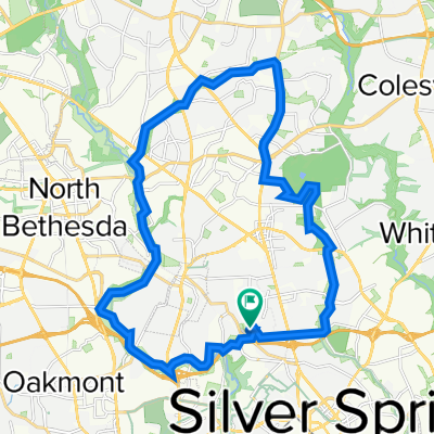
- 30,2 km
- 176 m
- 190 m
- Forest Glen, Maryland, USA
Fort Stevens Loop
Trasa rowerowa rozpoczynająca się w Forest Glen, Maryland, USA.
Przegląd
O tej trasie
Krótka trasa rozpoczynająca się w Woodside Park i prowadząca do historycznych miejsc związanych z atakiem Jubala Early'ego na Waszyngton D.C. latem 1864 roku. W przejażdżce zawarte są cmentarz konfederatów, cmentarz Unii oraz umocnienia w Fort Stevens i Fort DeRussy. Przejazd kończy się krótką podróżą przez Park Rock Creek i powrotem do Woodside.
- -:--
- Czas
- 20,3 km
- Dystans
- 157 m
- Przewyższenia
- 157 m
- Spadek
- ---
- Śr. Prędkość
- ---
- Maks. wysokość
utworzono 6 lat temu temu
Jakość trasy
Typy dróg i nawierzchnie na trasie
Typy dróg
Droga
7,5 km
(37 %)
Spokojna droga
5,1 km
(25 %)
Powierzchnie
Utwardzona
16,2 km
(80 %)
Asfalt
15,4 km
(76 %)
Nawierzchnia (nieokreślona)
0,6 km
(3 %)
Najważniejsze punkty trasy
Punkty zainteresowania na trasie
Interesujące miejsce po 1,6 km
9315 Greyrock Road. "Grey Rocks". At the time of Jubal Early's raid, this was the home of Doctor Henry Ford Condict. On July 11, 1864, the house was occupied by the Confederates and used as an observation post and a rendezvous point for cavalry searching for horses and provisions.
Interesujące miejsce po 2,6 km
Raymond W. Burche's home. Shells from Union artillery fell around this property. Now demolished.
Interesujące miejsce po 3,4 km
1504 Noyes Drive. When excavating the back yard of ths house for an addition, a ten-inch Union Parrott shell from the Civil War was discovered.
Interesujące miejsce po 3,4 km
8818 1st Avenue "Woodside" was Richard T. Wilson's Home at the time of the raid. This was a farmhouse with a driveway leading to Georgia Avenue. Wilson was a confederate sympathizer and this house was used as Confederate Major General John C. Breckinridge's headquarters. The Wilson Farm encompassed all of what is now Woodside and the western part of Woodside Park.
Interesujące miejsce po 3,6 km
John C. Wilson's home. John Wilson supported the Union. His brother Richard supported the Confederacy. The house is now demolished.
Interesujące miejsce po 4,4 km
"Sligo" was the name of Silver Spring during the Civil War. On 11-12 July 1864, the businesses here, including Lewis Graves' dry goods store, Rayney's store, and Barnes' Tavern farther south were looted by Confederate soldiers.
Interesujące miejsce po 4,4 km
The Eagle Inn.
Interesujące miejsce po 4,8 km
"Falkland", Montgomery Blair's mansion, stood here in 1864. It was burned by Confederate troops at the time of the raid. The ruin stood here until 1958, when it was burned down again to make way for Blair Plaza.
Interesujące miejsce po 5,3 km
Silver Cycles.
Interesujące miejsce po 5,4 km
Francis Preston Blair's "Silver Spring" mansion. This house was used by General Jubal Early as his headquarters. Now demolished.
Interesujące miejsce po 6,4 km
James Blair's "The Moorings". This is the only one of the Blair family's Silver Spring mansions still standing. From 1934 to 1957, the house served as the Silver Spring Public Library.
Interesujące miejsce po 8,5 km
Battleground National Cemetery. Here are buried the US soldiers who died defending Washington from Jubal Early's raid on 11-12 July 1864.
Interesujące miejsce po 9,5 km
Fort Stevens Battlefield Park There are a few gun emplacements remaining and a monument to the battle.
Interesujące miejsce po 12 km
Fort DeRussy. This fort is overgrown, but there is a marker and the banks that supported the gun emplacements can still be seen. There were no trees here in 1864.
Interesujące miejsce po 20,3 km
Confederate Cemetery. Ten years after the Civil War, soldiers of the Confederacy who had died during Jubal Early's raid on Washington, and who had been buried in nearby fields were exhumed and reburied together in Grace Church graveyard.
Kontynuuj z Bikemap
Użyj, edytuj lub pobierz tę trasę rowerową
Chcesz przejechać trasę Fort Stevens Loop lub dostosować ją do swojej wycieczki? Oto, co możesz zrobić z tą trasą na Bikemap:
Darmowe funkcje
- Zapisz tę trasę jako ulubioną lub w kolekcji
- Skopiuj i zaplanuj swoją wersję tej trasy
- Synchronizuj swoją trasę z Garminem lub Wahoo
Funkcje Premium
3 dni bezpłatnej wersji próbnej lub jednorazowa opłata. Dowiedz się więcej o Bikemap Premium.
- Nawiguj po tej trasie na iOS i Androidzie
- Eksportuj plik GPX / KML tej trasy
- Stwórz swój własny wydruk (wypróbuj za darmo)
- Pobierz tę trasę do nawigacji offline
Odkryj więcej funkcji Premium.
Uzyskaj Bikemap PremiumOd naszej społeczności
Forest Glen: Inne popularne trasy rozpoczynające się tutaj
- Hollow Glen Place 9910, Silver Spring to Hollow Glen Place 9910, Silver Spring
- Route to Willard Ave & River Rd, Bethesda
- 11,8 km
- 195 m
- 176 m
- Forest Glen, Maryland, USA
- Bethesda Apple Store
- 7,8 km
- 72 m
- 95 m
- Forest Glen, Maryland, USA
- Fort Stevens Loop
- 20,3 km
- 157 m
- 157 m
- Forest Glen, Maryland, USA
- Hollow Glen Place 9910, Silver Spring to Hollow Glen Place 9910, Silver Spring
- 36 km
- 256 m
- 250 m
- Forest Glen, Maryland, USA
- Hollow Glen Place 9910, Silver Spring to Hollow Glen Place 9910, Silver Spring
- 38,4 km
- 237 m
- 242 m
- Forest Glen, Maryland, USA
- Rosa Silver Spring
- 7,4 km
- 90 m
- 66 m
- Forest Glen, Maryland, USA
- Post Office Road 10, Silver Spring to Hollow Glen Place 9910, Silver Spring
- 43,8 km
- 276 m
- 283 m
- Forest Glen, Maryland, USA
Otwórz ją w aplikacji


