

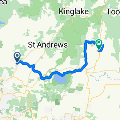
e-MTB Adventure Ride. Hurstbridge, Kinglake, Mt Everard Track, Eltham, Surrey Hills.
Trasa rowerowa rozpoczynająca się w Hurstbridge, Wiktoria, Australia.
Przegląd
O tej trasie
Ogólne wskazówki i komentarz.
Jadę moim e-MTB (Bosch Performance Line CX) z 2 bateriami 500Wh. Zasięg niektórych tras wymaga dwóch baterii 500Wh. Jeśli jeździsz e-MTB, zrozum zasięg baterii, jaki możesz uzyskać na swoim rowerze elektrycznym na dowolnym terenie oraz czy masz możliwości, aby ukończyć przejażdżkę. Wszystkie moje opublikowane trasy zostały przejechane i nagrane GPS.
Jeśli korzystasz z jakichkolwiek informacji zawartych w trasie/ścieżce, w całości lub częściowo, musisz wziąć pod uwagę następujące:
Jedziesz na własne ryzyko. Nie ponoszę odpowiedzialności za jakiekolwiek nieścisłości ani za wypadki lub urazy, które mogą wyniknąć z korzystania z dowolnej ścieżki GPS/GPX lub trasy lub innych danych lub informacji znajdujących się w jakimkolwiek opublikowanym materiale trasy.
Ścieżki, warunki drogowe i przejazdy przez cieki wodne mogą zmieniać się z dnia na dzień z różnych powodów (pogoda, osuwiska, zamknięcia szlaków, powodzie, roboty drogowe), przez co wcześniej dobre trasy mogą stać się nieprzejezdne, niebezpieczne lub zamknięte w dowolnym momencie. Spodziewaj się konieczności objazdów w każdej chwili. Miej "Plan B" i bądź przygotowany na każdą ewentualność.
Informacje podane o każdej trasie dotyczą momentu, kiedy trasa była przejechana. Ocena trudności może się znacznie różnić od tego, co uważasz za trasę dla średniozaawansowanych, doświadczonych lub zaawansowanych. Zawsze jedź zgodnie ze swoimi możliwościami. Traktuj każdą przejażdżkę na podstawie podanej informacji ostrożnie, spodziewając się, że warunki mogą być inne niż podczas nagrania trasy.
Spodziewaj się stromych podjazdów i zjazdów, luźnego żwiru, kolein, cieków wodnych, powalonych drzew i w niektórych przypadkach konieczności prowadzenia roweru.
Informacje zawierające trasy/ścieżki GPS/GPX są podawane "takie jakie są" i to twoja odpowiedzialność, by ocenić ich przydatność do twoich celów.
Sprawdź oceny zagrożenia pożarowego CFA przed jazdą. Nie jeźdź przy warunkach przekraczających poziom Niskie - Umiarkowane na skali zagrożenia pożarowego CFA.
Zawsze informuj kogoś o swoich planach, godzinie wyjazdu oraz szacowanym czasie przyjazdu.
Miej zapasową nawigację i korzystaj z urządzeń nawigacyjnych. Drugie urządzenie GPS lub telefon komórkowy z prawdziwym GPS, które nie zależy od zasięgu wieży telefonicznej. Zainstaluj trasy/ścieżki GPX na wszystkich urządzeniach lub noś mapę i kompas.
Nie polegaj na dostępie do zasięgu sieci komórkowej w każdej chwili.
Podczas wszystkich przejazdów musisz być samowystarczalny pod względem jedzenia, wody i zapasowych części oraz mieć umiejętność wykonywania napraw roweru.
- -:--
- Czas
- 82,1 km
- Dystans
- 1162 m
- Przewyższenia
- 1150 m
- Spadek
- ---
- Śr. Prędkość
- ---
- Maks. wysokość

Jakość trasy
Typy dróg i nawierzchnie na trasie
Typy dróg
Spokojna droga
40,2 km
(49 %)
Droga rowerowa
13,9 km
(17 %)
Powierzchnie
Utwardzona
38,6 km
(47 %)
Nieutwardzona
27,9 km
(34 %)
Asfalt
23,8 km
(29 %)
Nieutwardzony (nieokreślony)
17,2 km
(21 %)
Kontynuuj z Bikemap
Użyj, edytuj lub pobierz tę trasę rowerową
Chcesz przejechać trasę e-MTB Adventure Ride. Hurstbridge, Kinglake, Mt Everard Track, Eltham, Surrey Hills. lub dostosować ją do swojej wycieczki? Oto, co możesz zrobić z tą trasą na Bikemap:
Darmowe funkcje
- Zapisz tę trasę jako ulubioną lub w kolekcji
- Skopiuj i zaplanuj swoją wersję tej trasy
- Podziel trasę na etapy, aby utworzyć kilkudniową wycieczkę
- Synchronizuj swoją trasę z Garminem lub Wahoo
Funkcje Premium
3 dni bezpłatnej wersji próbnej lub jednorazowa opłata. Dowiedz się więcej o Bikemap Premium.
- Nawiguj po tej trasie na iOS i Androidzie
- Eksportuj plik GPX / KML tej trasy
- Stwórz swój własny wydruk (wypróbuj za darmo)
- Pobierz tę trasę do nawigacji offline
Odkryj więcej funkcji Premium.
Uzyskaj Bikemap PremiumOd naszej społeczności
Hurstbridge: Inne popularne trasy rozpoczynające się tutaj
 e-MTB Adventure Ride. Hurstbridge, Sugarloaf Reservoir, Warrandyte, Surrey Hills.
- Dystans
- 72,9 km
- Przewyższenia
- 808 m
- Spadek
- 815 m
- Lokalizacja
- Hurstbridge, Wiktoria, Australia
 Hurstbridge Kinglake loop
- Dystans
- 70,2 km
- Przewyższenia
- 665 m
- Spadek
- 665 m
- Lokalizacja
- Hurstbridge, Wiktoria, Australia
 e-MTB Adventure Ride. Hurstbridge, St Andrews, Panton Hill, Hurstbridge
- Dystans
- 50,9 km
- Przewyższenia
- 826 m
- Spadek
- 822 m
- Lokalizacja
- Hurstbridge, Wiktoria, Australia
 e-MTB Adventure Ride. Hurstbridge, Warrandyte-Kinglake Nature Conservation Reserve, Diamond Creek.
- Dystans
- 45,7 km
- Przewyższenia
- 847 m
- Spadek
- 870 m
- Lokalizacja
- Hurstbridge, Wiktoria, Australia
 1 Saturday Morning - Hurstbridge - Yarra Glen (ridge route)
- Dystans
- 34 km
- Przewyższenia
- 514 m
- Spadek
- 468 m
- Lokalizacja
- Hurstbridge, Wiktoria, Australia
 Maroondah Aqueduct
- Dystans
- 34 km
- Przewyższenia
- 369 m
- Spadek
- 392 m
- Lokalizacja
- Hurstbridge, Wiktoria, Australia
 Hurstbridge Kinglake
- Dystans
- 56,4 km
- Przewyższenia
- 659 m
- Spadek
- 664 m
- Lokalizacja
- Hurstbridge, Wiktoria, Australia
 e-MTB Adventure Ride. Hurstbridge, Kinglake, Mt Everard Track, Eltham, Surrey Hills.
- Dystans
- 82,1 km
- Przewyższenia
- 1162 m
- Spadek
- 1150 m
- Lokalizacja
- Hurstbridge, Wiktoria, Australia
Otwórz ją w aplikacji