

France - été 2019
Trasa rowerowa rozpoczynająca się w Puplinge, Genewa, Szwajcaria.
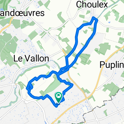
Przegląd
O tej trasie
Z Stéph - 6 tygodni - 2200 kilometrów według mojego licznika! Trasa przybliżona. Spaliśmy w:
-
dolinie Joux,
-
u Régine
-
u Maxime
-
u Muriel
-
na kempingu Belfort
-
5 nocy u Justine
-
jedna noc w Louvière (pensjonat)
-
u Bertranda Thiebault
-
2 noce u Aline w Troyes
-
jedna noc na kempingu na południe od Tonnerre w Lézinnes
-
2 noce w Precy sous Thil u Guillaume'a
-
jedna noc na kempingu przy jeziorze Saint Agnan
-
pensjonat niedaleko Glux en Glenn
-
kemping w Dornes (bardzo gorąco)
-
2 noce w hotelu w Montluçon (deszcz i burza)
-
jedna noc na kempingu w Aubusson
-
2 noce u Mary i José (blisko Gentioux Pigerolles)
-
jedna noc w Corrèze
-
jedna noc w Altillac nad Dordonną
-
pensjonat w Entraygues
-
jedna noc w Saint-Urcize
-
jedna noc w Chasserades
-
jedna noc na okropnym kempingu w Orgnac (zakurzony, hałaśliwy).
-
4 noce w Barroux
-
jedna noc w Crest
-
jedna noc w pięknym pensjonacie za przełęczą Quinssieu (les roches)
-
jedna noc w Paladru
-
i jedna noc w Seyssel!
(Zrobiłem też Ventoux przez Malaucène, gdy byliśmy w Barroux!)
- -:--
- Czas
- 2122,9 km
- Dystans
- 4948 m
- Przewyższenia
- 4948 m
- Spadek
- ---
- Śr. Prędkość
- ---
- Maks. wysokość

Jakość trasy
Typy dróg i nawierzchnie na trasie
Typy dróg
Droga
891,6 km
(42 %)
Spokojna droga
594,4 km
(28 %)
Powierzchnie
Utwardzona
743 km
(35 %)
Nieutwardzona
63,7 km
(3 %)
Asfalt
679,3 km
(32 %)
Nawierzchnia (nieokreślona)
42,5 km
(2 %)
Kontynuuj z Bikemap
Użyj, edytuj lub pobierz tę trasę rowerową
Chcesz przejechać trasę France - été 2019 lub dostosować ją do swojej wycieczki? Oto, co możesz zrobić z tą trasą na Bikemap:
Darmowe funkcje
- Zapisz tę trasę jako ulubioną lub w kolekcji
- Skopiuj i zaplanuj swoją wersję tej trasy
- Podziel trasę na etapy, aby utworzyć kilkudniową wycieczkę
- Synchronizuj swoją trasę z Garminem lub Wahoo
Funkcje Premium
3 dni bezpłatnej wersji próbnej lub jednorazowa opłata. Dowiedz się więcej o Bikemap Premium.
- Nawiguj po tej trasie na iOS i Androidzie
- Eksportuj plik GPX / KML tej trasy
- Stwórz swój własny wydruk (wypróbuj za darmo)
- Pobierz tę trasę do nawigacji offline
Odkryj więcej funkcji Premium.
Uzyskaj Bikemap PremiumOd naszej społeczności
Puplinge: Inne popularne trasy rozpoczynające się tutaj
 60km Rundfahrt relativ flach
- Dystans
- 58,7 km
- Przewyższenia
- 235 m
- Spadek
- 234 m
- Lokalizacja
- Puplinge, Genewa, Szwajcaria
 France - été 2019
- Dystans
- 2122,9 km
- Przewyższenia
- 4948 m
- Spadek
- 4948 m
- Lokalizacja
- Puplinge, Genewa, Szwajcaria
 Chemin des Agrimenseurs, Thônex à Chemin des Sillons 7, Thônex
- Dystans
- 7,1 km
- Przewyższenia
- 7 m
- Spadek
- 7 m
- Lokalizacja
- Puplinge, Genewa, Szwajcaria
 tour du salève
- Dystans
- 59,9 km
- Przewyższenia
- 1159 m
- Spadek
- 1049 m
- Lokalizacja
- Puplinge, Genewa, Szwajcaria
 Eté 2017 - Choulex - San Sebastian
- Dystans
- 1174,1 km
- Przewyższenia
- 3666 m
- Spadek
- 4037 m
- Lokalizacja
- Puplinge, Genewa, Szwajcaria
 Campagne Collonges - Bellerive
- Dystans
- 23,1 km
- Przewyższenia
- 169 m
- Spadek
- 170 m
- Lokalizacja
- Puplinge, Genewa, Szwajcaria
 Choulex - Tanay (projet)
- Dystans
- 89,7 km
- Przewyższenia
- 3482 m
- Spadek
- 2498 m
- Lokalizacja
- Puplinge, Genewa, Szwajcaria
 Avec Stéph et Aïmi
- Dystans
- 20,4 km
- Przewyższenia
- 134 m
- Spadek
- 133 m
- Lokalizacja
- Puplinge, Genewa, Szwajcaria
Otwórz ją w aplikacji