
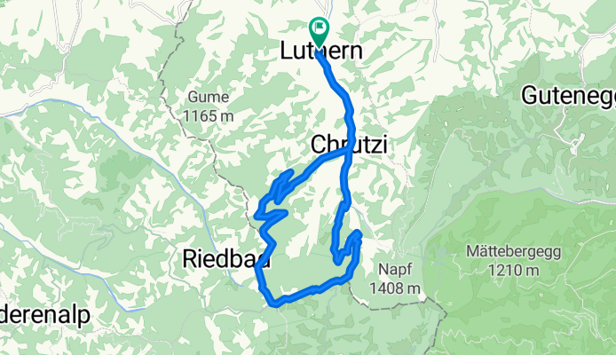
Änzi Tour
Trasa rowerowa rozpoczynająca się w Luthern, Lucerna, Szwajcaria.
Przegląd
O tej trasie
zum Bikehotel > www.kroneluthern.ch
Ta krótka trasa rowerowa pokazuje najdalszą i najbardziej południową część długiego Luthertal.
Trasa prowadzi cię z wioski w kierunku Napf, po około 2 km, droga skręca w prawo w boczną dolinę, która poprowadzi cię wzdłuż Längenbach do Gross Scheidegg.
Tam trasa wkracza w piękną drogę leśną. Na początku towarzyszą ci widoki w stronę północy, a po dotarciu do działu wodnego otwiera się okno, z wspaniałymi widokami na świat alpejski Berna, coraz bardziej, że odczuwasz trudności jako piękny ból.
Zatrzymaj się na Hochänzi i ciesz się ciszą oraz absolutną wolnością.
Teraz zaczyna się stromy, ale z czasem coraz bardziej łagodny zjazd do Nideränzi, Badegg, Luthern-Bad i z powrotem do Hotelu Rowerowego Krone w Luthern-Dorf.
- -:--
- Czas
- 20,7 km
- Dystans
- 639 m
- Przewyższenia
- 636 m
- Spadek
- ---
- Śr. Prędkość
- ---
- Maks. wysokość
Kontynuuj z Bikemap
Użyj, edytuj lub pobierz tę trasę rowerową
Chcesz przejechać trasę Änzi Tour lub dostosować ją do swojej wycieczki? Oto, co możesz zrobić z tą trasą na Bikemap:
Darmowe funkcje
- Zapisz tę trasę jako ulubioną lub w kolekcji
- Skopiuj i zaplanuj swoją wersję tej trasy
- Synchronizuj swoją trasę z Garminem lub Wahoo
Funkcje Premium
3 dni bezpłatnej wersji próbnej lub jednorazowa opłata. Dowiedz się więcej o Bikemap Premium.
- Nawiguj po tej trasie na iOS i Androidzie
- Eksportuj plik GPX / KML tej trasy
- Stwórz swój własny wydruk (wypróbuj za darmo)
- Pobierz tę trasę do nawigacji offline
Odkryj więcej funkcji Premium.
Uzyskaj Bikemap PremiumOd naszej społeczności
Luthern: Inne popularne trasy rozpoczynające się tutaj
 Napf-Luzern
- Dystans
- 39,8 km
- Przewyższenia
- 199 m
- Spadek
- 1161 m
- Lokalizacja
- Luthern, Lucerna, Szwajcaria
 Fritzefluh Tour
- Dystans
- 39,5 km
- Przewyższenia
- 871 m
- Spadek
- 868 m
- Lokalizacja
- Luthern, Lucerna, Szwajcaria
 Oberlehn - Tour
- Dystans
- 38 km
- Przewyższenia
- 791 m
- Spadek
- 791 m
- Lokalizacja
- Luthern, Lucerna, Szwajcaria
 A04 Hergiswil Napf
- Dystans
- 25,8 km
- Przewyższenia
- 578 m
- Spadek
- 577 m
- Lokalizacja
- Luthern, Lucerna, Szwajcaria
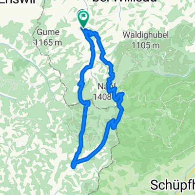
 Änzi Tour
- Dystans
- 20,7 km
- Przewyższenia
- 639 m
- Spadek
- 636 m
- Lokalizacja
- Luthern, Lucerna, Szwajcaria
 Mettlen Tour
- Dystans
- 32,5 km
- Przewyższenia
- 880 m
- Spadek
- 875 m
- Lokalizacja
- Luthern, Lucerna, Szwajcaria
 Napf - Hergiswil
- Dystans
- 13,2 km
- Przewyższenia
- 78 m
- Spadek
- 823 m
- Lokalizacja
- Luthern, Lucerna, Szwajcaria
 Ahornalp-Luthern
- Dystans
- 7,4 km
- Przewyższenia
- 41 m
- Spadek
- 400 m
- Lokalizacja
- Luthern, Lucerna, Szwajcaria
Otwórz ją w aplikacji