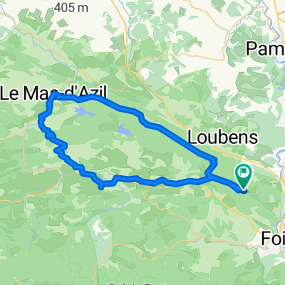
- 98,4 km
- 1429 m
- 1435 m
- Foix, Occitanie, Francja
2019-06 Foix - Circle to Col de Péguère
Trasa rowerowa rozpoczynająca się w Foix, Occitanie, Francja.
Przegląd
O tej trasie
W 2019 roku odbyliśmy samodzielnie wspierane wycieczki przez nieco mniej niż 2 miesiące od połowy września do początku listopada.
Dzień 6 - Foix - Rondo do Col de Péguerre
Większość tej trasy przejechaliśmy już kilka razy. D17 z Foix do Col de Péguerre na 1375M (mijając Col des Marrous na 990M i Col de Jouels na 1247M). To wspaniała trasa z bardzo małym ruchem, gdy tylko miniesz St-Pierre-de-Rivière. Wspinaczka jest w większości stosunkowo łagodna, bez stromych odcinków powyżej 8 %. Widok na szczycie jest wspaniały, chociaż po drodze las utrudnia uzyskanie widoku.
D15 była dla nas nowością. Była to znakomita, dobrze wyasfaltowana, prawie bezrurova droga jednokierunkowa (odcinek od D17 w dół o około dziesięć lub dwanaście kilometrów), która stanowiłaby prawdziwe wyzwanie do pokonania. W tej podróży zjeżdżaliśmy, ale czekamy z niecierpliwością na dzień, w którym będziemy mogli się wspinać.
Krótką chwilę po dotarciu do D117 zjechaliśmy na Voie Verte, co było łatwą jazdą, oczywiście bez samochodów. Ta Voie Verte nie jest utwardzona, ale większość z niej jest w dość dobrym stanie. Nasze opony 700x35 nie mają z tym problemów. Chociaż większość Voie Verte jest w dość dobrym stanie, niektóre jej części bliżej Foix degenerują w coś, co jest lepsze niż ścieżka kozia, ale niewiele lepsze. Rowerze wyścigowe z wąskimi oponami powinny być ostrożne na tym odcinku... lub unikać tego, korzystając z D117, która równolegle prowadzi do ścieżki w większości.
To była wspaniała przejażdżka, którą gorąco polecamy.
- -:--
- Czas
- 76,9 km
- Dystans
- 1138 m
- Przewyższenia
- 1137 m
- Spadek
- ---
- Śr. Prędkość
- ---
- Maks. wysokość
utworzono 6 lat temu temu
Zdjęcia trasy
Jakość trasy
Typy dróg i nawierzchnie na trasie
Typy dróg
Droga
43,1 km
(56 %)
Droga rowerowa
11,5 km
(15 %)
Powierzchnie
Utwardzona
53,8 km
(70 %)
Nieutwardzona
13,8 km
(18 %)
Asfalt
53,8 km
(70 %)
Luźny żwir
11,5 km
(15 %)
Kontynuuj z Bikemap
Użyj, edytuj lub pobierz tę trasę rowerową
Chcesz przejechać trasę 2019-06 Foix - Circle to Col de Péguère lub dostosować ją do swojej wycieczki? Oto, co możesz zrobić z tą trasą na Bikemap:
Darmowe funkcje
- Zapisz tę trasę jako ulubioną lub w kolekcji
- Skopiuj i zaplanuj swoją wersję tej trasy
- Synchronizuj swoją trasę z Garminem lub Wahoo
Funkcje Premium
3 dni bezpłatnej wersji próbnej lub jednorazowa opłata. Dowiedz się więcej o Bikemap Premium.
- Nawiguj po tej trasie na iOS i Androidzie
- Eksportuj plik GPX / KML tej trasy
- Stwórz swój własny wydruk (wypróbuj za darmo)
- Pobierz tę trasę do nawigacji offline
Odkryj więcej funkcji Premium.
Uzyskaj Bikemap PremiumOd naszej społeczności
Foix: Inne popularne trasy rozpoczynające się tutaj
- Soulcem AR
- Vernajoul Durban sur Arize
- 42,3 km
- 1148 m
- 1146 m
- Foix, Occitanie, Francja
- Foix to Dieppe 959km
- 969,4 km
- 1092 m
- 1474 m
- Foix, Occitanie, Francja
- Bpf 09/11 Train : Foix/Lordat/La Fajolle/ St Hilaire
- 272,5 km
- 2560 m
- 2765 m
- Foix, Occitanie, Francja
- **16-M. Foix - Gaillac (156 Km)
- 155,8 km
- 995 m
- 1284 m
- Foix, Occitanie, Francja
- 50k Flat To Mas d'Azil
- 51,9 km
- 570 m
- 578 m
- Foix, Occitanie, Francja
- 40k around the Séronais
- 40,7 km
- 759 m
- 785 m
- Foix, Occitanie, Francja
- Foix - Saint Martory
- 77,8 km
- 808 m
- 884 m
- Foix, Occitanie, Francja
Otwórz ją w aplikacji


