- 9,8 km
- 34 m
- 90 m
- Ryōtsu-minato, Prefektura Niigata, Japonia
SADO-ICHI (cycle around Sado Island)
Trasa rowerowa rozpoczynająca się w Ryōtsu-minato, Prefektura Niigata, Japonia.
Przegląd
O tej trasie
Welcome to Sado Island!
Sado Island is the largest island in Sea of Japan, slightly larger than the size of Singapore! All the roads are paved so you'll enjoy very comfortable ride with the view of the ocean. but the roads are narrow in some part and the traffic might be busy. So please be careful of the traffic and enjoy the spectacular ride!
Stay: There are hotels, ryokan, and hostels. Especially it's easy to find inns in these areas; Ryotsu, Matsugasaki, Akadomari, Ogi, Mano, Sawata, Aikawa.
Camping: There are good camp grounds along the way but most of them are operating only in summer season.
Camp grounds are in; Matsugasaki, Sobama beach, Kubota, Nyuzaki, Futatsugame.
Food: There are supermarkets and restaurants in the larger towns such as Ryotsu,Ogi, Hamochi, Mano, Sawata, Aikawa. But in other small villages along the coast, there are less options and the shops close quite earlier. Please be prepared for it.
- -:--
- Czas
- 208,7 km
- Dystans
- 792 m
- Przewyższenia
- 795 m
- Spadek
- ---
- Śr. Prędkość
- ---
- Maks. wysokość
utworzono 6 lat temu temu
Jakość trasy
Typy dróg i nawierzchnie na trasie
Typy dróg
Spokojna droga
56,4 km
(27 %)
Droga
14,6 km
(7 %)
Powierzchnie
Utwardzona
8,3 km
(4 %)
Asfalt
6,3 km
(3 %)
Nawierzchnia (nieokreślona)
2,1 km
(1 %)
Niezdefiniowany
200,4 km
(96 %)
Najważniejsze punkty trasy
Punkty zainteresowania na trasie
Interesujące miejsce po 1,4 km
Shiisaki Onsen (hot spa) Onsen with stunning view of the lake and mountains. Visit "green hotel Kiraku" and pay for the onsen. (500yen p.p.)
Interesujące miejsce po 9 km
Uga Shrine is at the top of a hill. Hundreds of steps to come to the shrine
Interesujące miejsce po 17,6 km
Nagisa Park Camping ground
Zdjęcie po 35,3 km
Matsugasaki Village Campground, Cafe with handmade donuts, Renovated Japanese traditional holiday home (its name is Kanemo). There are many traditional houses in this small village.
Interesujące miejsce po 44,9 km
Onsen (Hot spa)
Interesujące miejsce po 46,7 km
Akadomari port Supermarket, convenience store, restaurants, inns, Sake brewery
Interesujące miejsce po 59 km
Hamochi town Supermarket, convenience store, restaurant, amazing bakery (its name is T&M)
Interesujące miejsce po 62,7 km
Ogi port Supermarket, restaurant, inns
Interesujące miejsce po 67,6 km
Shukunegi Village Cafes Shipowners' and shipbuilders' village. traditional houses lined beautifully and you can ride Taraibune, tub boat.
Interesujące miejsce po 82,6 km
Sobama beach Camping
Interesujące miejsce po 99,4 km
Mano town Supermarket, convenience store, restaurant, inns
Interesujące miejsce po 103,5 km
Sawata town Supermarket, convenience store, restaurant, inns
Interesujące miejsce po 124,5 km
Aikawa town Supermarket, convenience store, restaurant, inns The town of gold mine, which was found in 16th century. you can visit some historical places and there is a good old alley, Kyomachi street.
Interesujące miejsce po 124,7 km
Sado Gold Mine
Zdjęcie po 137,2 km
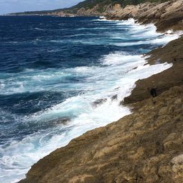
Hiranezaki amazing view of the sea. there are lots of marine potholes
Interesujące miejsce po 149,2 km
Nyuzaki beach Camping
Zdjęcie po 164,6 km
Z slope steep hill. View is great from the top.
Zdjęcie po 173,8 km
Onogame Huge rock and there is a walk path. in early June you can enjoy the picturesque flowers. Lodge, lunch
Zdjęcie po 176,4 km
Futatsugame Two huge rocks Restaurant, inn, camping, best beach
Interesujące miejsce po 180,5 km
Washisaki village Supermarket
Interesujące miejsce po 208,7 km
Ryotsu port Supermarket, convenience store, restaurant, inns
Kontynuuj z Bikemap
Użyj, edytuj lub pobierz tę trasę rowerową
Chcesz przejechać trasę SADO-ICHI (cycle around Sado Island) lub dostosować ją do swojej wycieczki? Oto, co możesz zrobić z tą trasą na Bikemap:
Darmowe funkcje
- Zapisz tę trasę jako ulubioną lub w kolekcji
- Skopiuj i zaplanuj swoją wersję tej trasy
- Podziel trasę na etapy, aby utworzyć kilkudniową wycieczkę
- Synchronizuj swoją trasę z Garminem lub Wahoo
Funkcje Premium
3 dni bezpłatnej wersji próbnej lub jednorazowa opłata. Dowiedz się więcej o Bikemap Premium.
- Nawiguj po tej trasie na iOS i Androidzie
- Eksportuj plik GPX / KML tej trasy
- Stwórz swój własny wydruk (wypróbuj za darmo)
- Pobierz tę trasę do nawigacji offline
Odkryj więcej funkcji Premium.
Uzyskaj Bikemap PremiumOd naszej społeczności
Ryōtsu-minato: Inne popularne trasy rozpoczynające się tutaj
- 1452−1, 佐渡市 まで佐渡市
- 日本、〒952-0014 新潟県佐渡市両津湊353 両津港ターミナル から たびのホテル佐渡 へのルート - 日本、〒952-0014 新潟県佐渡市両津湊353 両津港ターミナル - たびのホテル佐渡
- 101,7 km
- 2459 m
- 2452 m
- Ryōtsu-minato, Prefektura Niigata, Japonia
- 2013/05/04佐渡上陸
- 33,2 km
- 250 m
- 242 m
- Ryōtsu-minato, Prefektura Niigata, Japonia
- 2013/05/05佐渡193
- 190,3 km
- 1063 m
- 1069 m
- Ryōtsu-minato, Prefektura Niigata, Japonia
- June 6th - Sado Ryotsu Port - Futatsugame
- 34,3 km
- 621 m
- 543 m
- Ryōtsu-minato, Prefektura Niigata, Japonia
- 佐渡市 to 佐渡市
- 203 km
- 7684 m
- 7678 m
- Ryōtsu-minato, Prefektura Niigata, Japonia
- 佐渡市 まで佐渡市
- 1,9 km
- 9 m
- 41 m
- Ryōtsu-minato, Prefektura Niigata, Japonia
- たびのホテル佐渡 から Guest Villa on the 美一 へのルート - たびのホテル佐渡 - Guest Villa on the 美一
- 124 km
- 2802 m
- 2816 m
- Ryōtsu-minato, Prefektura Niigata, Japonia
Otwórz ją w aplikacji


