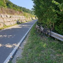
jogiibea1
Trasa rowerowa rozpoczynająca się w Kirchentellinsfurt, Badenia-Wirtembergia, Niemcy.
Przegląd
O tej trasie
- -:--
- Czas
- 94,4 km
- Dystans
- 450 m
- Przewyższenia
- 450 m
- Spadek
- ---
- Śr. Prędkość
- ---
- Maks. wysokość
Najważniejsze punkty trasy
Punkty zainteresowania na trasie
Interesujące miejsce po 1,1 km
Interesujące miejsce po 1,1 km
Interesujące miejsce po 1,5 km
Interesujące miejsce po 2,9 km
Interesujące miejsce po 3,3 km
Interesujące miejsce po 5,4 km
Interesujące miejsce po 6,1 km
Interesujące miejsce po 6,2 km
Interesujące miejsce po 8,4 km
Interesujące miejsce po 9,8 km
Interesujące miejsce po 10,4 km
Interesujące miejsce po 11 km
Interesujące miejsce po 11,4 km
Interesujące miejsce po 12,1 km
Interesujące miejsce po 13,9 km
Interesujące miejsce po 15,4 km
Interesujące miejsce po 15,7 km
Interesujące miejsce po 15,8 km
Interesujące miejsce po 16,8 km
Interesujące miejsce po 17,3 km
Interesujące miejsce po 17,4 km
Interesujące miejsce po 17,9 km
Interesujące miejsce po 18,4 km
Interesujące miejsce po 18,7 km
Interesujące miejsce po 19,3 km
Interesujące miejsce po 19,5 km
Interesujące miejsce po 20,2 km
Interesujące miejsce po 21 km
Interesujące miejsce po 21,5 km
Interesujące miejsce po 21,8 km
Interesujące miejsce po 22,2 km
Interesujące miejsce po 22,4 km
Interesujące miejsce po 23,1 km
Interesujące miejsce po 25,6 km
Interesujące miejsce po 26,2 km
Interesujące miejsce po 26,8 km
Interesujące miejsce po 27,6 km
Interesujące miejsce po 28 km
Interesujące miejsce po 28,3 km
Interesujące miejsce po 29,4 km
Interesujące miejsce po 30 km
Interesujące miejsce po 31,1 km
Interesujące miejsce po 32,2 km
Interesujące miejsce po 34 km
Interesujące miejsce po 34,2 km
Interesujące miejsce po 34,4 km
Interesujące miejsce po 34,7 km
Interesujące miejsce po 35,1 km
Interesujące miejsce po 35,5 km
Interesujące miejsce po 35,9 km
Interesujące miejsce po 36,9 km
Interesujące miejsce po 38,6 km
Interesujące miejsce po 39 km
Interesujące miejsce po 39,2 km
Interesujące miejsce po 39,8 km
Interesujące miejsce po 40,1 km
Interesujące miejsce po 40,6 km
Interesujące miejsce po 41,4 km
Interesujące miejsce po 41,9 km
Interesujące miejsce po 42,1 km
Interesujące miejsce po 42,5 km
Interesujące miejsce po 43,6 km
Interesujące miejsce po 44,3 km
Interesujące miejsce po 45,3 km
Interesujące miejsce po 45,5 km
Interesujące miejsce po 46,3 km
Interesujące miejsce po 46,7 km
Interesujące miejsce po 47,1 km
Interesujące miejsce po 47,2 km
Interesujące miejsce po 48,1 km
Interesujące miejsce po 48,7 km
Interesujące miejsce po 49 km
Interesujące miejsce po 49,3 km
Interesujące miejsce po 49,5 km
Interesujące miejsce po 49,6 km
Interesujące miejsce po 49,8 km
Interesujące miejsce po 49,9 km
Interesujące miejsce po 50,3 km
Interesujące miejsce po 50,4 km
Interesujące miejsce po 50,6 km
Interesujące miejsce po 50,8 km
Interesujące miejsce po 51,5 km
Interesujące miejsce po 51,9 km
Interesujące miejsce po 52,3 km
Interesujące miejsce po 52,7 km
Interesujące miejsce po 53,6 km
Interesujące miejsce po 54 km
Interesujące miejsce po 54,4 km
Interesujące miejsce po 54,7 km
Interesujące miejsce po 54,9 km
Interesujące miejsce po 55,4 km
Interesujące miejsce po 55,9 km
Interesujące miejsce po 84,8 km
Interesujące miejsce po 85,8 km
Interesujące miejsce po 87 km
Interesujące miejsce po 89 km
Interesujące miejsce po 92,3 km
Interesujące miejsce po 94,2 km
Interesujące miejsce po 94,2 km
Interesujące miejsce po 94,2 km
Kontynuuj z Bikemap
Użyj, edytuj lub pobierz tę trasę rowerową
Chcesz przejechać trasę jogiibea1 lub dostosować ją do swojej wycieczki? Oto, co możesz zrobić z tą trasą na Bikemap:
Darmowe funkcje
- Zapisz tę trasę jako ulubioną lub w kolekcji
- Skopiuj i zaplanuj swoją wersję tej trasy
- Podziel trasę na etapy, aby utworzyć kilkudniową wycieczkę
- Synchronizuj swoją trasę z Garminem lub Wahoo
Funkcje Premium
3 dni bezpłatnej wersji próbnej lub jednorazowa opłata. Dowiedz się więcej o Bikemap Premium.
- Nawiguj po tej trasie na iOS i Androidzie
- Eksportuj plik GPX / KML tej trasy
- Stwórz swój własny wydruk (wypróbuj za darmo)
- Pobierz tę trasę do nawigacji offline
Odkryj więcej funkcji Premium.
Uzyskaj Bikemap PremiumOd naszej społeczności
Kirchentellinsfurt: Inne popularne trasy rozpoczynające się tutaj
 Gäu-Neckartal
- Dystans
- 82 km
- Przewyższenia
- 442 m
- Spadek
- 426 m
- Lokalizacja
- Kirchentellinsfurt, Badenia-Wirtembergia, Niemcy
 K-Furt - Nebelhöle - K.Furt
- Dystans
- 67,9 km
- Przewyższenia
- 676 m
- Spadek
- 675 m
- Lokalizacja
- Kirchentellinsfurt, Badenia-Wirtembergia, Niemcy
 Südliche Runde um Tübingen und zurück
- Dystans
- 43,3 km
- Przewyższenia
- 369 m
- Spadek
- 372 m
- Lokalizacja
- Kirchentellinsfurt, Badenia-Wirtembergia, Niemcy
 Naturpark Schönbuch | Durch das Herz des Schönbuchs
- Dystans
- 30,9 km
- Przewyższenia
- 502 m
- Spadek
- 503 m
- Lokalizacja
- Kirchentellinsfurt, Badenia-Wirtembergia, Niemcy
 B27, Kirchentellinsfurt nach Eichhaldestraße 157, Bad Urach
- Dystans
- 29,7 km
- Przewyższenia
- 166 m
- Spadek
- 36 m
- Lokalizacja
- Kirchentellinsfurt, Badenia-Wirtembergia, Niemcy
 jogiibea1
- Dystans
- 94,4 km
- Przewyższenia
- 450 m
- Spadek
- 450 m
- Lokalizacja
- Kirchentellinsfurt, Badenia-Wirtembergia, Niemcy
 siderunde
- Dystans
- 6,9 km
- Przewyższenia
- 47 m
- Spadek
- 44 m
- Lokalizacja
- Kirchentellinsfurt, Badenia-Wirtembergia, Niemcy
 Kirchentellinsfurt (TÜ, RT) - Ulm über Radwege
- Dystans
- 96,6 km
- Przewyższenia
- 745 m
- Spadek
- 535 m
- Lokalizacja
- Kirchentellinsfurt, Badenia-Wirtembergia, Niemcy
Otwórz ją w aplikacji

