Templars, Germans & a Poet
Trasa rowerowa rozpoczynająca się w Barrowby, Anglia, Zjednoczone Królestwo Wielkiej Brytanii.
Przegląd
O tej trasie
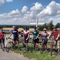
Wizyta w Preceptory Rycerzy Templariuszy w Temple Bruer i na cmentarzu wojennym w Scopwick. Nie jestem zwolennikiem zjeżdżania głowy i kręcenia mil. Wolę nacieszyć się okolicą i odkrywać nowe miejsca - podczas kręcenia mil. Dziś był taki dzień. Mieliśmy plan odwiedzić ruiny Preceptory Templariuszy w Temple Bruer. Potem nie było już planu. Uznając Scopwick za miejsce spoczynku Johna Gillespie Magee, 19-letniego pilota z WW11, który napisał słynny wiersz 'High Flight', zatrzymaliśmy się, aby złożyć wizytę. Podczas poszukiwania jego grobu natrafiliśmy na małą grupę niemieckich grobów. Czworo z nich stanowiło załogę Dorniera, który przeprowadził śmiałą samotną misję bombową na Lincoln. Po zasiewaniu śmierci i zniszczenia mieli nieszczęście spotkać jednego z najlepszych RAF, w postaci Mosquito. Starcie spowodowało poważne uszkodzenia Mosquito, ale załoga zdołała wylądować bez kontuzji, podczas gdy czwórka załogi Dorniera zginęła w wyniku uderzenia w pobliżu Boothby Graffoe. To była jazda na 53 mile, ale nie czułem się tak, głównie z powodu rozproszeń.
- -:--
- Czas
- 84,4 km
- Dystans
- 422 m
- Przewyższenia
- 422 m
- Spadek
- ---
- Śr. Prędkość
- ---
- Maks. wysokość
Jakość trasy
Typy dróg i nawierzchnie na trasie
Typy dróg
Droga
22,8 km
(27 %)
Spokojna droga
21,1 km
(25 %)
Powierzchnie
Utwardzona
25,3 km
(30 %)
Asfalt
17,7 km
(21 %)
Nawierzchnia (nieokreślona)
7,6 km
(9 %)
Niezdefiniowany
59,1 km
(70 %)
Kontynuuj z Bikemap
Użyj, edytuj lub pobierz tę trasę rowerową
Chcesz przejechać trasę Templars, Germans & a Poet lub dostosować ją do swojej wycieczki? Oto, co możesz zrobić z tą trasą na Bikemap:
Darmowe funkcje
- Zapisz tę trasę jako ulubioną lub w kolekcji
- Skopiuj i zaplanuj swoją wersję tej trasy
- Podziel trasę na etapy, aby utworzyć kilkudniową wycieczkę
- Synchronizuj swoją trasę z Garminem lub Wahoo
Funkcje Premium
3 dni bezpłatnej wersji próbnej lub jednorazowa opłata. Dowiedz się więcej o Bikemap Premium.
- Nawiguj po tej trasie na iOS i Androidzie
- Eksportuj plik GPX / KML tej trasy
- Stwórz swój własny wydruk (wypróbuj za darmo)
- Pobierz tę trasę do nawigacji offline
Odkryj więcej funkcji Premium.
Uzyskaj Bikemap PremiumOd naszej społeczności
Barrowby: Inne popularne trasy rozpoczynające się tutaj
 Templars, Germans & a Poet
- Dystans
- 84,4 km
- Przewyższenia
- 422 m
- Spadek
- 422 m
- Lokalizacja
- Barrowby, Anglia, Zjednoczone Królestwo Wielkiej Brytanii
 Belvoir to Hickling
- Dystans
- 45,4 km
- Przewyższenia
- 294 m
- Spadek
- 293 m
- Lokalizacja
- Barrowby, Anglia, Zjednoczone Królestwo Wielkiej Brytanii
 Vale 32
- Dystans
- 52,3 km
- Przewyższenia
- 403 m
- Spadek
- 403 m
- Lokalizacja
- Barrowby, Anglia, Zjednoczone Królestwo Wielkiej Brytanii
 Belvoir Sunday slouch
- Dystans
- 44,6 km
- Przewyższenia
- 207 m
- Spadek
- 205 m
- Lokalizacja
- Barrowby, Anglia, Zjednoczone Królestwo Wielkiej Brytanii
 Shortened Castle view quick
- Dystans
- 26,4 km
- Przewyższenia
- 237 m
- Spadek
- 236 m
- Lokalizacja
- Barrowby, Anglia, Zjednoczone Królestwo Wielkiej Brytanii
 54 miles via Velo Verde
- Dystans
- 86,3 km
- Przewyższenia
- 481 m
- Spadek
- 490 m
- Lokalizacja
- Barrowby, Anglia, Zjednoczone Królestwo Wielkiej Brytanii
 Three Counties 50 miles
- Dystans
- 80,4 km
- Przewyższenia
- 466 m
- Spadek
- 466 m
- Lokalizacja
- Barrowby, Anglia, Zjednoczone Królestwo Wielkiej Brytanii
 2017 Viking Challenge 50km Route
- Dystans
- 55,5 km
- Przewyższenia
- 440 m
- Spadek
- 438 m
- Lokalizacja
- Barrowby, Anglia, Zjednoczone Królestwo Wielkiej Brytanii
Otwórz ją w aplikacji


