P-Biel/Twann/Lignières/CHASSERAL/Nods/Orvin/Evilard (62 km)
Trasa rowerowa rozpoczynająca się w Biel/Bienne, Canton of Bern, Switzerland.
Przegląd
O tej trasie
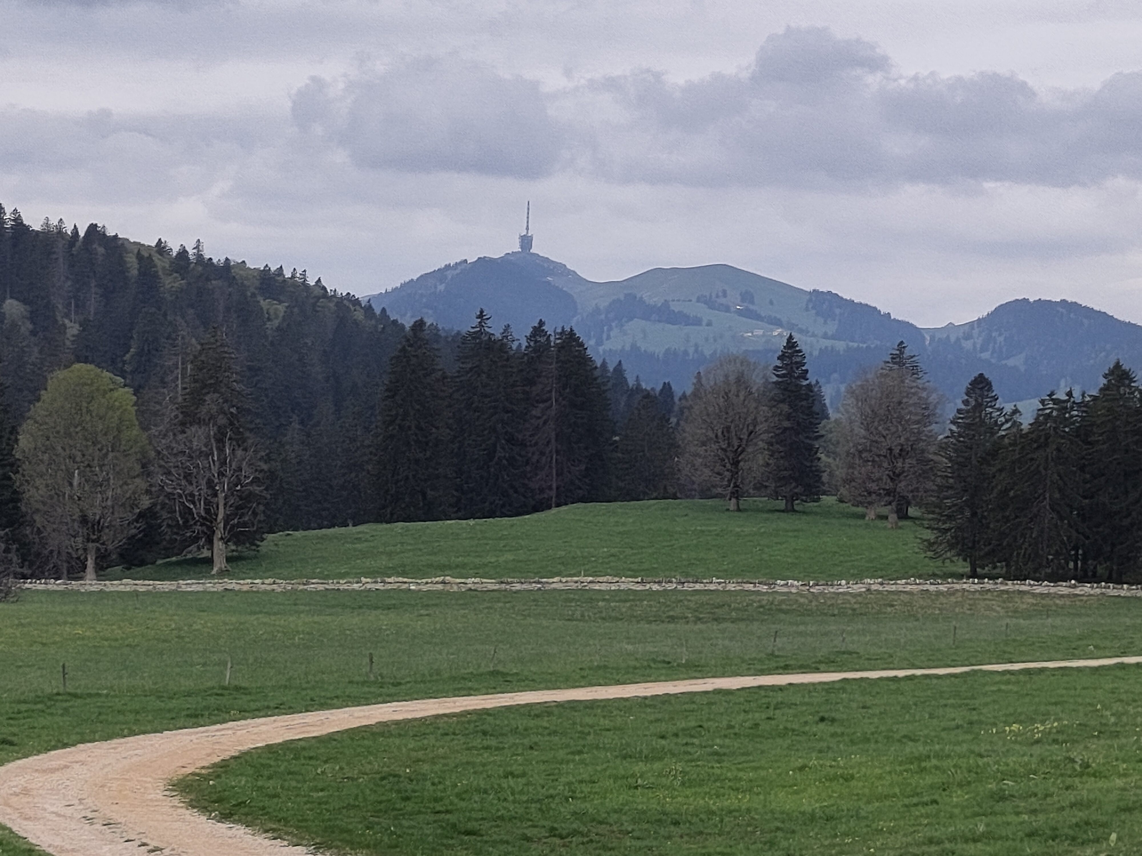
Wonderful route to get to the Chasseral (1606 mt. highest peak of Jura mountains). Few km to warm-up then at km 7 (Twann) starts steep climb of 4km. The real climb to Chasseral starts at km 24 (La Combe du Sapin) and the most difficult part is in the forest, till km 29 (around 8%). As soon as you get out of the forest, the climb is less difficult and it ends at the Chasseral hotel and parking. You can also continue by bike till the antenna, symbol of Chasseral mountain and region. Then it's a long downhill, apart 1km mild climb to Evilard, till Biel/Bienne.
- -:--
- Czas
- 62,8 km
- Dystans
- 1389 m
- Przewyższenia
- 1386 m
- Spadek
- ---
- Śr. Prędkość
- ---
- Maks. wysokość
Jakość trasy
Typy dróg i nawierzchnie na trasie
Typy dróg
Droga
43,7 km
(70 %)
Spokojna droga
8,4 km
(13 %)
Powierzchnie
Utwardzona
32,6 km
(52 %)
Asfalt
31,4 km
(50 %)
Nawierzchnia (nieokreślona)
1,1 km
(2 %)
Niezdefiniowany
30,2 km
(48 %)
Najważniejsze punkty trasy
Punkty zainteresowania na trasie
Woda pitna po 13,2 km
Woda pitna po 20,6 km
Woda pitna po 20,7 km

Interesujące miejsce po 38,4 km
Chasseral telecommunication station (highest peak of Jura mountains 1606 mt.) https://fr.wikipedia.org/wiki/Chasseral https://en.wikipedia.org/wiki/Chasseral
Woda pitna po 41,2 km
Woda pitna po 56 km
Kontynuuj z Bikemap
Użyj, edytuj lub pobierz tę trasę rowerową
Chcesz przejechać trasę P-Biel/Twann/Lignières/CHASSERAL/Nods/Orvin/Evilard (62 km) lub dostosować ją do swojej wycieczki? Oto, co możesz zrobić z tą trasą na Bikemap:
Darmowe funkcje
- Zapisz tę trasę jako ulubioną lub w kolekcji
- Skopiuj i zaplanuj swoją wersję tej trasy
- Synchronizuj swoją trasę z Garminem lub Wahoo
Funkcje Premium
3 dni bezpłatnej wersji próbnej lub jednorazowa opłata. Dowiedz się więcej o Bikemap Premium.
- Nawiguj po tej trasie na iOS i Androidzie
- Eksportuj plik GPX / KML tej trasy
- Stwórz swój własny wydruk (wypróbuj za darmo)
- Pobierz tę trasę do nawigacji offline
Odkryj więcej funkcji Premium.
Uzyskaj Bikemap PremiumOd naszej społeczności
Biel/Bienne: Inne popularne trasy rozpoczynające się tutaj
 P-Biel/Corgémont/Orvin/Biel (Bridge of the Anabaptists) 40km
- Dystans
- 40,4 km
- Przewyższenia
- 1718 m
- Spadek
- 1717 m
- Lokalizacja
- Biel/Bienne, Canton of Bern, Switzerland
 P-Biel/Bienne tour 1.5hrs v2 (28 km)
- Dystans
- 28,3 km
- Przewyższenia
- 295 m
- Spadek
- 294 m
- Lokalizacja
- Biel/Bienne, Canton of Bern, Switzerland
 P-Biel/Grenchen/Plagne (31km)
- Dystans
- 30,9 km
- Przewyższenia
- 538 m
- Spadek
- 536 m
- Lokalizacja
- Biel/Bienne, Canton of Bern, Switzerland
 47°Nord Tour de Suisse Etappe 1
- Dystans
- 91,5 km
- Przewyższenia
- 225 m
- Spadek
- 172 m
- Lokalizacja
- Biel/Bienne, Canton of Bern, Switzerland
 P-Biel/Bienne tour 1.5hrs v3 (29 km)
- Dystans
- 29,5 km
- Przewyższenia
- 275 m
- Spadek
- 274 m
- Lokalizacja
- Biel/Bienne, Canton of Bern, Switzerland
 Biel - Saisselin - Jobert - Biel
- Dystans
- 38,5 km
- Przewyższenia
- 1292 m
- Spadek
- 1293 m
- Lokalizacja
- Biel/Bienne, Canton of Bern, Switzerland
 P-Biel/Twann/Lignières/CHASSERAL/Nods/Orvin/Evilard (62 km)
- Dystans
- 62,8 km
- Przewyższenia
- 1389 m
- Spadek
- 1386 m
- Lokalizacja
- Biel/Bienne, Canton of Bern, Switzerland
 P-Biel/Bienne tour 1.5hrs v4 (31 km)
- Dystans
- 31,8 km
- Przewyższenia
- 286 m
- Spadek
- 285 m
- Lokalizacja
- Biel/Bienne, Canton of Bern, Switzerland
Otwórz ją w aplikacji


