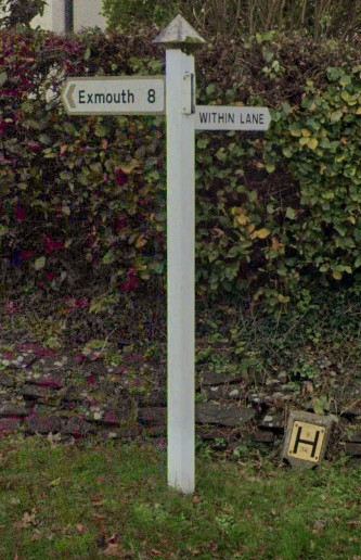
Bikeroute for Sue
Trasa rowerowa rozpoczynająca się w Exeter, Anglia, Zjednoczone Królestwo Wielkiej Brytanii.
Przegląd
O tej trasie
- -:--
- Czas
- 32,6 km
- Dystans
- 270 m
- Przewyższenia
- 216 m
- Spadek
- ---
- Śr. Prędkość
- ---
- Maks. wysokość
Najważniejsze punkty trasy
Punkty zainteresowania na trasie
Interesujące miejsce po 4,1 km
Off road cycleroute follows the canal downstream to the Countesswear Bridge
Interesujące miejsce po 5,9 km
There is an pavement cyclepath alongside the dual carriageway here
Interesujące miejsce po 7 km
The pavement cycleroute bears off to the lft here and follows the sirection of the slip road although not on it, before joining the pavement alongside the dual carriageway again.
Interesujące miejsce po 8,4 km
Pavement path rejoins the pavement here alongside dual carriageway
Interesujące miejsce po 8,7 km
Big 24hr Tesco
Interesujące miejsce po 9,1 km
Pavement cyclepath
Interesujące miejsce po 10,5 km
Join pavement cyclepath on the righthand side of carriage way.
Interesujące miejsce po 11,2 km
Cross at pedestrian crossing and continue to follow pavement cyclepath
Interesujące miejsce po 12,2 km
Pavement cyclepath joins road
Interesujące miejsce po 14,1 km
This is old A30 and a lot quieter than the main A30 dual carriageway
Interesujące miejsce po 21,1 km
Follow cycleroute signs to Honiton
Kontynuuj z Bikemap
Użyj, edytuj lub pobierz tę trasę rowerową
Chcesz przejechać trasę Bikeroute for Sue lub dostosować ją do swojej wycieczki? Oto, co możesz zrobić z tą trasą na Bikemap:
Darmowe funkcje
- Zapisz tę trasę jako ulubioną lub w kolekcji
- Skopiuj i zaplanuj swoją wersję tej trasy
- Synchronizuj swoją trasę z Garminem lub Wahoo
Funkcje Premium
3 dni bezpłatnej wersji próbnej lub jednorazowa opłata. Dowiedz się więcej o Bikemap Premium.
- Nawiguj po tej trasie na iOS i Androidzie
- Eksportuj plik GPX / KML tej trasy
- Stwórz swój własny wydruk (wypróbuj za darmo)
- Pobierz tę trasę do nawigacji offline
Odkryj więcej funkcji Premium.
Uzyskaj Bikemap PremiumOd naszej społeczności
Exeter: Inne popularne trasy rozpoczynające się tutaj
 Fantasy Tour of Britain - Day 4
- Dystans
- 184,7 km
- Przewyższenia
- 2246 m
- Spadek
- 1776 m
- Lokalizacja
- Exeter, Anglia, Zjednoczone Królestwo Wielkiej Brytanii
 Exeter, Dawlish, Ashcombe circuit
- Dystans
- 50,1 km
- Przewyższenia
- 521 m
- Spadek
- 521 m
- Lokalizacja
- Exeter, Anglia, Zjednoczone Królestwo Wielkiej Brytanii
 Fosterville loop
- Dystans
- 47,7 km
- Przewyższenia
- 553 m
- Spadek
- 555 m
- Lokalizacja
- Exeter, Anglia, Zjednoczone Królestwo Wielkiej Brytanii
 Feniton-Silverton
- Dystans
- 57,9 km
- Przewyższenia
- 410 m
- Spadek
- 410 m
- Lokalizacja
- Exeter, Anglia, Zjednoczone Królestwo Wielkiej Brytanii
 Shobrooke loop
- Dystans
- 33,4 km
- Przewyższenia
- 383 m
- Spadek
- 387 m
- Lokalizacja
- Exeter, Anglia, Zjednoczone Królestwo Wielkiej Brytanii
 Fernworthy circuit from Exeter
- Dystans
- 76,9 km
- Przewyższenia
- 871 m
- Spadek
- 871 m
- Lokalizacja
- Exeter, Anglia, Zjednoczone Królestwo Wielkiej Brytanii
 30 miles 2500ft
- Dystans
- 52,7 km
- Przewyższenia
- 472 m
- Spadek
- 486 m
- Lokalizacja
- Exeter, Anglia, Zjednoczone Królestwo Wielkiej Brytanii
 34km Ride – Gentle Hills and Peaceful Roads
- Dystans
- 34,1 km
- Przewyższenia
- 210 m
- Spadek
- 212 m
- Lokalizacja
- Exeter, Anglia, Zjednoczone Królestwo Wielkiej Brytanii
Otwórz ją w aplikacji


