Nice route to the near villas and back to Blago
Trasa rowerowa rozpoczynająca się w Błagojewgrad, Blagoevgrad, Bułgaria.
Przegląd
O tej trasie
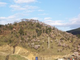
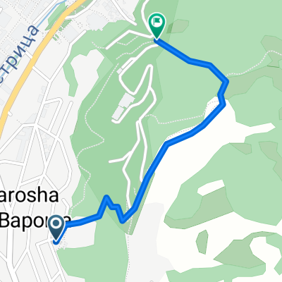
Po stadionie droga jest bardzo stroma, ale jeśli masz dobre przełożenia i jesteś w formie, można nią jechać, ponieważ jest wyłożona asfaltem. Kiedy dotrzesz na szczyt wzgórza, zobaczysz dziwny budynek przypominający strefę 51 (stację zaopatrzenia w wodę). Przejdź obok niego lewą stroną, a potem idź dalej. Wkrótce zobaczysz kilka szop i ogrodów po prawej stronie, a po lewej ładny las. Wjedź na drogę, ten odcinek jest całkowicie odosobniony, więc nie martw się o jazdę na dziko - nie ma samochodów. W pewnym momencie dotrzesz do zakurzonego skrzyżowania w pobliżu kilku domów, skręć w lewo i przejedź przez wieś. Uważaj na psy i ciesz się prędkością. Ponownie, samochodów jest bardzo mało, ale bądź ostrożny. Droga staje się dość kręta około dwóch km przed Blago - tam radzę zwolnić i być ostrożnym na szalonych kierowców. To ładna trasa - świetna progresja i zmiana krajobrazu. Bezpiecznej jazdy!
- -:--
- Czas
- 9,4 km
- Dystans
- 243 m
- Przewyższenia
- 213 m
- Spadek
- ---
- Śr. Prędkość
- ---
- Maks. wysokość
Najważniejsze punkty trasy
Punkty zainteresowania na trasie

Zdjęcie po 0 km
Kontynuuj z Bikemap
Użyj, edytuj lub pobierz tę trasę rowerową
Chcesz przejechać trasę Nice route to the near villas and back to Blago lub dostosować ją do swojej wycieczki? Oto, co możesz zrobić z tą trasą na Bikemap:
Darmowe funkcje
- Zapisz tę trasę jako ulubioną lub w kolekcji
- Skopiuj i zaplanuj swoją wersję tej trasy
- Synchronizuj swoją trasę z Garminem lub Wahoo
Funkcje Premium
3 dni bezpłatnej wersji próbnej lub jednorazowa opłata. Dowiedz się więcej o Bikemap Premium.
- Nawiguj po tej trasie na iOS i Androidzie
- Eksportuj plik GPX / KML tej trasy
- Stwórz swój własny wydruk (wypróbuj za darmo)
- Pobierz tę trasę do nawigacji offline
Odkryj więcej funkcji Premium.
Uzyskaj Bikemap PremiumOd naszej społeczności
Błagojewgrad: Inne popularne trasy rozpoczynające się tutaj
 Razhodka okolo Blagoevgrad
- Dystans
- 20,7 km
- Przewyższenia
- 424 m
- Spadek
- 515 m
- Lokalizacja
- Błagojewgrad, Blagoevgrad, Bułgaria
 Blagoevgrad-Demirevo-Bistrica-Blagoevgrad CLONED FROM ROUTE 819503
- Dystans
- 34 km
- Przewyższenia
- 854 m
- Spadek
- 858 m
- Lokalizacja
- Błagojewgrad, Blagoevgrad, Bułgaria
 Nice route to the near villas and back to Blago
- Dystans
- 9,4 km
- Przewyższenia
- 243 m
- Spadek
- 213 m
- Lokalizacja
- Błagojewgrad, Blagoevgrad, Bułgaria
 6 Macedonia
- Dystans
- 122,3 km
- Przewyższenia
- 1142 m
- Spadek
- 2178 m
- Lokalizacja
- Błagojewgrad, Blagoevgrad, Bułgaria
 Near the river (right side) to the lake
- Dystans
- 2 km
- Przewyższenia
- 70 m
- Spadek
- 26 m
- Lokalizacja
- Błagojewgrad, Blagoevgrad, Bułgaria
 Shortcut to/and the extreme downhill path
- Dystans
- 1,1 km
- Przewyższenia
- 85 m
- Spadek
- 75 m
- Lokalizacja
- Błagojewgrad, Blagoevgrad, Bułgaria
 Steep route to the almond forest
- Dystans
- 0,7 km
- Przewyższenia
- 50 m
- Spadek
- 29 m
- Lokalizacja
- Błagojewgrad, Blagoevgrad, Bułgaria
 Scenic Route to Elenovo and back to Skapto
- Dystans
- 8,8 km
- Przewyższenia
- 283 m
- Spadek
- 303 m
- Lokalizacja
- Błagojewgrad, Blagoevgrad, Bułgaria
Otwórz ją w aplikacji

