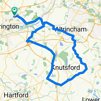
stretton - warburton loop
Trasa rowerowa rozpoczynająca się w Croft, England, United Kingdom.
Przegląd
O tej trasie
-
down fearnhead lane into padgate lane and then on to kingsway.
-
go over kingsway bridge and follow the road.. at the 2nd set of lights turn left and then immediatley right up the side of the canal (climb).
-
turn left at the top over the bridge and follow the road down turning right at the bottom.
-
at the lights turn right and then left at the next set (under a bridge) taking the first left (bridge lane)
-
turn right into broom ave which becomes lyons road.
-
at the end of the road, turn left into london road.
-
eventually turn right into hatton lane
-
as the road splits, turn left and go under the M6... turning right into pilmoss lane.
-
turn left into newton lane and then right into higher lane.
-
turn left into marsh lane (cross over tarporley road into heath lane)
*take ash house lane off to the left which becomes coghill lane - follow this and trun right into hough lane.
-
as hough lane goes off to the right - STOP on the road and go back into gogshall lane turning right into marbury road.
-
turn right into budworth lane - cross the a559 into high street and join westgate lane. bare left onto budworth road.
-
turn left into CANN lane and go under the M6... you are now in whitley lane.
-
turn left into rowey bank lane and then right into halliwells brow.
-
as you hit the a50 turn left and then right into W lane (high leigh). Follow this under the M56 and into high leigh road
-
at the a56 (higher lane) cross over into bullford lane)
-
go over the canal into mill lane
-
at the a6144 turn right into heatley and left on the b5159 (townfield lane)
-
follow this through the toll road.... and left on to manchester road..... then home...
- -:--
- Czas
- 54,6 km
- Dystans
- 144 m
- Przewyższenia
- 142 m
- Spadek
- ---
- Śr. Prędkość
- ---
- Maks. wysokość
Kontynuuj z Bikemap
Użyj, edytuj lub pobierz tę trasę rowerową
Chcesz przejechać trasę stretton - warburton loop lub dostosować ją do swojej wycieczki? Oto, co możesz zrobić z tą trasą na Bikemap:
Darmowe funkcje
- Zapisz tę trasę jako ulubioną lub w kolekcji
- Skopiuj i zaplanuj swoją wersję tej trasy
- Synchronizuj swoją trasę z Garminem lub Wahoo
Funkcje Premium
3 dni bezpłatnej wersji próbnej lub jednorazowa opłata. Dowiedz się więcej o Bikemap Premium.
- Nawiguj po tej trasie na iOS i Androidzie
- Eksportuj plik GPX / KML tej trasy
- Stwórz swój własny wydruk (wypróbuj za darmo)
- Pobierz tę trasę do nawigacji offline
Odkryj więcej funkcji Premium.
Uzyskaj Bikemap PremiumOd naszej społeczności
Croft: Inne popularne trasy rozpoczynające się tutaj
- 14–15 Delenty Drive, Warrington to 14–15 Delenty Drive, Warrington
- Dystans
- 23,6 km
- Przewyższenia
- 87 m
- Spadek
- 88 m
- Lokalizacja
- Croft, England, United Kingdom
- OTO Day 1 Stoke
- Dystans
- 72,7 km
- Przewyższenia
- 235 m
- Spadek
- 127 m
- Lokalizacja
- Croft, England, United Kingdom
- delamere circular
- Dystans
- 78,9 km
- Przewyższenia
- 353 m
- Spadek
- 354 m
- Lokalizacja
- Croft, England, United Kingdom
- tatton circular
- Dystans
- 55,5 km
- Przewyższenia
- 135 m
- Spadek
- 135 m
- Lokalizacja
- Croft, England, United Kingdom
- appleton, stretton, daresbury 29.5mile
- Dystans
- 47,5 km
- Przewyższenia
- 143 m
- Spadek
- 143 m
- Lokalizacja
- Croft, England, United Kingdom
- mini lymm route
- Dystans
- 26,4 km
- Przewyższenia
- 59 m
- Spadek
- 61 m
- Lokalizacja
- Croft, England, United Kingdom
- stretton - warburton loop
- Dystans
- 54,6 km
- Przewyższenia
- 144 m
- Spadek
- 142 m
- Lokalizacja
- Croft, England, United Kingdom
- leigh 18 miler
- Dystans
- 29,4 km
- Przewyższenia
- 65 m
- Spadek
- 66 m
- Lokalizacja
- Croft, England, United Kingdom
Otwórz ją w aplikacji