

Around Mount Warning
Trasa rowerowa rozpoczynająca się w Murwillumbah, Nowa Południowa Walia, Australia.
Przegląd
O tej trasie
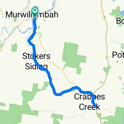
Zaczynamy w Uki i podróżujemy na wschód, a potem na północ wzdłuż Kyogle Road wzdłuż rzeki Tweed. Po około 10 km skręcamy w lewo w Tyalgum Road, która biegnie wzdłuż rzeki Oxley. Zatrzymujemy się w Tyalgum na poranną herbatę. Następnie udajemy się na południe Brays Creek Road. Przy 33 km skręcamy w lewo w Byrrill Creek Road. Stałym tempem wspinamy się przez busz po nieutwardzonej drodze. Na znaku 38 km zaczynamy zjeżdżać z widokiem na Byrrill Creek po prawej stronie oraz Mount Warning po lewej. Przy 49,8 km skręcamy w lewo w Kyogle Road, którą podążamy do Uki. Obiad w Uki w parku lub w kawiarni lub pubie.
- -:--
- Czas
- 56,2 km
- Dystans
- 808 m
- Przewyższenia
- 806 m
- Spadek
- ---
- Śr. Prędkość
- ---
- Maks. wysokość

Kontynuuj z Bikemap
Użyj, edytuj lub pobierz tę trasę rowerową
Chcesz przejechać trasę Around Mount Warning lub dostosować ją do swojej wycieczki? Oto, co możesz zrobić z tą trasą na Bikemap:
Darmowe funkcje
- Zapisz tę trasę jako ulubioną lub w kolekcji
- Skopiuj i zaplanuj swoją wersję tej trasy
- Synchronizuj swoją trasę z Garminem lub Wahoo
Funkcje Premium
3 dni bezpłatnej wersji próbnej lub jednorazowa opłata. Dowiedz się więcej o Bikemap Premium.
- Nawiguj po tej trasie na iOS i Androidzie
- Eksportuj plik GPX / KML tej trasy
- Stwórz swój własny wydruk (wypróbuj za darmo)
- Pobierz tę trasę do nawigacji offline
Odkryj więcej funkcji Premium.
Uzyskaj Bikemap PremiumOd naszej społeczności
Murwillumbah: Inne popularne trasy rozpoczynające się tutaj
 18 Murwillumbah YHA to Mt Warning, round
- Dystans
- 66,5 km
- Przewyższenia
- 443 m
- Spadek
- 445 m
- Lokalizacja
- Murwillumbah, Nowa Południowa Walia, Australia
 maybe
maybe- Dystans
- 56,6 km
- Przewyższenia
- 446 m
- Spadek
- 446 m
- Lokalizacja
- Murwillumbah, Nowa Południowa Walia, Australia
 Crystal Creek
- Dystans
- 11,6 km
- Przewyższenia
- 286 m
- Spadek
- 214 m
- Lokalizacja
- Murwillumbah, Nowa Południowa Walia, Australia
 Murwillimbah to Kyogle
- Dystans
- 78,7 km
- Przewyższenia
- 1614 m
- Spadek
- 1555 m
- Lokalizacja
- Murwillumbah, Nowa Południowa Walia, Australia
 Murwillumbah Rail Trail Loop 1
- Dystans
- 78,5 km
- Przewyższenia
- 1063 m
- Spadek
- 1058 m
- Lokalizacja
- Murwillumbah, Nowa Południowa Walia, Australia
 Nullum St, Murwillumbah to 1 Broadway La, Burringbar
- Dystans
- 20,5 km
- Przewyższenia
- 374 m
- Spadek
- 366 m
- Lokalizacja
- Murwillumbah, Nowa Południowa Walia, Australia
 Recovered Route
- Dystans
- 48,5 km
- Przewyższenia
- 375 m
- Spadek
- 375 m
- Lokalizacja
- Murwillumbah, Nowa Południowa Walia, Australia
 Murwillumbah Rail Loop 2
- Dystans
- 82,1 km
- Przewyższenia
- 1002 m
- Spadek
- 1005 m
- Lokalizacja
- Murwillumbah, Nowa Południowa Walia, Australia
Otwórz ją w aplikacji