- 30,7 km
- 284 m
- 289 m
- West End, Kolumbia Brytyjska, Kanada
Spanish Gold
Trasa rowerowa rozpoczynająca się w West End, Kolumbia Brytyjska, Kanada.
Przegląd
O tej trasie
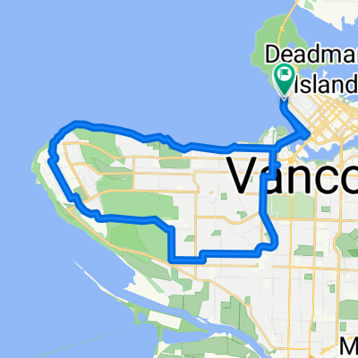
Idealna niedzielna trasa do jednej z najlepszych plaż Vancouver, Spanish Banks. Dużo luzu, tylko łatwa, płaska jazda przez False Creek, Granville Island, Kitsilano i Jericho Beach.
Trasa
Do Spanish Banks:
Rozpocznij w English Bay Bike Rentals przy 1754 Davie Street
Jedź na południe do promenady Vancouver (Inukshuk w English Bay)
Jedź promenadą na wschód wzdłuż False Creek
Na Hornby Street skręć na północ w Beach Avenue i kontynuuj na wschód
Jedź pod Spinning Chandelier i wokół George Wainborn Park, wracając Beach Cresent do promenady
Kontynuuj przyjemną jazdę na wschód do Science World
Objedź wschodni kraniec False Creek i kontynuuj na zachód wzdłuż promenady
Postój w Brewhall, aby zaopatrzyć się w piwo plażowe
Kontynuuj wzdłuż promenady do Granville Island
Postój na rynku po przekąski na wynos na piknik
Podziwiaj Os Gemeos 'Giganty'
Na szybkie taco z rybą, zatrzymaj się w budce gastronomicznej Go Fish, tuż obok Granville Island
Podążaj ścieżką promenady pod Burrard Bride i wokół Vanier Park
W Muzeum Morskim skieruj się na południe w Chestnut Street i szybko skręć w prawo w Ogden Avenue
Skret w lewo w Maple Street i jedź na południe do McNicoll Avenue
Skręć w prawo i jedź wzdłuż McNicoll, która łączy się z Arbutus i biegnie równolegle do Kitsilano Beach
Minąć korty tenisowe i natychmiast skręć w prawo, skręcając przez parking
Podążaj ścieżką wokół plaży w kierunku zachodnim i zjedź na Balsam Street
Kontynuuj na ścieżce do jazdy na rowerze Point Grey przez 2,5 km
Wyjdź z alei Point Grey na szutrową ścieżkę równoległą do plaży
Kontynuuj na zachód do Jericho Sailing Club
Postój na napoje i smażoną rybę na ich pięknej werandzie
Jedź obok Locarno Beach i kortów do siatkówki
Im dalej na zachód, tym mniej tłumów
Kiedy dojdziesz do kotwicy, dotrzesz do celu
Podróż powrotna:
Wracając, podążaj tą samą trasą do Burrard Bridge lub weź York Street przez Kits
Na Burrard wróć do centrum po wschodniej stronie mostu
Zejdź z mostu i skręć w prawo
Zrób kolejny szybki skręt w prawo przy Hornby i jedź na południe do promenady
Przejedź nieco ponad 1 km do Bidwell i skręć w prawo
Idź dwa bloki do Davie Street, a następnie w lewo na chodnik na pół bloku i wracasz do sklepu
- -:--
- Czas
- 31,2 km
- Dystans
- 156 m
- Przewyższenia
- 152 m
- Spadek
- ---
- Śr. Prędkość
- ---
- Maks. wysokość
utworzono 5 lat temu temu
Jakość trasy
Typy dróg i nawierzchnie na trasie
Typy dróg
Droga rowerowa
11,9 km
(38 %)
Ścieżka
6,6 km
(21 %)
Powierzchnie
Utwardzona
20,6 km
(66 %)
Nieutwardzona
7,5 km
(24 %)
Asfalt
19 km
(61 %)
Żwir
7,5 km
(24 %)
Najważniejsze punkty trasy
Punkty zainteresowania na trasie

Zdjęcie po 0,7 km
Engagement Rings
Zdjęcie po 1,6 km
The Spinning Chandelier

Interesujące miejsce po 2 km
George Wainborn Park

Zdjęcie po 2,1 km
Finger Paint Mural

Interesujące miejsce po 4,9 km
Science World

Interesujące miejsce po 5,2 km
Olympic Athlete's Village

Interesujące miejsce po 5,3 km
Brewhall - Brewery

Interesujące miejsce po 7 km
Charleson Park

Zdjęcie po 8,4 km
The Giants - Os Gemeos

Interesujące miejsce po 8,5 km
Granville Island Public Market

Interesujące miejsce po 8,9 km
Go Fish - Food Stall

Interesujące miejsce po 9,9 km
Vanier Park

Interesujące miejsce po 10,9 km
Kitsilano Beach

Interesujące miejsce po 14,6 km
Jericho Beach
Interesujące miejsce po 15,2 km
'The Galley Patio & Grill (Jericho Sailing Club)

Zdjęcie po 17,9 km
The Anchor Sculpture by Christel Fuoss-Moore

Interesujące miejsce po 18,9 km
Spanish Banks

Interesujące miejsce po 23,2 km
Chip Wilson's Mansion - Lululemon founder

Interesujące miejsce po 26,4 km
Burrard Bridge - Bike Path

Interesujące miejsce po 28,4 km
Inukshuk
Kontynuuj z Bikemap
Użyj, edytuj lub pobierz tę trasę rowerową
Chcesz przejechać trasę Spanish Gold lub dostosować ją do swojej wycieczki? Oto, co możesz zrobić z tą trasą na Bikemap:
Darmowe funkcje
- Zapisz tę trasę jako ulubioną lub w kolekcji
- Skopiuj i zaplanuj swoją wersję tej trasy
- Synchronizuj swoją trasę z Garminem lub Wahoo
Funkcje Premium
3 dni bezpłatnej wersji próbnej lub jednorazowa opłata. Dowiedz się więcej o Bikemap Premium.
- Nawiguj po tej trasie na iOS i Androidzie
- Eksportuj plik GPX / KML tej trasy
- Stwórz swój własny wydruk (wypróbuj za darmo)
- Pobierz tę trasę do nawigacji offline
Odkryj więcej funkcji Premium.
Uzyskaj Bikemap PremiumOd naszej społeczności
West End: Inne popularne trasy rozpoczynające się tutaj
- English Bay, Vancouver to Morton Ave, Vancouver
- Groves of Academe
- 71,1 km
- 764 m
- 767 m
- West End, Kolumbia Brytyjska, Kanada
- défi espoir 2011
- 5189,2 km
- 3336 m
- 3164 m
- West End, Kolumbia Brytyjska, Kanada
- Haro Street to Vancouver
- 8,9 km
- 21 m
- 27 m
- West End, Kolumbia Brytyjska, Kanada
- Vancouver Sunny Tour
- 55 km
- 476 m
- 535 m
- West End, Kolumbia Brytyjska, Kanada
- Roundtown Rob
- 16,5 km
- 152 m
- 165 m
- West End, Kolumbia Brytyjska, Kanada
- WB W Georgia St @ Denman St to Bayshore Drive
- 8,6 km
- 201 m
- 154 m
- West End, Kolumbia Brytyjska, Kanada
- Vancouver lacs CAPILANO et SEYMOUR
- 64,2 km
- 982 m
- 860 m
- West End, Kolumbia Brytyjska, Kanada
Otwórz ją w aplikacji


