

Ornamental Ride
Trasa rowerowa rozpoczynająca się w Brockenhurst, Anglia, Zjednoczone Królestwo Wielkiej Brytanii.
Przegląd
O tej trasie
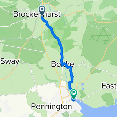
Start/End: Brockenhurst Railway Station. Grid ref. SU301020. Postcode SO42 7TW
what3words ///fulfilled.gladiator.corkscrew
On this ride you begin in Brockenhurst and travel through an area of the National Park rich in plants, animals and history on quiet gravel tracks.
A spectacular cycle under the tallest trees in the Park.
- Back of the station
Starting at the Railway Station ticket office. Head towards the back of the car park where there is an access gate on the right hand side.
- Avenue Road
Go through this access gate and turn left onto East Bank Road, and then take the next right down Avenue Road.
- Sway Road
At the bottom of Avenue Road, turn left onto Sway Road and continue until you see Brockenhurst Primary School on the opposite side of the road.
- Right at the school
At the school turn right, go through the school car park and onto the narrow gravel track (waymarker 233) that takes you through Culverley Green and over a small weir.
- Left then right over the road on North Weirs
The gravel track takes you to Burley Road (waymarker 234) where you carefully take a left and then right, to continue on the gravel path (waymarker 235). Follow this wide gravel track until it ends at Rhinefield road (waymarker 236).
- Left onto Rhinefield Road
Take a left onto Rhinefield Road. Continue along past Aldridgehill Inclosure on your right. The edges of the road are uneven in places so please take care.
- Rhinefield House Hotel
The road becomes wooded on both sides, keep going until you pass Rhinefield House Hotel on your left.
Caution: there is a sharp bend in the road.
- Left onto cycle track
Just after the 90 degree bend in the road a small cottage is visible on the left side. Take a turning just before the cottage onto a cycle track (waymarker 241).
- Ford
The track continues straight ahead (past waymarker 242). Rounding the first right there is a downhill section towards a ford.
Caution: ford may be impassable in very saturated conditions.
(To re-route if necessary, return to Rhinefield Road and continue past Black Water car park until waymarker 248 where you turn onto the off-road track).
- Across Rhinefield Road
Continue up the hill (past waymarker 243 and 244).
Caution: the track crosses over Rhinefield Road (waymarker 245/248).
- Left at crossroads
The gravel track continues through a few turns arriving at a crossroads (waymarker 250). Take a left-hand turn following the track until a gate (waymarker 253).
Toilet stop: if you wish to make a detour to use a toilet or picnic benches, take a right at the crossroads at waymarker 250. To then return to the route come back the same way and continue straight ahead at waymarker 250 until the gate at waymarker 253.
- Deer sanctuary
The route opens out with heathland on both sides. Shortly after the woodland resumes, there is a deer sanctuary on your left. After passing this there is another gate (waymarker 254).
- Right-hand fork
Continue along the gravel track (past waymarker 255 and 256). At the next gate (waymarker 257) take the right-hand fork where the track splits at a triangle (waymarker 258). There is another gate to go through.
- Right at T-junction
The gravel track continues (waymarker 259 and 260). At the next T-junction (waymarker 262) take a right turn.
- Past Black Knowl
There is another gate to go through (waymarker 263) and then the gravel track crosses the Lymington River and follows the edge of an area known as Black Knowl (waymarker 264).
- Onto a minor road
The gravel track ends at a minor road (waymarker 265). Head straight along this road, round a corner (waymarker 239) and up to Rhinefield Road (waymarker 238 and 237) that leads into Brockenhurst.
- Left towards the village
Take a left towards Brockenhurst. Follow this road past Forest Park Hotel and continue until there is a ford on the left. Caution: ford can be high in adverse weather, there is a footpath around if needed.
- Over the watersplash ford
Turn left to travel through ford and through the centre of Brockenhurst Village. At the end of this road take a right up into Brockenhurst Railway Car Park.
- 1 h 27 min
- Czas
- 17,3 km
- Dystans
- 90 m
- Przewyższenia
- 90 m
- Spadek
- 12 km/h
- Śr. Prędkość
- ---
- Maks. wysokość
Jakość trasy
Typy dróg i nawierzchnie na trasie
Typy dróg
Droga leśna
8,7 km
(50 %)
Droga
5,2 km
(30 %)
Powierzchnie
Utwardzona
5,7 km
(33 %)
Nieutwardzona
10,2 km
(59 %)
Żwir
10,2 km
(59 %)
Asfalt
5,7 km
(33 %)
Niezdefiniowany
1,4 km
(8 %)
Kontynuuj z Bikemap
Użyj, edytuj lub pobierz tę trasę rowerową
Chcesz przejechać trasę Ornamental Ride lub dostosować ją do swojej wycieczki? Oto, co możesz zrobić z tą trasą na Bikemap:
Darmowe funkcje
- Zapisz tę trasę jako ulubioną lub w kolekcji
- Skopiuj i zaplanuj swoją wersję tej trasy
- Synchronizuj swoją trasę z Garminem lub Wahoo
Funkcje Premium
3 dni bezpłatnej wersji próbnej lub jednorazowa opłata. Dowiedz się więcej o Bikemap Premium.
- Nawiguj po tej trasie na iOS i Androidzie
- Eksportuj plik GPX / KML tej trasy
- Stwórz swój własny wydruk (wypróbuj za darmo)
- Pobierz tę trasę do nawigacji offline
Odkryj więcej funkcji Premium.
Uzyskaj Bikemap PremiumOd naszej społeczności
Brockenhurst: Inne popularne trasy rozpoczynające się tutaj
 Brockenhurst to Lymington
- Dystans
- 8,5 km
- Przewyższenia
- 72 m
- Spadek
- 86 m
- Lokalizacja
- Brockenhurst, Anglia, Zjednoczone Królestwo Wielkiej Brytanii
 New Forest mtb
- Dystans
- 47,5 km
- Przewyższenia
- 224 m
- Spadek
- 224 m
- Lokalizacja
- Brockenhurst, Anglia, Zjednoczone Królestwo Wielkiej Brytanii
 Ornamental Woods - New Forest National Pak
- Dystans
- 22,9 km
- Przewyższenia
- 164 m
- Spadek
- 162 m
- Lokalizacja
- Brockenhurst, Anglia, Zjednoczone Królestwo Wielkiej Brytanii
 Mummy & Daddy Rhodes route in New Forest
- Dystans
- 14,9 km
- Przewyższenia
- 104 m
- Spadek
- 104 m
- Lokalizacja
- Brockenhurst, Anglia, Zjednoczone Królestwo Wielkiej Brytanii
 Brockenhurst- Lydhurst- Beaulieu
- Dystans
- 34,4 km
- Przewyższenia
- 159 m
- Spadek
- 159 m
- Lokalizacja
- Brockenhurst, Anglia, Zjednoczone Królestwo Wielkiej Brytanii
 New Forest (Brockenhurst) Circular
- Dystans
- 38,3 km
- Przewyższenia
- 96 m
- Spadek
- 100 m
- Lokalizacja
- Brockenhurst, Anglia, Zjednoczone Królestwo Wielkiej Brytanii
 New Forest 1
- Dystans
- 53 km
- Przewyższenia
- 215 m
- Spadek
- 217 m
- Lokalizacja
- Brockenhurst, Anglia, Zjednoczone Królestwo Wielkiej Brytanii
 New Forrest
- Dystans
- 39,2 km
- Przewyższenia
- 164 m
- Spadek
- 161 m
- Lokalizacja
- Brockenhurst, Anglia, Zjednoczone Królestwo Wielkiej Brytanii
Otwórz ją w aplikacji