

Berg- und Talfahrt im Teutoburger Wald
Trasa rowerowa rozpoczynająca się w Werther, Nadrenia Północna-Westfalia, Niemcy.
Przegląd
O tej trasie
Ta trasa jest już bardzo wymagająca i skierowana bardziej do ambitnych sportowo rowerzystów. Mimo to, warto poświęcić wystarczająco dużo czasu i zadbać o odpowiedni zapas napojów. Ponieważ w tej trasie bardziej liczył się aspekt sportowy, nie zaznaczyłem żadnych szczególnych punktów do zwiedzania, poza kilkoma miejscami na odpoczynek. Jednakże trasa oferuje wiele wspaniałych widoków na przyrodę i krajobraz. Można też z łatwością włączyć się w trasę z Bielefeld lub Werther. Jeśli wydaje się zbyt długa, wystarczy na skrzyżowaniu w Ascheloh nie jechać prosto w Berghagen, tylko skręcić w prawo w Grüner Weg w kierunku Werther i zakończyć trasę pysznym lodem w lodziarni przy kościele w Werther. Reinhard 22.09.2007
- -:--
- Czas
- 46,7 km
- Dystans
- 615 m
- Przewyższenia
- 610 m
- Spadek
- ---
- Śr. Prędkość
- 239 m
- Maks. wysokość
Jakość trasy
Typy dróg i nawierzchnie na trasie
Typy dróg
Spokojna droga
21 km
(45 %)
Droga
9,3 km
(20 %)
Powierzchnie
Utwardzona
36 km
(77 %)
Asfalt
31,8 km
(68 %)
Nawierzchnia (nieokreślona)
4,2 km
(9 %)
Niezdefiniowany
10,8 km
(23 %)
Najważniejsze punkty trasy
Punkty zainteresowania na trasie
Interesujące miejsce po 3,9 km
Blick zur Schwedenschanze
Interesujące miejsce po 7,5 km
Peter auf'm Berge
Interesujące miejsce po 12 km
Gaststätte Friedrichshöhe
Interesujące miejsce po 12,1 km
Leberblümchenberg
Interesujące miejsce po 16,3 km
Hier kann man über Grüner Weg nach Werther abkürzen
Interesujące miejsce po 24,9 km
Eisdiele in Borgholzhausen
Interesujące miejsce po 37,3 km
Gaststätte Specht
Interesujące miejsce po 41,9 km
Gaststätte DREI LINDEN
Kontynuuj z Bikemap
Użyj, edytuj lub pobierz tę trasę rowerową
Chcesz przejechać trasę Berg- und Talfahrt im Teutoburger Wald lub dostosować ją do swojej wycieczki? Oto, co możesz zrobić z tą trasą na Bikemap:
Darmowe funkcje
- Zapisz tę trasę jako ulubioną lub w kolekcji
- Skopiuj i zaplanuj swoją wersję tej trasy
- Synchronizuj swoją trasę z Garminem lub Wahoo
Funkcje Premium
3 dni bezpłatnej wersji próbnej lub jednorazowa opłata. Dowiedz się więcej o Bikemap Premium.
- Nawiguj po tej trasie na iOS i Androidzie
- Eksportuj plik GPX / KML tej trasy
- Stwórz swój własny wydruk (wypróbuj za darmo)
- Pobierz tę trasę do nawigacji offline
Odkryj więcej funkcji Premium.
Uzyskaj Bikemap PremiumOd naszej społeczności
Werther: Inne popularne trasy rozpoczynające się tutaj
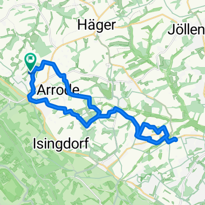
 Ascheloh-bRothenfelde-uz 42km
- Dystans
- 42 km
- Przewyższenia
- 239 m
- Spadek
- 230 m
- Lokalizacja
- Werther, Nadrenia Północna-Westfalia, Niemcy
 Von Werther zum Griechen Lindos
- Dystans
- 19,2 km
- Przewyższenia
- 100 m
- Spadek
- 101 m
- Lokalizacja
- Werther, Nadrenia Północna-Westfalia, Niemcy
 Route im Schneckentempo in Werther (Westfalen)
- Dystans
- 18,5 km
- Przewyższenia
- 213 m
- Spadek
- 216 m
- Lokalizacja
- Werther, Nadrenia Północna-Westfalia, Niemcy
 Frühlingsrunde am 31.3.2009
- Dystans
- 44,5 km
- Przewyższenia
- 255 m
- Spadek
- 245 m
- Lokalizacja
- Werther, Nadrenia Północna-Westfalia, Niemcy
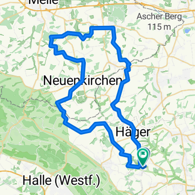
 Dornberg-Neuenkirchen und zurück
- Dystans
- 34,7 km
- Przewyższenia
- 239 m
- Spadek
- 241 m
- Lokalizacja
- Werther, Nadrenia Północna-Westfalia, Niemcy
 Nachtradeln Bifurkation-Else-Werre mit Anfahrt und wieder zurück nach Deppendorf (Bielefeld)
- Dystans
- 123,6 km
- Przewyższenia
- 370 m
- Spadek
- 370 m
- Lokalizacja
- Werther, Nadrenia Północna-Westfalia, Niemcy
 1. sonnige Ausfahrt 2008
- Dystans
- 42,9 km
- Przewyższenia
- 263 m
- Spadek
- 243 m
- Lokalizacja
- Werther, Nadrenia Północna-Westfalia, Niemcy
 Tour zu den drei "Zwillingswindrädern" im Ravensberger Hügelland mit Fotos
- Dystans
- 46 km
- Przewyższenia
- 348 m
- Spadek
- 329 m
- Lokalizacja
- Werther, Nadrenia Północna-Westfalia, Niemcy
Otwórz ją w aplikacji