50km Waterloo
- 49.8 km
- 397 m
- 399 m
- Waterloo, Ontario, Canada
A cycling route starting in Waterloo, Ontario, Canada.
Overview
created this 16 years ago
Route quality
Quiet road
11.4 km
33 %
Road
7.6 km
22 %
Paved
28.1 km
(81 %)
Unpaved
2.4 km
(7 %)
Asphalt
26.3 km
76 %
Unpaved (undefined)
2.4 km
7 %
Route highlights
Consider detour through this condo area to avoid having to turn left from Westmount to Father David Bauer
Park is rough and narrow heading south from here to Agnes Street or so. Iron Horse Trail is a possible alternate. Other alternate routes would be good.
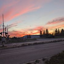
Another sharply angled rail crossing
A pedestrian crossing at Courtland and Manitou, then following Manitou and to Webster or Wabanki might be preferable to avoid this small gravel section.
This is a pretty high traffic roundabout, be extra cautious.
Continue with Bikemap
You would like to ride Northwest Waterloo to Southeast Cambridge or customize it for your own trip? Here is what you can do with this Bikemap route:
Free trial for 3 days, or one-time payment. More about Bikemap Premium.
Discover more Premium features.
Get Bikemap PremiumFrom our community
Open it in the app