Cessnock mit dem Fahrrad
Entdecke eine Karte mit 43 Radrouten und Radwegen rund um Cessnock, erstellt von unserer Community.
Regionenporträt
Lerne Cessnock kennen
Finde die richtige Fahrradroute in Cessnock, wo wir 43 Fahrradrouten für dich zum Erkunden haben.
1.718 km
Aufgezeichnete Strecken
43
Fahrradrouten
16.393
Einwohner
Community
Die aktivsten Nutzer in Cessnock
Von unserer Community
Die besten Fahrradrouten in und um Cessnock

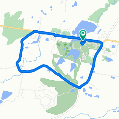
Route in Nulkaba
Fahrradtour in Cessnock, New South Wales, Australien
- 19,1 km
- Distanz
- 197 m
- Aufstieg
- 188 m
- Abstieg

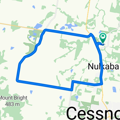
Millfield to Cessnock loop
Fahrradtour in Cessnock, New South Wales, Australien
- 37,3 km
- Distanz
- 430 m
- Aufstieg
- 430 m
- Abstieg

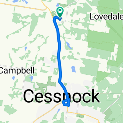
Wine & Ride Elfin Hill Hunter Valley
Fahrradtour in Cessnock, New South Wales, Australien
- 28,3 km
- Distanz
- 374 m
- Aufstieg
- 379 m
- Abstieg

Hunter Valley
Fahrradtour in Cessnock, New South Wales, Australien
- 33,2 km
- Distanz
- 252 m
- Aufstieg
- 248 m
- Abstieg
Mehr Routen entdecken
- Alle Routen in Cessnock
- Rundwege
- Entspannt
- Gravel
- Rennrad
- MTB
- Trekking
- 85 Lovedale Road, Lovedale to 29–37 King Road, Mount View0
- 16,7 km
- 410 m
- 231 m
- Cessnock, New South Wales, Australien
- Wine Country Drive, Lovedale to Wine Country Drive, Lovedale0
- 20,8 km
- 265 m
- 268 m
- Cessnock, New South Wales, Australien
- Wine Country Drive, Lovedale to Wine Country Drive, Lovedale0
- 16,5 km
- 200 m
- 202 m
- Cessnock, New South Wales, Australien
- Wine Country Drive 430, Lovedale to Merewether Street, Newcastle0
- 56,9 km
- 662 m
- 716 m
- Cessnock, New South Wales, Australien
- Wine Country Drive, Lovedale to Wine Country Drive, Lovedale0
- 16,1 km
- 89 m
- 89 m
- Cessnock, New South Wales, Australien