
Radfahren in Tadley
Entdecke eine Karte mit 153 Radrouten und Radwegen rund um Tadley, erstellt von unserer Community.
Regionenporträt
Lerne Tadley kennen
Finde die richtige Fahrradroute in Tadley, wo wir 153 Fahrradrouten für dich zum Erkunden haben. Die meisten Leute fahren hier in den Monaten Mai und September Fahrrad.
5.031 km
Aufgezeichnete Strecken
153
Fahrradrouten
15.990
Einwohner
Community
Die aktivsten Nutzer in Tadley
Von unserer Community
Die besten Fahrradrouten in und um Tadley
Pamber Heath/Tadley to Greenham Common
Fahrradtour in Tadley, England, Vereinigtes Königreich
The road takes a right turn at the top of Crookham Deane Hill but this route goes straight into Beenham Common and uses the gravel track that was one of the runways of RAF Beenham, a Bomber Command station in WW2.
The route is gently uphill all the way with a challenging h
- 16,7 km
- Distanz
- 65 m
- Aufstieg
- 44 m
- Abstieg
Pamber Heath/Sherborne St. John circular route
Fahrradtour in Tadley, England, Vereinigtes Königreich
This is a pleasant, quiet country road training ride - a mixture of flats and moderate hills. It crosses the A340 at traffic lights in Tadley and in a 30mph zone in Sherborne St. John. There are built up areas in Bramley, Sherborne St. John and Tadley, but these are relatively short.
- 23,2 km
- Distanz
- 119 m
- Aufstieg
- 119 m
- Abstieg
Circular tour of Kennet Valley
Fahrradtour in Tadley, England, Vereinigtes Königreich
This route starts on high ground on the south side of the Kennet valley. There are steep sections on both sides of the valley.
- 30,1 km
- Distanz
- 182 m
- Aufstieg
- 181 m
- Abstieg
DJ30k
Fahrradtour in Tadley, England, Vereinigtes Königreich
30k cycling route with a variety of flat, long straights and challenging inclines.
(cloned from route 3448955)
- 30,8 km
- Distanz
- 126 m
- Aufstieg
- 126 m
- Abstieg
Mehr Routen entdecken
- Pamber to Mortimer hilly circuit
- Distanz
- 14,5 km
- Aufstieg
- 92 m
- Abstieg
- 90 m
- Standort
- Tadley, England, Vereinigtes Königreich
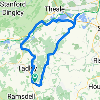
- Pamber to Peckham - possible route
- Distanz
- 94,3 km
- Aufstieg
- 274 m
- Abstieg
- 352 m
- Standort
- Tadley, England, Vereinigtes Königreich
- Cufaude Lane, Bramley to Chineham
- Distanz
- 20,3 km
- Aufstieg
- 789 m
- Abstieg
- 786 m
- Standort
- Tadley, England, Vereinigtes Königreich
- September House, Heathrow Copse, Tadley to Bramley Road, Reading
- Distanz
- 5,7 km
- Aufstieg
- 0 m
- Abstieg
- 3 m
- Standort
- Tadley, England, Vereinigtes Königreich
- work
- Distanz
- 4,3 km
- Aufstieg
- 42 m
- Abstieg
- 37 m
- Standort
- Tadley, England, Vereinigtes Königreich
- Hannington loop.
- Distanz
- 28,7 km
- Aufstieg
- 318 m
- Abstieg
- 319 m
- Standort
- Tadley, England, Vereinigtes Königreich
- Boar's Bridge, Bramley, Tadley to Duke's Lane, Windsor Great Park, Windsor
- Distanz
- 52,6 km
- Aufstieg
- 188 m
- Abstieg
- 247 m
- Standort
- Tadley, England, Vereinigtes Königreich
- Flat as a pancake
- Distanz
- 10,6 km
- Aufstieg
- 8 m
- Abstieg
- 9 m
- Standort
- Tadley, England, Vereinigtes Königreich