
Shipley mit dem Fahrrad
Entdecke eine Karte mit 80 Radrouten und Radwegen rund um Shipley, erstellt von unserer Community.
Regionenporträt
Lerne Shipley kennen
Finde die richtige Fahrradroute in Shipley, wo wir 80 Fahrradrouten für dich zum Erkunden haben. Die meisten Leute fahren hier in den Monaten Juli und August Fahrrad.
2.737 km
Aufgezeichnete Strecken
80
Fahrradrouten
28.544
Einwohner
Community
Die aktivsten Nutzer in Shipley


Handverlesene Routen
Entdecke Shipley durch diese Sammlungen

Von unserer Community
Die besten Fahrradrouten in und um Shipley

Get miles
Fahrradtour in Shipley, England, Vereinigtes Königreich
- 124,4 km
- Distanz
- 434 m
- Aufstieg
- 514 m
- Abstieg
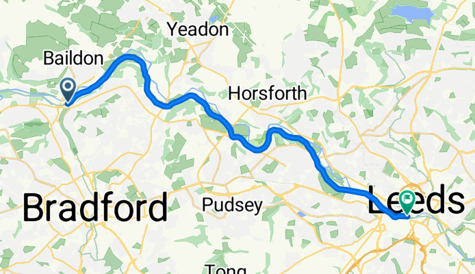
Shipley - Leeds
Fahrradtour in Shipley, England, Vereinigtes Königreich
- 20,4 km
- Distanz
- 47 m
- Aufstieg
- 87 m
- Abstieg
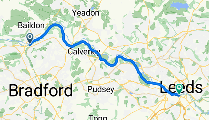
Shipley - Leeds
Fahrradtour in Shipley, England, Vereinigtes Königreich
- 20,2 km
- Distanz
- 150 m
- Aufstieg
- 190 m
- Abstieg

Greengates/Skipton/Eccup loop
Fahrradtour in Shipley, England, Vereinigtes Königreich
- 104,9 km
- Distanz
- 718 m
- Aufstieg
- 720 m
- Abstieg
Mehr Routen entdecken
 The Moo-ers
- Distanz
- 31,8 km
- Aufstieg
- 400 m
- Abstieg
- 401 m
- Standort
- Shipley, England, Vereinigtes Königreich
 Canal and moors
- Distanz
- 33,5 km
- Aufstieg
- 329 m
- Abstieg
- 329 m
- Standort
- Shipley, England, Vereinigtes Königreich
 Apperley Bridge/Steeton loop
- Distanz
- 49,5 km
- Aufstieg
- 353 m
- Abstieg
- 385 m
- Standort
- Shipley, England, Vereinigtes Königreich
 Greengates to Manjit's loop
- Distanz
- 28,3 km
- Aufstieg
- 404 m
- Abstieg
- 398 m
- Standort
- Shipley, England, Vereinigtes Königreich
 East Morton & East Bradford
- Distanz
- 44,5 km
- Aufstieg
- 451 m
- Abstieg
- 449 m
- Standort
- Shipley, England, Vereinigtes Königreich
 Loop around Bradford
- Distanz
- 48,3 km
- Aufstieg
- 541 m
- Abstieg
- 541 m
- Standort
- Shipley, England, Vereinigtes Königreich
 Bumpy Wharfedale route
- Distanz
- 54,3 km
- Aufstieg
- 612 m
- Abstieg
- 612 m
- Standort
- Shipley, England, Vereinigtes Königreich
 Greengates to Selby #2
- Distanz
- 115,8 km
- Aufstieg
- 312 m
- Abstieg
- 314 m
- Standort
- Shipley, England, Vereinigtes Königreich