
Cardross mit dem Fahrrad
Entdecke eine Karte mit 17 Radrouten und Radwegen rund um Cardross, erstellt von unserer Community.
Pioniere gesucht
Inspiriere andere Radfahrer mit deiner Route in Cardross
Bikemap ist eine globale Fahrrad-Community mit Millionen von Routen, die von Radfahrern wie dir erstellt wurden. Es gibt bisher nur wenige Routen in Cardross, also zeichne deine Lieblingsstrecken jetzt auf der Karte ein, um anderen zu helfen, die besten Radrouten zu finden.
Handverlesene Routen
Entdecke Cardross durch diese Sammlungen

Von unserer Community
Die besten Fahrradrouten in und um Cardross


Cardross to Wemyss Bay
Fahrradtour in Cardross, Schottland, Vereinigtes Königreich
- 66 km
- Distanz
- 497 m
- Aufstieg
- 498 m
- Abstieg

Cardross to Balloch
Fahrradtour in Cardross, Schottland, Vereinigtes Königreich
- 9,9 km
- Distanz
- 224 m
- Aufstieg
- 218 m
- Abstieg

Short hilly route from Cardross
Fahrradtour in Cardross, Schottland, Vereinigtes Königreich
- 28,7 km
- Distanz
- 325 m
- Aufstieg
- 325 m
- Abstieg

4. Rhu and Smugglers Way
Fahrradtour in Cardross, Schottland, Vereinigtes Königreich
- 24,4 km
- Distanz
- 125 m
- Aufstieg
- 125 m
- Abstieg
Mehr Routen entdecken
 3. Whistlefield Hill and back
- Distanz
- 41,5 km
- Aufstieg
- 241 m
- Abstieg
- 241 m
- Standort
- Cardross, Schottland, Vereinigtes Königreich
 11. Rhu Hotel and back (TT route)
- Distanz
- 21,8 km
- Aufstieg
- 91 m
- Abstieg
- 91 m
- Standort
- Cardross, Schottland, Vereinigtes Königreich
 9.Crow rd twice and roof of world both ways
- Distanz
- 137,7 km
- Aufstieg
- 1.082 m
- Abstieg
- 1.088 m
- Standort
- Cardross, Schottland, Vereinigtes Königreich
 Loch Fyne Oyster Bar and Back
- Distanz
- 108,5 km
- Aufstieg
- 787 m
- Abstieg
- 786 m
- Standort
- Cardross, Schottland, Vereinigtes Königreich
 8. Faslane Roundabout and back
- Distanz
- 34,5 km
- Aufstieg
- 156 m
- Abstieg
- 156 m
- Standort
- Cardross, Schottland, Vereinigtes Königreich
 10. Callander via Dukes Pass
- Distanz
- 121,1 km
- Aufstieg
- 814 m
- Abstieg
- 813 m
- Standort
- Cardross, Schottland, Vereinigtes Königreich
 1. Coulport Loop
- Distanz
- 70,5 km
- Aufstieg
- 349 m
- Abstieg
- 349 m
- Standort
- Cardross, Schottland, Vereinigtes Königreich
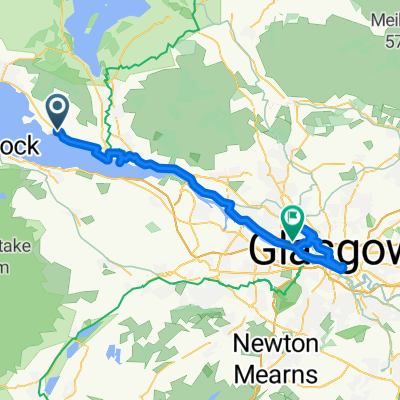 Cardross to Glasgow side trip
- Distanz
- 46,5 km
- Aufstieg
- 132 m
- Abstieg
- 128 m
- Standort
- Cardross, Schottland, Vereinigtes Königreich