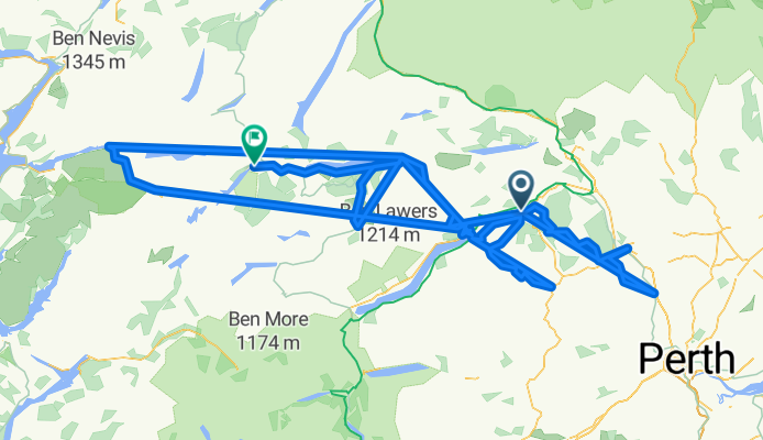
Aberfeldy mit dem Fahrrad
Entdecke eine Karte mit 77 Radrouten und Radwegen rund um Aberfeldy, erstellt von unserer Community.
Regionenporträt
Lerne Aberfeldy kennen
Finde die richtige Fahrradroute in Aberfeldy, wo wir 77 Fahrradrouten für dich zum Erkunden haben. Die meisten Leute fahren hier in den Monaten Mai und August Fahrrad.
4.932 km
Aufgezeichnete Strecken
77
Fahrradrouten
1.937
Einwohner
Community
Die aktivsten Nutzer in Aberfeldy
Von unserer Community
Die besten Fahrradrouten in und um Aberfeldy
Amulree To Perth II
Fahrradtour in Aberfeldy, Schottland, Vereinigtes Königreich
- 34,1 km
- Distanz
- 137 m
- Aufstieg
- 400 m
- Abstieg
Aberfeldy to Aberfoyle
Fahrradtour in Aberfeldy, Schottland, Vereinigtes Königreich
- 90 km
- Distanz
- 794 m
- Aufstieg
- 848 m
- Abstieg
River Tay Way (sustrans.org.uk)
Fahrradtour in Aberfeldy, Schottland, Vereinigtes Königreich
The River Tay Way is a great ride through some of the finest countryside that Perthshire has to offer. Following the path of the mighty River Tay, Scotland’s longest river, this 65 mile/105 km route passes through the communities of Kenmore, Aberfeldy, Dunkeld and Birnam, and the cities of Perth and Dundee. It connects thousands of years of Scottish history by linking the Scottish Crannog Centre at Kenmore and its replica Iron Age crannog, with the V&A Dundee which opened in 2018.
https://www.visitscotland.com/things-to-do/outdoor-activities/cycling/sustrans-map#/river-tay-way
https://www.sustrans.org.uk/
- 110,5 km
- Distanz
- 979 m
- Aufstieg
- 1.091 m
- Abstieg
coast to coast
Fahrradtour in Aberfeldy, Schottland, Vereinigtes Königreich
Von Schottlands Ostküste zur Westküste
Wanderweg
Startpunkt: Perth
Ziel: Fort William
- 160,3 km
- Distanz
- 366 m
- Aufstieg
- 347 m
- Abstieg
Mehr Routen entdecken
 Highland Glens and Lowland Hills
- Distanz
- 67,9 km
- Aufstieg
- 593 m
- Abstieg
- 567 m
- Standort
- Aberfeldy, Schottland, Vereinigtes Königreich
 Schottland Tag 3
- Distanz
- 71 km
- Aufstieg
- 520 m
- Abstieg
- 503 m
- Standort
- Aberfeldy, Schottland, Vereinigtes Königreich
 2. Tag
- Distanz
- 77,8 km
- Aufstieg
- 873 m
- Abstieg
- 560 m
- Standort
- Aberfeldy, Schottland, Vereinigtes Königreich
 Crieff Road, Aberfeldy to Urlar Road, Aberfeldy
- Distanz
- 26,7 km
- Aufstieg
- 758 m
- Abstieg
- 710 m
- Standort
- Aberfeldy, Schottland, Vereinigtes Königreich
 Glen Tay
- Distanz
- 136,9 km
- Aufstieg
- 1.917 m
- Abstieg
- 1.483 m
- Standort
- Aberfeldy, Schottland, Vereinigtes Königreich
 Crieff Road, Aberfeldy to B8019, Pitlochry
- Distanz
- 21,7 km
- Aufstieg
- 331 m
- Abstieg
- 282 m
- Standort
- Aberfeldy, Schottland, Vereinigtes Königreich
 Loch Tay & Kenmore Hill
- Distanz
- 101,5 km
- Aufstieg
- 1.439 m
- Abstieg
- 1.433 m
- Standort
- Aberfeldy, Schottland, Vereinigtes Königreich
 Amulree/Ben Lawers
- Distanz
- 114,7 km
- Aufstieg
- 1.280 m
- Abstieg
- 1.310 m
- Standort
- Aberfeldy, Schottland, Vereinigtes Königreich


