Saint-Marcel mit dem Fahrrad
Entdecke eine Karte mit 12 Radrouten und Radwegen rund um Saint-Marcel, erstellt von unserer Community.
Regionenporträt
Lerne Saint-Marcel kennen
Finde die richtige Fahrradroute in Saint-Marcel, wo wir 12 Fahrradrouten für dich zum Erkunden haben.
293 km
Aufgezeichnete Strecken
12
Fahrradrouten
1.678
Einwohner
Community
Die aktivsten Nutzer in Saint-Marcel
Von unserer Community
Die besten Fahrradrouten in und um Saint-Marcel
5 Chemin de l'Image, Saint-Marcel à 153 Avenue d'Argenton, Châteauroux
Fahrradtour in Saint-Marcel, Centre-Val de Loire, Frankreich
- 26,7 km
- Distanz
- 143 m
- Aufstieg
- 146 m
- Abstieg
Rund ums Chateau
Fahrradtour in Saint-Marcel, Centre-Val de Loire, Frankreich
- 7,3 km
- Distanz
- 56 m
- Aufstieg
- 59 m
- Abstieg
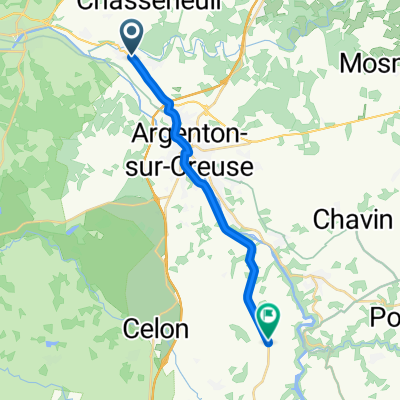
Voie Verte des Vallées: Saint-Marcel to Le Blanc
Fahrradtour in Saint-Marcel, Centre-Val de Loire, Frankreich
- 38,5 km
- Distanz
- 130 m
- Aufstieg
- 180 m
- Abstieg
5 Chemin de l'Image, Saint-Marcel à 4 Impasse du Moulinet, Argenton-sur-Creuse
Fahrradtour in Saint-Marcel, Centre-Val de Loire, Frankreich
- 2,4 km
- Distanz
- 19 m
- Aufstieg
- 66 m
- Abstieg
Mehr Routen entdecken
 clm saint marcel
- Distanz
- 9,3 km
- Aufstieg
- 123 m
- Abstieg
- 150 m
- Standort
- Saint-Marcel, Centre-Val de Loire, Frankreich
 5)SaintMarcelto Chinon
- Distanz
- 128,4 km
- Aufstieg
- 257 m
- Abstieg
- 355 m
- Standort
- Saint-Marcel, Centre-Val de Loire, Frankreich
 6 Rue du Rocher, Le Pont-Chrétien-Chabenet nach Allée du Parc, Le Pont-Chrétien-Chabenet
- Distanz
- 0,7 km
- Aufstieg
- 7 m
- Abstieg
- 25 m
- Standort
- Saint-Marcel, Centre-Val de Loire, Frankreich
 De 3–17 Chemin de l'Image, Saint-Marcel à 5 Impasse du Moulinet, Argenton-sur-Creuse
- Distanz
- 1,9 km
- Aufstieg
- 0 m
- Abstieg
- 45 m
- Standort
- Saint-Marcel, Centre-Val de Loire, Frankreich
 De 5 Chemin de l'Image, Saint-Marcel à Avenue Charles de Gaulle, Châteauroux
- Distanz
- 36,2 km
- Aufstieg
- 253 m
- Abstieg
- 251 m
- Standort
- Saint-Marcel, Centre-Val de Loire, Frankreich
 De 244 Chem du Palis, Saint-Marcel à D44, Ciron
- Distanz
- 23,9 km
- Aufstieg
- 217 m
- Abstieg
- 235 m
- Standort
- Saint-Marcel, Centre-Val de Loire, Frankreich
 De Rue nationale à Rue des Marnières
- Distanz
- 15,8 km
- Aufstieg
- 193 m
- Abstieg
- 107 m
- Standort
- Saint-Marcel, Centre-Val de Loire, Frankreich
 9 Chemin de l'Image, Saint-Marcel à 10 Rue du Moulinet, Argenton-sur-Creuse
- Distanz
- 1,5 km
- Aufstieg
- 0 m
- Abstieg
- 44 m
- Standort
- Saint-Marcel, Centre-Val de Loire, Frankreich


