
Peschadoires mit dem Fahrrad
Entdecke eine Karte mit 6 Radrouten und Radwegen rund um Peschadoires, erstellt von unserer Community.
Regionenporträt
Lerne Peschadoires kennen
Finde die richtige Fahrradroute in Peschadoires, wo wir 6 Fahrradrouten für dich zum Erkunden haben.
929 km
Aufgezeichnete Strecken
6
Fahrradrouten
2.060
Einwohner
Community
Die aktivsten Nutzer in Peschadoires


Von unserer Community
Die besten Fahrradrouten in und um Peschadoires
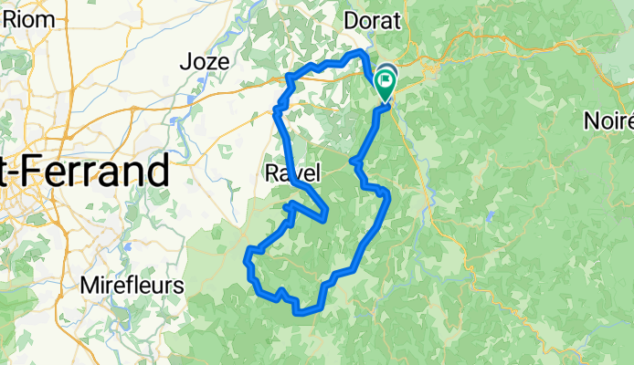
De Route de Clermont à Chemin des Torrents
Fahrradtour in Peschadoires, Auvergne-Rhône-Alpes, Frankreich
- 76,9 km
- Distanz
- 890 m
- Aufstieg
- 882 m
- Abstieg

Thiers - Meilhan
Fahrradtour in Peschadoires, Auvergne-Rhône-Alpes, Frankreich
- 522,2 km
- Distanz
- 2.716 m
- Aufstieg
- 2.963 m
- Abstieg

2009 Euro Tour -- Ride Day 7 — 27 June 2009 — 63300 Thiers to 42120 Le Coteau (Roanne)
Fahrradtour in Peschadoires, Auvergne-Rhône-Alpes, Frankreich
- 102,7 km
- Distanz
- 1.023 m
- Aufstieg
- 1.039 m
- Abstieg
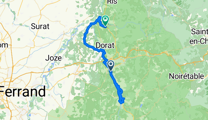
De Route de Courpière 57, Peschadoires à Les Charbonniers 22, Paslières
Fahrradtour in Peschadoires, Auvergne-Rhône-Alpes, Frankreich
- 54,1 km
- Distanz
- 244 m
- Aufstieg
- 221 m
- Abstieg