Le Mont-Dore mit dem Fahrrad
Entdecke eine Karte mit 309 Radrouten und Radwegen rund um Le Mont-Dore, erstellt von unserer Community.
Regionenporträt
Lerne Le Mont-Dore kennen
Finde die richtige Fahrradroute in Le Mont-Dore, wo wir 309 Fahrradrouten für dich zum Erkunden haben. Die meisten Leute fahren hier in den Monaten Juli und August Fahrrad.
21.169 km
Aufgezeichnete Strecken
309
Fahrradrouten
1.787
Einwohner
Community
Die aktivsten Nutzer in Le Mont-Dore
Handverlesene Routen
Entdecke Le Mont-Dore durch diese Sammlungen
Tour
Tour
Von unserer Community
Die besten Fahrradrouten in und um Le Mont-Dore
2019-25 Le-Mont-Dore to Riom-ès-Montagnes
Fahrradtour in Le Mont-Dore, Auvergne-Rhône-Alpes, Frankreich
- 60,4 km
- Distanz
- 716 m
- Aufstieg
- 893 m
- Abstieg
3.etapa Mont-Dore - Riom-es-Montagnes
Fahrradtour in Le Mont-Dore, Auvergne-Rhône-Alpes, Frankreich
- 71,2 km
- Distanz
- 1.218 m
- Aufstieg
- 1.380 m
- Abstieg
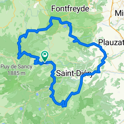
Boucle Est Mont Dore
Fahrradtour in Le Mont-Dore, Auvergne-Rhône-Alpes, Frankreich
- 93,6 km
- Distanz
- 1.610 m
- Aufstieg
- 1.612 m
- Abstieg
Boucle nord Mont Dore
Fahrradtour in Le Mont-Dore, Auvergne-Rhône-Alpes, Frankreich
- 64,1 km
- Distanz
- 949 m
- Aufstieg
- 948 m
- Abstieg
Mehr Routen entdecken
 France 4 - Massif Central 2
- Distanz
- 107,7 km
- Aufstieg
- 1.542 m
- Abstieg
- 1.542 m
- Standort
- Le Mont-Dore, Auvergne-Rhône-Alpes, Frankreich
 Puy de dome 2 - Mont Doré - Sancy
- Distanz
- 85 km
- Aufstieg
- 1.406 m
- Abstieg
- 1.413 m
- Standort
- Le Mont-Dore, Auvergne-Rhône-Alpes, Frankreich
 Auvergne1
- Distanz
- 45,2 km
- Aufstieg
- 1.443 m
- Abstieg
- 1.448 m
- Standort
- Le Mont-Dore, Auvergne-Rhône-Alpes, Frankreich
 Mont-Dore Trip#1 60km
- Distanz
- 57 km
- Aufstieg
- 1.158 m
- Abstieg
- 1.134 m
- Standort
- Le Mont-Dore, Auvergne-Rhône-Alpes, Frankreich
 Mont-Dore Trip#2 80km
- Distanz
- 80,9 km
- Aufstieg
- 1.649 m
- Abstieg
- 1.604 m
- Standort
- Le Mont-Dore, Auvergne-Rhône-Alpes, Frankreich
 Mont-Dore Trip#3 80km
- Distanz
- 77,6 km
- Aufstieg
- 1.599 m
- Abstieg
- 1.585 m
- Standort
- Le Mont-Dore, Auvergne-Rhône-Alpes, Frankreich
 Lac de Guery et retour
- Distanz
- 73,1 km
- Aufstieg
- 1.375 m
- Abstieg
- 1.377 m
- Standort
- Le Mont-Dore, Auvergne-Rhône-Alpes, Frankreich
 Mont dore tour du lac Chambon
- Distanz
- 38,6 km
- Aufstieg
- 938 m
- Abstieg
- 938 m
- Standort
- Le Mont-Dore, Auvergne-Rhône-Alpes, Frankreich


