Le Malzieu-Ville mit dem Fahrrad
Entdecke eine Karte mit 51 Radrouten und Radwegen rund um Le Malzieu-Ville, erstellt von unserer Community.
Regionenporträt
Lerne Le Malzieu-Ville kennen
Finde die richtige Fahrradroute in Le Malzieu-Ville, wo wir 51 Fahrradrouten für dich zum Erkunden haben. Die meisten Leute fahren hier in den Monaten Juli und August Fahrrad.
3.004 km
Aufgezeichnete Strecken
51
Fahrradrouten
1.023
Einwohner
Community
Die aktivsten Nutzer in Le Malzieu-Ville
Von unserer Community
Die besten Fahrradrouten in und um Le Malzieu-Ville
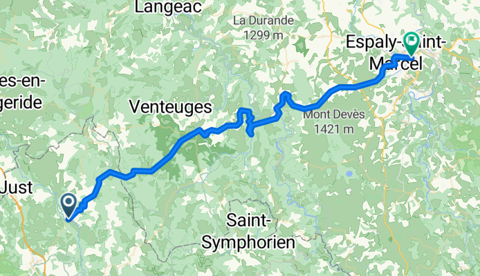
2016 Ride Day 138 - Le Malzieu-Ville to Le-Puy-en-Velay
Fahrradtour in Le Malzieu-Ville, Occitanie, Frankreich
- 70,5 km
- Distanz
- 1.221 m
- Aufstieg
- 1.457 m
- Abstieg
8.etapa Le Malzieu-Ville - Le Puy-en-Velay
Fahrradtour in Le Malzieu-Ville, Occitanie, Frankreich
- 72,4 km
- Distanz
- 1.233 m
- Aufstieg
- 1.432 m
- Abstieg
Ardèche-Cévennes-Auvergne_8
Fahrradtour in Le Malzieu-Ville, Occitanie, Frankreich
- 62 km
- Distanz
- 993 m
- Aufstieg
- 1.047 m
- Abstieg
2004 ツール観戦記 第11ステージ 走行ルート
Fahrradtour in Le Malzieu-Ville, Occitanie, Frankreich
- 513,1 km
- Distanz
- 1.595 m
- Aufstieg
- 2.221 m
- Abstieg
Mehr Routen entdecken
 Liaison GTMC SCA-Ste Eulalie-SCA
- Distanz
- 57,4 km
- Aufstieg
- 1.192 m
- Abstieg
- 1.194 m
- Standort
- Le Malzieu-Ville, Occitanie, Frankreich
 GTMC 170901
- Distanz
- 42,3 km
- Aufstieg
- 888 m
- Abstieg
- 589 m
- Standort
- Le Malzieu-Ville, Occitanie, Frankreich
 TMC2_St-Chély-d'Apcher - St-Flour
- Distanz
- 65,1 km
- Aufstieg
- 2.134 m
- Abstieg
- 2.251 m
- Standort
- Le Malzieu-Ville, Occitanie, Frankreich
 AUV D4 116 km
- Distanz
- 111,6 km
- Aufstieg
- 0 m
- Abstieg
- 0 m
- Standort
- Le Malzieu-Ville, Occitanie, Frankreich
 Pont de Gabarit château d orfeuillette
- Distanz
- 57 km
- Aufstieg
- 777 m
- Abstieg
- 737 m
- Standort
- Le Malzieu-Ville, Occitanie, Frankreich
 9 Le Malzieu-Ville - Barjac
- Distanz
- 51,4 km
- Aufstieg
- 730 m
- Abstieg
- 925 m
- Standort
- Le Malzieu-Ville, Occitanie, Frankreich
 tape 5 : St Chély d'Apcher-St Germain de Calberte
- Distanz
- 188,8 km
- Aufstieg
- 2.321 m
- Abstieg
- 2.816 m
- Standort
- Le Malzieu-Ville, Occitanie, Frankreich
 SCA-Truyère-SCA
- Distanz
- 48,4 km
- Aufstieg
- 536 m
- Abstieg
- 537 m
- Standort
- Le Malzieu-Ville, Occitanie, Frankreich


