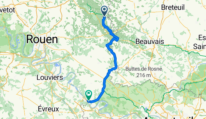
Gaillefontaine mit dem Fahrrad
Entdecke eine Karte mit 6 Radrouten und Radwegen rund um Gaillefontaine, erstellt von unserer Community.
Regionenporträt
Lerne Gaillefontaine kennen
Finde die richtige Fahrradroute in Gaillefontaine, wo wir 6 Fahrradrouten für dich zum Erkunden haben.
274 km
Aufgezeichnete Strecken
6
Fahrradrouten
1.496
Einwohner
Community
Die aktivsten Nutzer in Gaillefontaine
Von unserer Community
Die besten Fahrradrouten in und um Gaillefontaine
Gaillefontaine - Gasny
Fahrradtour in Gaillefontaine, Normandie, Frankreich
- 70,6 km
- Distanz
- 441 m
- Aufstieg
- 547 m
- Abstieg
2–4 Rue Artus de Fricourt, Haussez to 2–4 Rue Artus de Fricourt, Haussez
Fahrradtour in Gaillefontaine, Normandie, Frankreich
- 0,3 km
- Distanz
- 146 m
- Aufstieg
- 151 m
- Abstieg
De Rue Arthur de Fricourt, Haussez à 1 Rue Guy de Maupassant, Forges-les-Eaux
Fahrradtour in Gaillefontaine, Normandie, Frankreich
- 9,2 km
- Distanz
- 151 m
- Aufstieg
- 144 m
- Abstieg
Gaillefontaine - Limetz-Villez
Fahrradtour in Gaillefontaine, Normandie, Frankreich
- 87,8 km
- Distanz
- 488 m
- Aufstieg
- 595 m
- Abstieg


