
Châtillon-sur-Marne mit dem Fahrrad
Entdecke eine Karte mit 10 Radrouten und Radwegen rund um Châtillon-sur-Marne, erstellt von unserer Community.
Regionenporträt
Lerne Châtillon-sur-Marne kennen
Finde die richtige Fahrradroute in Châtillon-sur-Marne, wo wir 10 Fahrradrouten für dich zum Erkunden haben.
404 km
Aufgezeichnete Strecken
10
Fahrradrouten
1.009
Einwohner


Von unserer Community
Die besten Fahrradrouten in und um Châtillon-sur-Marne
![[Trek] V 52 - La véloroute de la Marne](https://media.bikemap.net/routes/9771421/staticmaps/in_317a5de9-720f-4c03-bc70-65e5e17f67de_694x400_bikemap-2021-3D-static.png)
[Trek] V 52 - La véloroute de la Marne
Fahrradtour in Châtillon-sur-Marne, Grand Est, Frankreich
From Dormans to Epernay, Marne flows between the foothills of the Montagne de Reims and the Côte des Blancs, which marks the eastern border of the Paris basin. in the wait of a new greenway to be developed, the route follows a section on preliminary automobile roads. The surrounding land fades gradually as we approach Chalons-en-Champagne. From the boat cruise you can see the "Venise Pétillante" before arriving to Vitry-le-François to follow a temporary route on a low traffic road.
Modified: 23 weeks ago
- 19,5 km
- Distanz
- 22 m
- Aufstieg
- 18 m
- Abstieg

Circuit du Chatillonais
Fahrradtour in Châtillon-sur-Marne, Grand Est, Frankreich
Cette balade de 25 km sur les routes départementales du territoire vous permettra de découvrir notamment la trilogie de paysages symbole du parc régional : Vignes , Forêts et Cultures . Cet itinéraire s’adresse à des cyclotouristes qui n’ont pas peur du dénivelé.
- 25 km
- Distanz
- 370 m
- Aufstieg
- 368 m
- Abstieg

Autour de Châtillon-sur-Marne
Fahrradtour in Châtillon-sur-Marne, Grand Est, Frankreich
Cette balade de 26 km sur les routes départementales du territoire vous permettra de découvrir notamment une variété de paysages, la Statue Urbain II à Châtillon sur Marne et son point de vue équipé d’une table de lecture du paysage dominant la vallée de la Marne, des églises romanes, … N’hésitez pas à pousser les portes de l’office de tourisme de Châtillon-sur-Marne.
- 26,1 km
- Distanz
- 438 m
- Aufstieg
- 439 m
- Abstieg

Champagne plat
Fahrradtour in Châtillon-sur-Marne, Grand Est, Frankreich
- 53,5 km
- Distanz
- 367 m
- Aufstieg
- 369 m
- Abstieg
Mehr Routen entdecken
 Binson-et-Orquigny
- Distanz
- 54,2 km
- Aufstieg
- 522 m
- Abstieg
- 521 m
- Standort
- Châtillon-sur-Marne, Grand Est, Frankreich
 "'(§è
"'(§è- Distanz
- 40 km
- Aufstieg
- 389 m
- Abstieg
- 485 m
- Standort
- Châtillon-sur-Marne, Grand Est, Frankreich
 Recovered Route
- Distanz
- 49,4 km
- Aufstieg
- 882 m
- Abstieg
- 897 m
- Standort
- Châtillon-sur-Marne, Grand Est, Frankreich
 Etappe 7_ Vandières - Jouarre
- Distanz
- 69,5 km
- Aufstieg
- 324 m
- Abstieg
- 266 m
- Standort
- Châtillon-sur-Marne, Grand Est, Frankreich
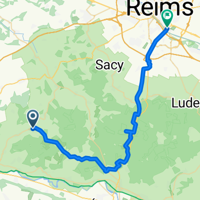 vrijgezellenfeest Reims
- Distanz
- 37,4 km
- Aufstieg
- 611 m
- Abstieg
- 637 m
- Standort
- Châtillon-sur-Marne, Grand Est, Frankreich
 Steady Donnerstag Course In Vandières
- Distanz
- 29,3 km
- Aufstieg
- 175 m
- Abstieg
- 175 m
- Standort
- Châtillon-sur-Marne, Grand Est, Frankreich