
Beynat mit dem Fahrrad
Entdecke eine Karte mit 17 Radrouten und Radwegen rund um Beynat, erstellt von unserer Community.
Regionenporträt
Lerne Beynat kennen
Finde die richtige Fahrradroute in Beynat, wo wir 17 Fahrradrouten für dich zum Erkunden haben.
904 km
Aufgezeichnete Strecken
17
Fahrradrouten
1.233
Einwohner
Community
Die aktivsten Nutzer in Beynat
Von unserer Community
Die besten Fahrradrouten in und um Beynat
Albussac (Les Quatre Routes) - Circle through Neuville
Fahrradtour in Beynat, Aquitaine-Limousin-Poitou-Charentes, Frankreich
Except for the inital few kilometers to Beynat, all of the ride was on outstanding scenic zero and low traffic roads. Outstanding.
- 37,8 km
- Distanz
- 686 m
- Aufstieg
- 686 m
- Abstieg
Albussac (Les Quatre Routes) - Circle to Brive-la-Gaillarde (Malemort)
Fahrradtour in Beynat, Aquitaine-Limousin-Poitou-Charentes, Frankreich
This turned into a heck of a ride. A few kilometers after leaving Brive while on D141E3, thunder, lighting, and really heavy rains started up. For a half hour or so, we took shelter where a building had a covered entryway in St-Hilaire-Peyroux. After that, we took a wrong turn when it was raining and we ended up having to ride some on D1089, which was less than pleasant...especially in the rain. This road also had some tunnels; fortunately, we had some tail-lights that we put on the bikes since with the heavy overcast and rain it was relatively dark. Eventually we got to Cornil, where we could pick up D1 to head due east to Ste-Fortunade and D940, which then allowed us to head south back to our hotel. Our original destination was Tulle, where we intended to do some grocery shopping and pick up some McDonalds items for our dinner. With the thunder, lightning, and rain, we bypassed Tulle...maybe tomorrow.
With the exception of being inside Malemort and on D1089, all roads were excellent. D921 from Les Quatre Routes to Malemort was surprisingly good with relatively little traffic.
- 75,3 km
- Distanz
- 1.422 m
- Aufstieg
- 1.422 m
- Abstieg
Albussac (Les Quatre Routes) to Égletons
Fahrradtour in Beynat, Aquitaine-Limousin-Poitou-Charentes, Frankreich
This was a great route mostly on excellent zero and low-traffic roads. Only along D16 nearing Égletons was there any traffic to speak of.
- 53,5 km
- Distanz
- 978 m
- Aufstieg
- 889 m
- Abstieg
Albussac (Les Quatre Routes) - Circle through Tulle
Fahrradtour in Beynat, Aquitaine-Limousin-Poitou-Charentes, Frankreich
his was one wonderful ride on all zero and low traffic scenic roads (with the one exception of the few kilometers that we were within Tulle). The climb out of Tulle was challenging, and the descent on D130 was excellent as well.
- 59,4 km
- Distanz
- 1.179 m
- Aufstieg
- 1.180 m
- Abstieg
Mehr Routen entdecken
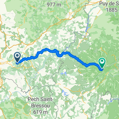
- Albussac (Les Quatre Routes) - Circle to Argentat and Barrage
- Distanz
- 63,9 km
- Aufstieg
- 1.701 m
- Abstieg
- 1.696 m
- Standort
- Beynat, Aquitaine-Limousin-Poitou-Charentes, Frankreich
- Montée Lanteuil-Brousse
- Distanz
- 7,7 km
- Aufstieg
- 354 m
- Abstieg
- 95 m
- Standort
- Beynat, Aquitaine-Limousin-Poitou-Charentes, Frankreich
- Circuit championat
- Distanz
- 9,7 km
- Aufstieg
- 156 m
- Abstieg
- 156 m
- Standort
- Beynat, Aquitaine-Limousin-Poitou-Charentes, Frankreich
- puy mary 2
- Distanz
- 116,8 km
- Aufstieg
- 1.874 m
- Abstieg
- 824 m
- Standort
- Beynat, Aquitaine-Limousin-Poitou-Charentes, Frankreich
- Palazinges - Barrage aigle
- Distanz
- 66,7 km
- Aufstieg
- 508 m
- Abstieg
- 764 m
- Standort
- Beynat, Aquitaine-Limousin-Poitou-Charentes, Frankreich
- le planchat
- Distanz
- 3,8 km
- Aufstieg
- 212 m
- Abstieg
- 93 m
- Standort
- Beynat, Aquitaine-Limousin-Poitou-Charentes, Frankreich
- espagnagol
- Distanz
- 7,1 km
- Aufstieg
- 135 m
- Abstieg
- 135 m
- Standort
- Beynat, Aquitaine-Limousin-Poitou-Charentes, Frankreich
- De Étang de Miel 22, Beynat à Rue du Rial 9, Pont-de-Salars
- Distanz
- 179,7 km
- Aufstieg
- 2.506 m
- Abstieg
- 2.328 m
- Standort
- Beynat, Aquitaine-Limousin-Poitou-Charentes, Frankreich