
Beuvillers mit dem Fahrrad
Entdecke eine Karte mit 28 Radrouten und Radwegen rund um Beuvillers, erstellt von unserer Community.
Regionenporträt
Lerne Beuvillers kennen
Finde die richtige Fahrradroute in Beuvillers, wo wir 28 Fahrradrouten für dich zum Erkunden haben.
1.277 km
Aufgezeichnete Strecken
28
Fahrradrouten
1.130
Einwohner
Community
Die aktivsten Nutzer in Beuvillers


Von unserer Community
Die besten Fahrradrouten in und um Beuvillers

2009 Euro Tour -- Ride Day 21 — 16 July 2009 — 14100 Lisieux to 76230 Isneauville (Rouen) CLONED FROM ROUTE 1682067
Fahrradtour in Beuvillers, Normandie, Frankreich
- 106,1 km
- Distanz
- 649 m
- Aufstieg
- 638 m
- Abstieg

Circuit de l'Orbiquet
Fahrradtour in Beuvillers, Normandie, Frankreich
- 29,8 km
- Distanz
- 477 m
- Aufstieg
- 478 m
- Abstieg

2013/08/26 2. Tag Tour Vire - Baunatal (Lisieux - Gournay-en-Bray)
Fahrradtour in Beuvillers, Normandie, Frankreich
- 128,5 km
- Distanz
- 489 m
- Aufstieg
- 523 m
- Abstieg

Quick ride through Saint-Martin-de-Mailloc
Fahrradtour in Beuvillers, Normandie, Frankreich
- 6,9 km
- Distanz
- 101 m
- Aufstieg
- 102 m
- Abstieg
Mehr Routen entdecken
 78 Le Bourg, Courtonne-la-Meurdrac à 37 Rue du Carmel, Lisieux
- Distanz
- 7,7 km
- Aufstieg
- 15 m
- Abstieg
- 43 m
- Standort
- Beuvillers, Normandie, Frankreich
 De La Trabière, Courtonne-la-Meurdrac à Route d'Orbec, Livarot
- Distanz
- 21,1 km
- Aufstieg
- 325 m
- Abstieg
- 329 m
- Standort
- Beuvillers, Normandie, Frankreich
 pretreville
- Distanz
- 9,8 km
- Aufstieg
- 99 m
- Abstieg
- 133 m
- Standort
- Beuvillers, Normandie, Frankreich
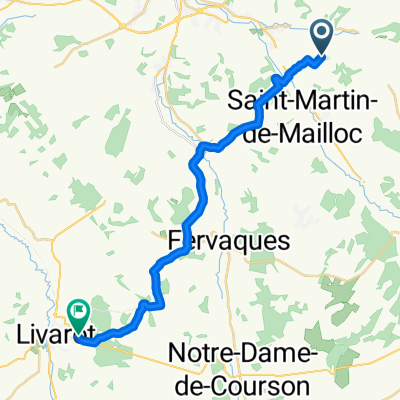
 De 10 Route de la Mairie, Saint-Martin-de-Mailloc à 36–54 Rue du Docteur Degrenne, Lisieux
- Distanz
- 13,1 km
- Aufstieg
- 145 m
- Abstieg
- 202 m
- Standort
- Beuvillers, Normandie, Frankreich
 grande boucle Orbec broglie bernay
- Distanz
- 58,6 km
- Aufstieg
- 233 m
- Abstieg
- 232 m
- Standort
- Beuvillers, Normandie, Frankreich
 glos, premiere
- Distanz
- 86,2 km
- Aufstieg
- 1.723 m
- Abstieg
- 1.750 m
- Standort
- Beuvillers, Normandie, Frankreich
 Day 3 Amos London to Paris
- Distanz
- 114,5 km
- Aufstieg
- 298 m
- Abstieg
- 356 m
- Standort
- Beuvillers, Normandie, Frankreich
 lxddd
lxddd- Distanz
- 4 km
- Aufstieg
- 32 m
- Abstieg
- 35 m
- Standort
- Beuvillers, Normandie, Frankreich