
Radfahren in Hustopeče Nad Bečvou
Entdecke eine Karte mit 17 Radrouten und Radwegen rund um Hustopeče Nad Bečvou, erstellt von unserer Community.
Regionenporträt
Lerne Hustopeče Nad Bečvou kennen
Finde die richtige Fahrradroute in Hustopeče Nad Bečvou, wo wir 17 Fahrradrouten für dich zum Erkunden haben.
796 km
Aufgezeichnete Strecken
17
Fahrradrouten
1.748
Einwohner
Community
Die aktivsten Nutzer in Hustopeče Nad Bečvou
Von unserer Community
Die besten Fahrradrouten in und um Hustopeče Nad Bečvou
10.-Heřmanice-N.Jičín-Kopřivnice-Kamenec
Fahrradtour in Hustopeče Nad Bečvou, Olomoucký kraj, Tschechische Republik
- 58,2 km
- Distanz
- 475 m
- Aufstieg
- 440 m
- Abstieg
Rožnov 2
Fahrradtour in Hustopeče Nad Bečvou, Olomoucký kraj, Tschechische Republik
- 71,8 km
- Distanz
- 558 m
- Aufstieg
- 407 m
- Abstieg
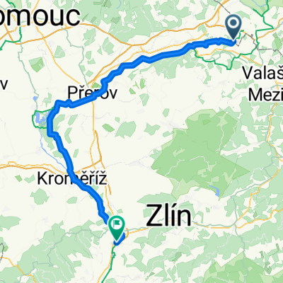
2. den Hustopeče-Ostrožská nová ves
Fahrradtour in Hustopeče Nad Bečvou, Olomoucký kraj, Tschechische Republik
lehokolmo
(cloned from route 2420548)
- 103,1 km
- Distanz
- 79 m
- Aufstieg
- 164 m
- Abstieg
Hustopeče n/B. - Bohumín
Fahrradtour in Hustopeče Nad Bečvou, Olomoucký kraj, Tschechische Republik
Jantarová stezka
(cloned from route 2257686)
- 76,7 km
- Distanz
- 272 m
- Aufstieg
- 330 m
- Abstieg
Mehr Routen entdecken
- Hustopeče-Ostrožská nová ves
- Distanz
- 103 km
- Aufstieg
- 79 m
- Abstieg
- 164 m
- Standort
- Hustopeče Nad Bečvou, Olomoucký kraj, Tschechische Republik
- ride through Hranice
- Distanz
- 17,1 km
- Aufstieg
- 204 m
- Abstieg
- 246 m
- Standort
- Hustopeče Nad Bečvou, Olomoucký kraj, Tschechische Republik
- Powrót austr 9/2018
- Distanz
- 57,2 km
- Aufstieg
- 146 m
- Abstieg
- 272 m
- Standort
- Hustopeče Nad Bečvou, Olomoucký kraj, Tschechische Republik
- Silnice 35, Špičky to Nádražní 498, Hranice
- Distanz
- 10,4 km
- Aufstieg
- 159 m
- Abstieg
- 141 m
- Standort
- Hustopeče Nad Bečvou, Olomoucký kraj, Tschechische Republik
- Trasa z 49.5248563N, 17.8517822E do 49.5238010N, 17.8527778E
- Distanz
- 28,1 km
- Aufstieg
- 283 m
- Abstieg
- 282 m
- Standort
- Hustopeče Nad Bečvou, Olomoucký kraj, Tschechische Republik
- Tag 7
- Distanz
- 64,4 km
- Aufstieg
- 1.145 m
- Abstieg
- 789 m
- Standort
- Hustopeče Nad Bečvou, Olomoucký kraj, Tschechische Republik
- Cyklostezka Bečva nach aleja Jana Łyska 16, Cieszyn
- Distanz
- 97,5 km
- Aufstieg
- 739 m
- Abstieg
- 712 m
- Standort
- Hustopeče Nad Bečvou, Olomoucký kraj, Tschechische Republik
- náměstí Míru, Hustopeče nad Bečvou do Komenského 276, Hranice
- Distanz
- 19,6 km
- Aufstieg
- 133 m
- Abstieg
- 157 m
- Standort
- Hustopeče Nad Bečvou, Olomoucký kraj, Tschechische Republik