Crockett mit dem Fahrrad
Entdecke eine Fahrradkarte von Crockett mit hervorgehobenen Radwegen, Pfaden und relevanten Orten.
Pioniere gesucht
Inspiriere andere Radfahrer mit deiner Route in Crockett
Bikemap ist eine globale Fahrrad-Community mit Millionen von Routen, die von Radfahrern wie dir erstellt wurden. Es gibt bisher nur wenige Routen in Crockett, also zeichne deine Lieblingsstrecken jetzt auf der Karte ein, um anderen zu helfen, die besten Radrouten zu finden.
Von unserer Community
Die besten Fahrradrouten in und um Crockett
Crockett to Palestine
Fahrradtour in Crockett, Texas, USA
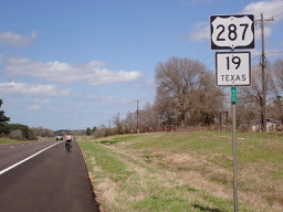
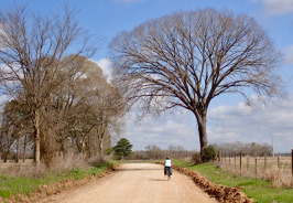
After passing the northern part of the highway ring around Crockett, we were soon on a local road that had a temporary sign saying “Rough Road”. They weren’t kidding since after a short time we lost the pavement and had an unpaved road for a while. Getting into Latexo, we crossed over U.S. 287/Texas 19 onto a local road…that really turned out to be local. It was unpaved often with a sandy base that we had to push the bikes through. This went on for a number of miles until we got close to Grapeland when paving reappeared. Being gun-shy, we decided against the originally planned local roads which would have taken us to Elkhart and Palestine and took U.S. 287/Texas 19 instead. Noisy, but mostly good road shoulder to ride on.
Because of the sandy road conditions, this route was not good for a road bike. You should use US 287/Texas 19 instead of the small local roads.
- 63,1 km
- Distanz
- 512 m
- Aufstieg
- 456 m
- Abstieg
Crockett, TX - Buffalo, TX
Fahrradtour in Crockett, Texas, USA
Route for tour IcelandAcrossAmerica 2011
- 80,3 km
- Distanz
- 293 m
- Aufstieg
- 281 m
- Abstieg