
Parsons mit dem Fahrrad
Entdecke eine Karte mit 26 Radrouten und Radwegen rund um Parsons, erstellt von unserer Community.
Regionenporträt
Lerne Parsons kennen
Finde die richtige Fahrradroute in Parsons, wo wir 26 Fahrradrouten für dich zum Erkunden haben.
1.358 km
Aufgezeichnete Strecken
26
Fahrradrouten
1.485
Einwohner


Von unserer Community
Die besten Fahrradrouten in und um Parsons
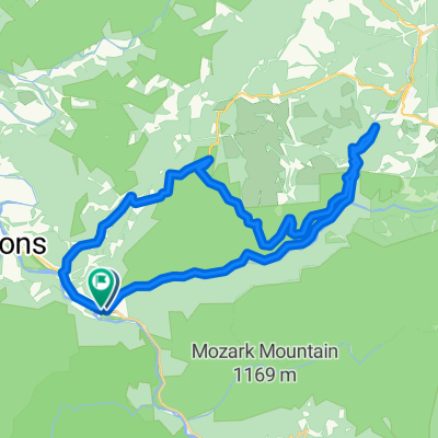
Allegheny Highlands Trail of Wv, Parsons to Main St, Parsons
Fahrradtour in Parsons, West Virginia, Vereinigte Staaten
- 42,2 km
- Distanz
- 531 m
- Aufstieg
- 527 m
- Abstieg

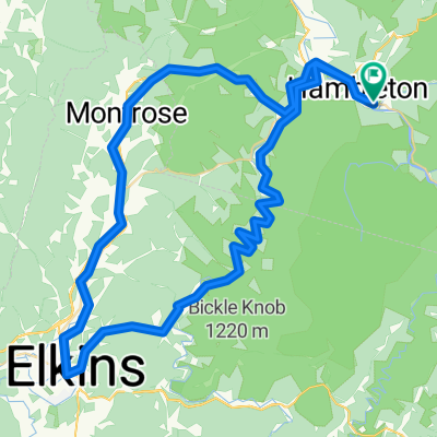
Limestone Mt. Loop
Fahrradtour in Parsons, West Virginia, Vereinigte Staaten
- 33,4 km
- Distanz
- 587 m
- Aufstieg
- 587 m
- Abstieg

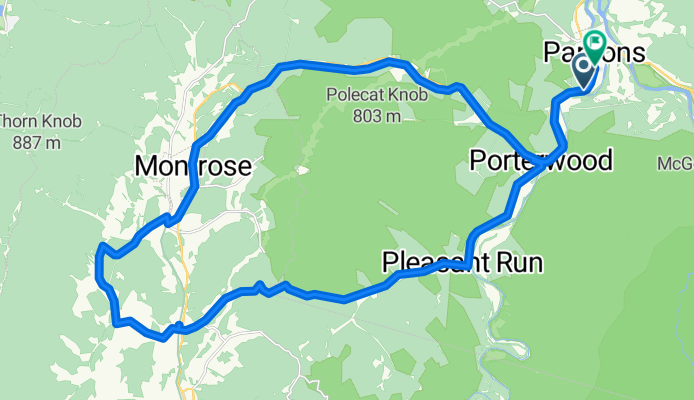
Parsons-Montrose Loop
Fahrradtour in Parsons, West Virginia, Vereinigte Staaten
- 61,5 km
- Distanz
- 604 m
- Aufstieg
- 602 m
- Abstieg

Horseshoe - Limestone Mt. Ride
Fahrradtour in Parsons, West Virginia, Vereinigte Staaten
- 55 km
- Distanz
- 677 m
- Aufstieg
- 677 m
- Abstieg
Mehr Routen entdecken
 Texas Mountain
- Distanz
- 34,7 km
- Aufstieg
- 502 m
- Abstieg
- 502 m
- Standort
- Parsons, West Virginia, Vereinigte Staaten
 Pifer Mountain Loop
- Distanz
- 31,4 km
- Aufstieg
- 557 m
- Abstieg
- 557 m
- Standort
- Parsons, West Virginia, Vereinigte Staaten
 Backbone Mountain Climb
- Distanz
- 8,7 km
- Aufstieg
- 534 m
- Abstieg
- 26 m
- Standort
- Parsons, West Virginia, Vereinigte Staaten
 Olson Fire Tower to Parsons
- Distanz
- 35,8 km
- Aufstieg
- 96 m
- Abstieg
- 710 m
- Standort
- Parsons, West Virginia, Vereinigte Staaten
 BW falls to Parsons to Deck Creek to apt
- Distanz
- 124,3 km
- Aufstieg
- 959 m
- Abstieg
- 1.571 m
- Standort
- Parsons, West Virginia, Vereinigte Staaten
 Route in Hendricks
- Distanz
- 83,8 km
- Aufstieg
- 1.531 m
- Abstieg
- 1.531 m
- Standort
- Parsons, West Virginia, Vereinigte Staaten
 Bfalls to Moundsville
- Distanz
- 201,5 km
- Aufstieg
- 1.391 m
- Abstieg
- 2.151 m
- Standort
- Parsons, West Virginia, Vereinigte Staaten
 Second St, Hendricks to Allegheny Highlands Trail of Wv, Hendricks
- Distanz
- 39,5 km
- Aufstieg
- 798 m
- Abstieg
- 794 m
- Standort
- Parsons, West Virginia, Vereinigte Staaten