
Conneaut mit dem Fahrrad
Entdecke eine Karte mit 10 Radrouten und Radwegen rund um Conneaut, erstellt von unserer Community.
Regionenporträt
Lerne Conneaut kennen
Finde die richtige Fahrradroute in Conneaut, wo wir 10 Fahrradrouten für dich zum Erkunden haben.
318 km
Aufgezeichnete Strecken
10
Fahrradrouten
12.841
Einwohner


Von unserer Community
Die besten Fahrradrouten in und um Conneaut


Conneaut OH to Austinburg OH
Fahrradtour in Conneaut, Ohio, Vereinigte Staaten
- 33,8 km
- Distanz
- 230 m
- Aufstieg
- 188 m
- Abstieg

Conneaut to Erie/Forest Park
Fahrradtour in Conneaut, Ohio, Vereinigte Staaten
- 96,6 km
- Distanz
- 139 m
- Aufstieg
- 148 m
- Abstieg
413–439 Gore Rd, Conneaut to 1230 Walnut Blvd, Ashtabula
Fahrradtour in Conneaut, Ohio, Vereinigte Staaten
- 18,2 km
- Distanz
- 49 m
- Aufstieg
- 257 m
- Abstieg

380 State St, Conneaut to 102 W Main Rd, Conneaut
Fahrradtour in Conneaut, Ohio, Vereinigte Staaten
- 2 km
- Distanz
- 17 m
- Aufstieg
- 12 m
- Abstieg
Mehr Routen entdecken
 251 State St, Conneaut to 380 State St, Conneaut
- Distanz
- 0,7 km
- Aufstieg
- 0 m
- Abstieg
- 3 m
- Standort
- Conneaut, Ohio, Vereinigte Staaten
 102 W Main Rd, Conneaut to 404 Gore Rd, Conneaut
- Distanz
- 3,1 km
- Aufstieg
- 10 m
- Abstieg
- 10 m
- Standort
- Conneaut, Ohio, Vereinigte Staaten
 Recording from 7:19pm, August 18
- Distanz
- 51,1 km
- Aufstieg
- 247 m
- Abstieg
- 65 m
- Standort
- Conneaut, Ohio, Vereinigte Staaten
 USBR 30: Conneaut to Lake City
- Distanz
- 17,5 km
- Aufstieg
- 83 m
- Abstieg
- 74 m
- Standort
- Conneaut, Ohio, Vereinigte Staaten
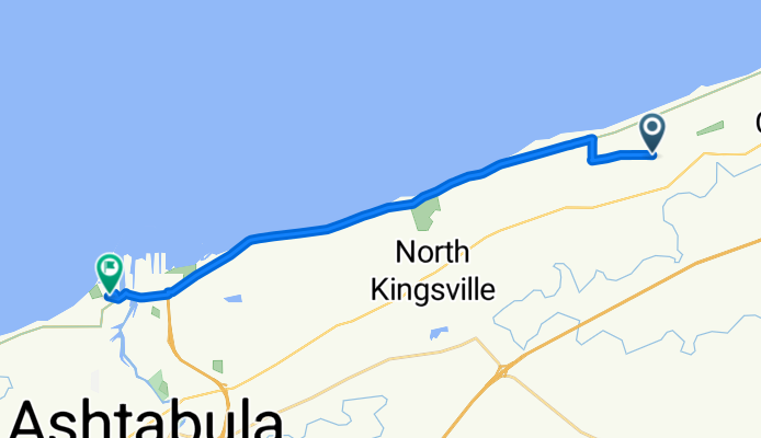
 USBR 30: Conneaut to North Kingsville
- Distanz
- 18,1 km
- Aufstieg
- 72 m
- Abstieg
- 60 m
- Standort
- Conneaut, Ohio, Vereinigte Staaten
 300 Park Ave, Conneaut to 7 W Jackson St, Painesville
- Distanz
- 77 km
- Aufstieg
- 749 m
- Abstieg
- 735 m
- Standort
- Conneaut, Ohio, Vereinigte Staaten