
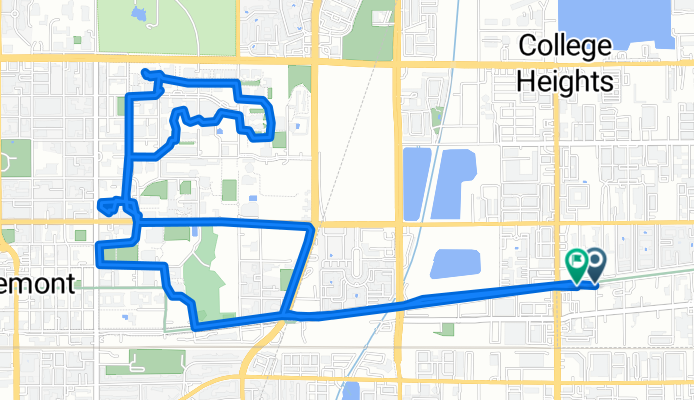
Montclair mit dem Fahrrad
Entdecke eine Karte mit 65 Radrouten und Radwegen rund um Montclair, erstellt von unserer Community.
Regionenporträt
Lerne Montclair kennen
Finde die richtige Fahrradroute in Montclair, wo wir 65 Fahrradrouten für dich zum Erkunden haben. Die meisten Leute fahren hier in den Monaten Mai und August Fahrrad.
1.256 km
Aufgezeichnete Strecken
65
Fahrradrouten
36.664
Einwohner
Community
Die aktivsten Nutzer in Montclair


Von unserer Community
Die besten Fahrradrouten in und um Montclair

ontario warm up
Fahrradtour in Montclair, Kalifornien, Vereinigte Staaten
- 12,9 km
- Distanz
- 35 m
- Aufstieg
- 35 m
- Abstieg

Carbon Canyon Regional Park
Fahrradtour in Montclair, Kalifornien, Vereinigte Staaten
THIS IS A ROUTE FOR ROAD BIKES !!
This route is good when you want to work on climbing and recovery reps.
I left my Apex mountain bike at home for this one and hopped on the Allez Elite for a day of climbing.
The run starts out with an easy quick pace going downhill all the way to Pipeline and Chino Hills Parkway. There begins a gradual climb until you reach Carbon Canyon Road, and that is where you begin the mountain climb. Rolling Hills all the way to Carbon Canyon park, so pace yourself and stay well hydrated.
This ride is approx 31 miles roundtrip. Safe-for Ipod use.
- 49,6 km
- Distanz
- 430 m
- Aufstieg
- 430 m
- Abstieg
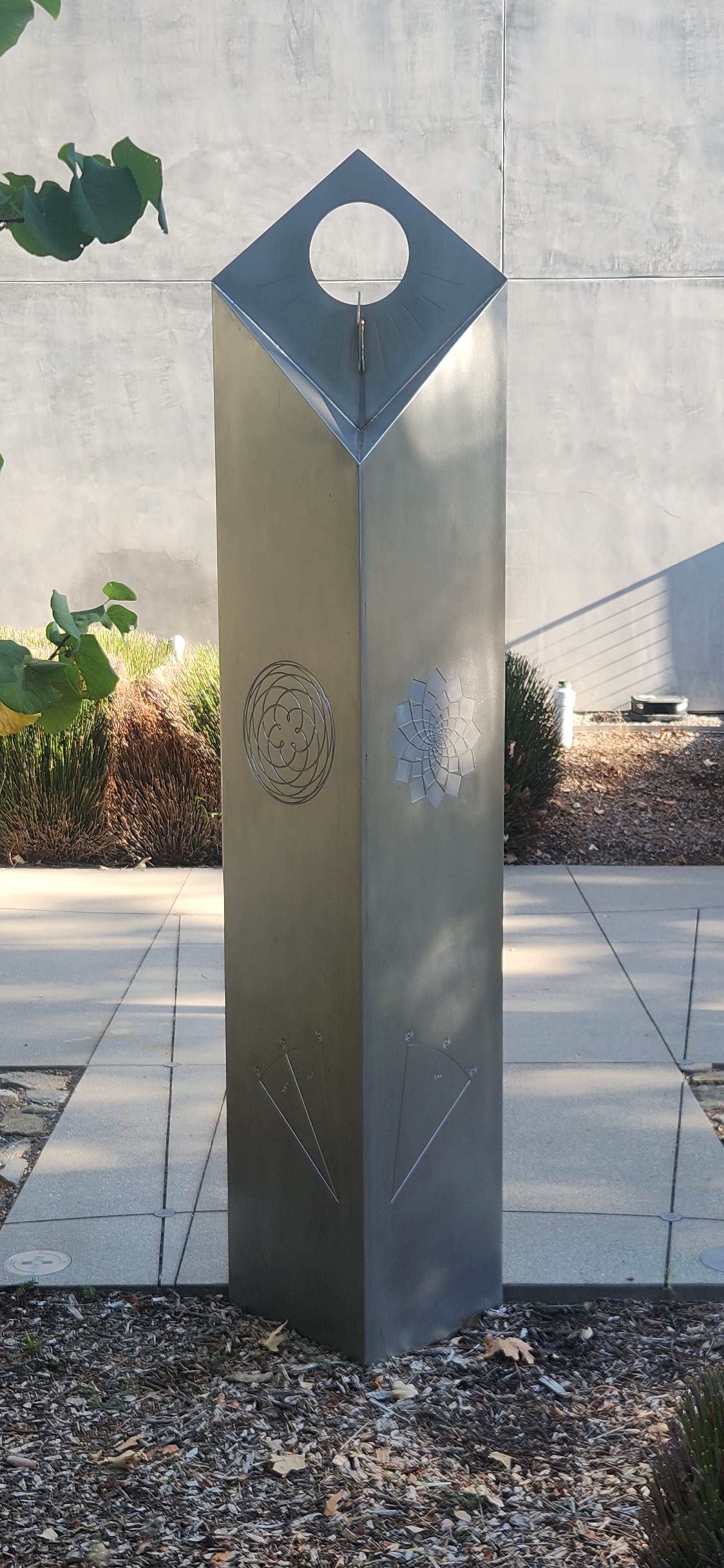
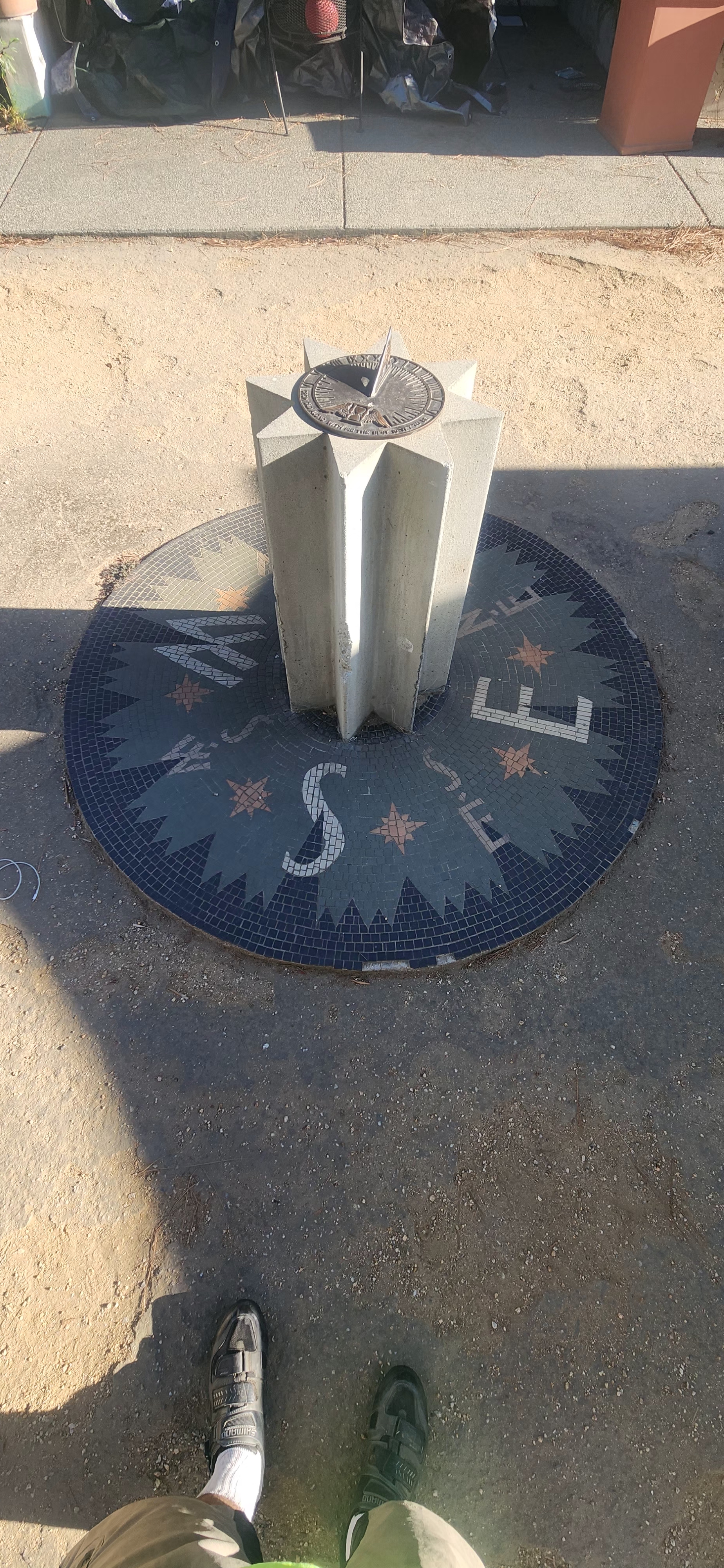
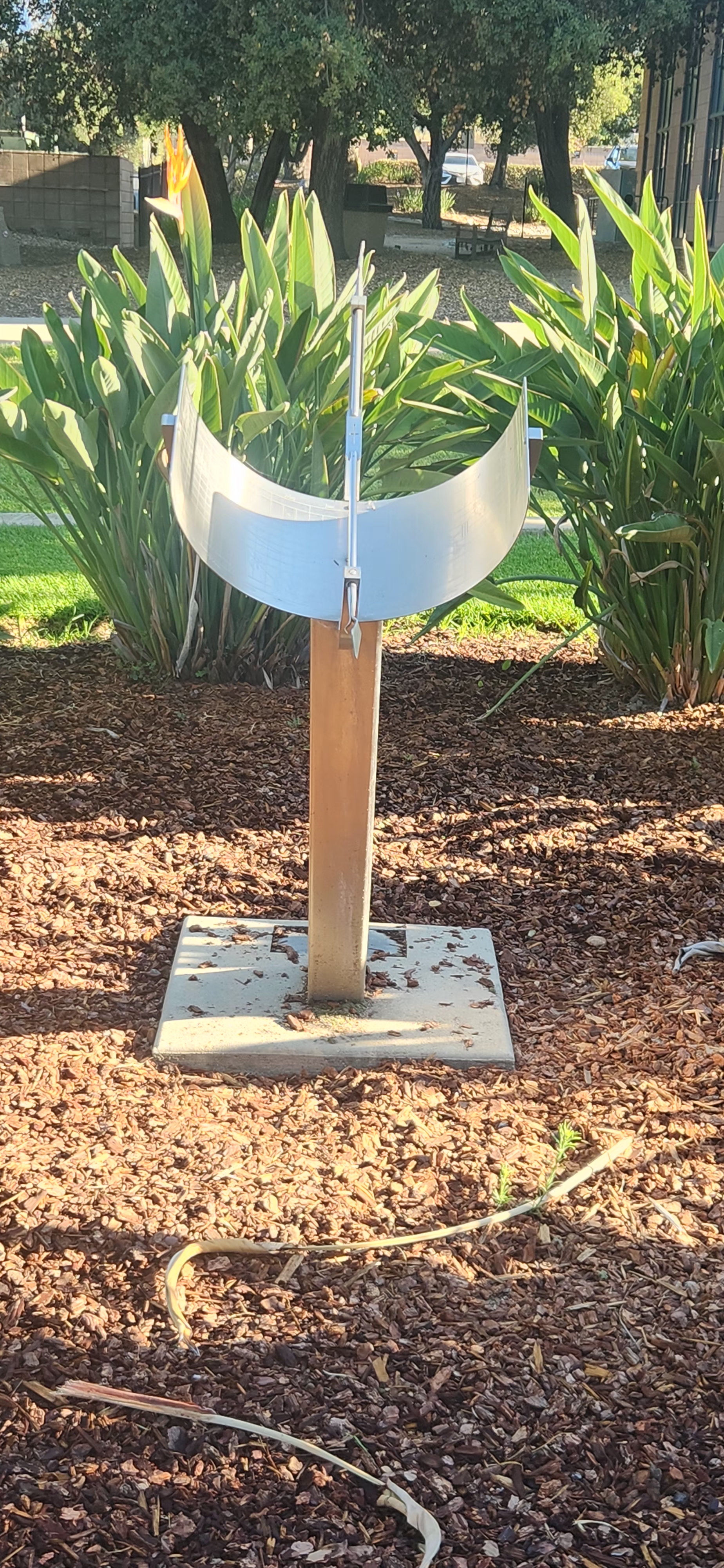
Claremont colleges sun dial tour
Fahrradtour in Montclair, Kalifornien, Vereinigte Staaten
- 10,5 km
- Distanz
- 147 m
- Aufstieg
- 116 m
- Abstieg

Pacific Electric Trail - Round Trip
Fahrradtour in Montclair, Kalifornien, Vereinigte Staaten
This trip starts out in Chino then goes thru Montclair and then into Claremont. There you enter the Pacific Electric trailhead. The trail will take you thru Upland, Rancho Cucamonga, Fontana, and finally ends in Rialto. After a brief break it's time to head all the way back. A very good ride for training with some elevation mixed in the miles.
This ride is approx 50 miles roundtrip, and a safe-for-Ipod run.
- 79,9 km
- Distanz
- 220 m
- Aufstieg
- 221 m
- Abstieg
Mehr Routen entdecken
 A Ride to Central Park in Rancho Cucamonga
- Distanz
- 40,3 km
- Aufstieg
- 221 m
- Abstieg
- 221 m
- Standort
- Montclair, Kalifornien, Vereinigte Staaten
 Route 66 Trailhead
- Distanz
- 26 km
- Aufstieg
- 126 m
- Abstieg
- 124 m
- Standort
- Montclair, Kalifornien, Vereinigte Staaten
 Ontario International Airport Loop
- Distanz
- 38,5 km
- Aufstieg
- 99 m
- Abstieg
- 101 m
- Standort
- Montclair, Kalifornien, Vereinigte Staaten
 Urban Bike Route
- Distanz
- 22,3 km
- Aufstieg
- 76 m
- Abstieg
- 76 m
- Standort
- Montclair, Kalifornien, Vereinigte Staaten
 Red Hill Park
- Distanz
- 18 km
- Aufstieg
- 55 m
- Abstieg
- 54 m
- Standort
- Montclair, Kalifornien, Vereinigte Staaten
 Kimball Park
- Distanz
- 13,6 km
- Aufstieg
- 36 m
- Abstieg
- 34 m
- Standort
- Montclair, Kalifornien, Vereinigte Staaten
 Olive Street 4948, Montclair to North Campus Avenue 379, Upland
- Distanz
- 6 km
- Aufstieg
- 29 m
- Abstieg
- 351 m
- Standort
- Montclair, Kalifornien, Vereinigte Staaten
 Olive Street 4948, Montclair to Olive Street 4948, Montclair
- Distanz
- 29,9 km
- Aufstieg
- 88 m
- Abstieg
- 80 m
- Standort
- Montclair, Kalifornien, Vereinigte Staaten