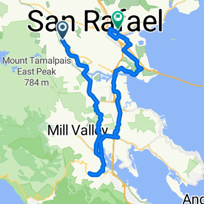
Ross mit dem Fahrrad
Entdecke eine Karte mit 14 Radrouten und Radwegen rund um Ross, erstellt von unserer Community.
Regionenporträt
Lerne Ross kennen
Finde die richtige Fahrradroute in Ross, wo wir 14 Fahrradrouten für dich zum Erkunden haben.
297 km
Aufgezeichnete Strecken
14
Fahrradrouten
2.415
Einwohner
Community
Die aktivsten Nutzer in Ross
Von unserer Community
Die besten Fahrradrouten in und um Ross
Ross - Five Points - Lake Lagunitas - Eldridge Loop
Fahrradtour in Ross, Kalifornien, Vereinigte Staaten
- 15,8 km
- Distanz
- 467 m
- Aufstieg
- 464 m
- Abstieg
Ross - Five Points - Lake Lagunitas - Eldridge Loop CLONED FROM ROUTE 51515
Fahrradtour in Ross, Kalifornien, Vereinigte Staaten
- 15,8 km
- Distanz
- 467 m
- Aufstieg
- 464 m
- Abstieg
Greatest Hits
Fahrradtour in Ross, Kalifornien, Vereinigte Staaten
- 24,9 km
- Distanz
- 558 m
- Aufstieg
- 556 m
- Abstieg
Mehr Routen entdecken
 Test 2
- Distanz
- 6,4 km
- Aufstieg
- 50 m
- Abstieg
- 100 m
- Standort
- Ross, Kalifornien, Vereinigte Staaten
 Ross Common 1 to Ross Common 26
- Distanz
- 22,2 km
- Aufstieg
- 440 m
- Abstieg
- 440 m
- Standort
- Ross, Kalifornien, Vereinigte Staaten
 26 El Camino Bueno, Ross to E Sir Francis Drake Blvd, Larkspur
- Distanz
- 6,4 km
- Aufstieg
- 50 m
- Abstieg
- 110 m
- Standort
- Ross, Kalifornien, Vereinigte Staaten
 210 Dibblee Rd, Ross to 305 San Anselmo Ave, San Anselmo
- Distanz
- 2,1 km
- Aufstieg
- 27 m
- Abstieg
- 39 m
- Standort
- Ross, Kalifornien, Vereinigte Staaten
 Greatest Hits with Rocky Ridge
- Distanz
- 26,5 km
- Aufstieg
- 692 m
- Abstieg
- 689 m
- Standort
- Ross, Kalifornien, Vereinigte Staaten
 milk.
milk.- Distanz
- 32,4 km
- Aufstieg
- 488 m
- Abstieg
- 495 m
- Standort
- Ross, Kalifornien, Vereinigte Staaten
 237 Laurel Grove Ave, Kentfield to Marina Green Dr, San Francisco
- Distanz
- 26,5 km
- Aufstieg
- 625 m
- Abstieg
- 654 m
- Standort
- Ross, Kalifornien, Vereinigte Staaten
 26 El Camino Bueno, Ross to 935 Sir Francis Drake Blvd, Kentfield
- Distanz
- 2,2 km
- Aufstieg
- 0 m
- Abstieg
- 50 m
- Standort
- Ross, Kalifornien, Vereinigte Staaten


