
Cranbrook mit dem Fahrrad
Entdecke eine Karte mit 37 Radrouten und Radwegen rund um Cranbrook, erstellt von unserer Community.
Regionenporträt
Lerne Cranbrook kennen
Finde die richtige Fahrradroute in Cranbrook, wo wir 37 Fahrradrouten für dich zum Erkunden haben. Die meisten Leute fahren hier in den Monaten Juli und August Fahrrad.
3.248 km
Aufgezeichnete Strecken
37
Fahrradrouten
18.610
Einwohner
Community
Die aktivsten Nutzer in Cranbrook

Von unserer Community
Die besten Fahrradrouten in und um Cranbrook
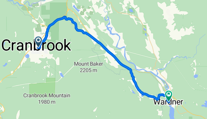
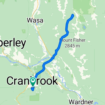
Trans Canada Trail/Route Cranbrook Pavilion to Wardner Provincial Park
Fahrradtour in Cranbrook, British Columbia, Kanada
- 38,1 km
- Distanz
- 107 m
- Aufstieg
- 279 m
- Abstieg

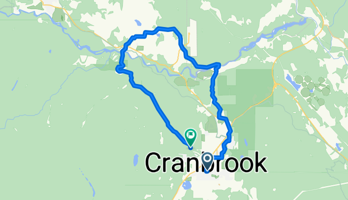
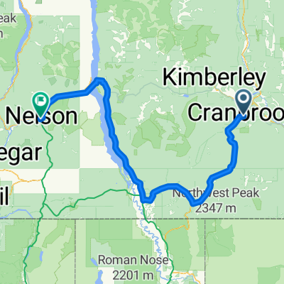
Option 2 Cranbrook -Creston
Fahrradtour in Cranbrook, British Columbia, Kanada
- 109,5 km
- Distanz
- 437 m
- Aufstieg
- 708 m
- Abstieg
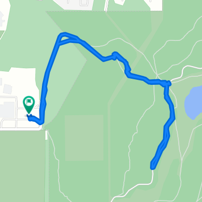
Recovered Route
Fahrradtour in Cranbrook, British Columbia, Kanada
- 36,6 km
- Distanz
- 424 m
- Aufstieg
- 435 m
- Abstieg
Mehr Routen entdecken
 18 55+ Road Race Course
- Distanz
- 13,6 km
- Aufstieg
- 152 m
- Abstieg
- 152 m
- Standort
- Cranbrook, British Columbia, Kanada
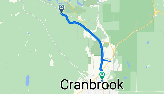
 21 Avenue North 252, Cranbrook to V1A, Kimberley
- Distanz
- 33,5 km
- Aufstieg
- 896 m
- Abstieg
- 558 m
- Standort
- Cranbrook, British Columbia, Kanada
 Can11 Cranbrook Sparwood
- Distanz
- 132,4 km
- Aufstieg
- 603 m
- Abstieg
- 382 m
- Standort
- Cranbrook, British Columbia, Kanada
 Kootenay Gravel Grinder
- Distanz
- 496,4 km
- Aufstieg
- 4.035 m
- Abstieg
- 4.035 m
- Standort
- Cranbrook, British Columbia, Kanada
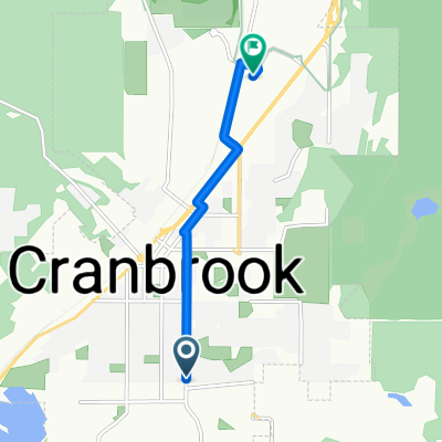 14th Avenue South 701, Cranbrook to Theatre Road 1950, Cranbrook
- Distanz
- 4,4 km
- Aufstieg
- 9 m
- Abstieg
- 55 m
- Standort
- Cranbrook, British Columbia, Kanada
 wildhorse fsr
- Distanz
- 103,6 km
- Aufstieg
- 1.510 m
- Abstieg
- 1.511 m
- Standort
- Cranbrook, British Columbia, Kanada
 NOT USED!!! Canada Day 18B: Cranbrook to Creston to Nelson
- Distanz
- 231,9 km
- Aufstieg
- 545 m
- Abstieg
- 930 m
- Standort
- Cranbrook, British Columbia, Kanada
 1st ride 😎
- Distanz
- 5,1 km
- Aufstieg
- 52 m
- Abstieg
- 44 m
- Standort
- Cranbrook, British Columbia, Kanada