
Tagesausflug mit dem Fahrrad von Minneapolis nach Mendota Heights
Erstelle deine eigene Route auf der Grundlage unserer Vorlage oder lass dich inspirieren, wie unsere Nutzer am liebsten von Minneapolis nach Mendota Heights radeln.
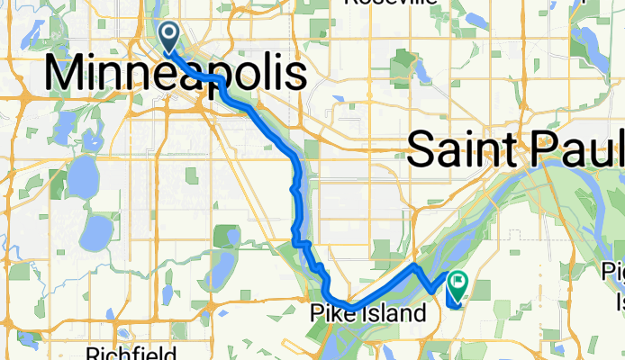
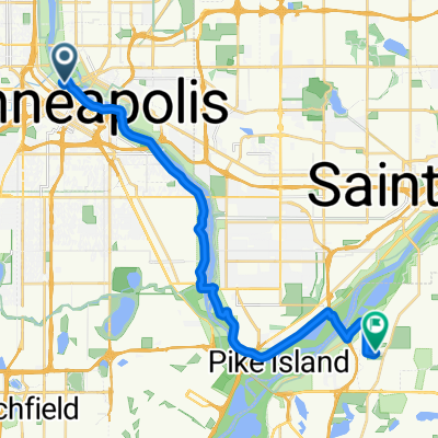
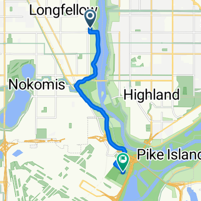
Routenvorlage
Minneapolis nach Mendota Heights
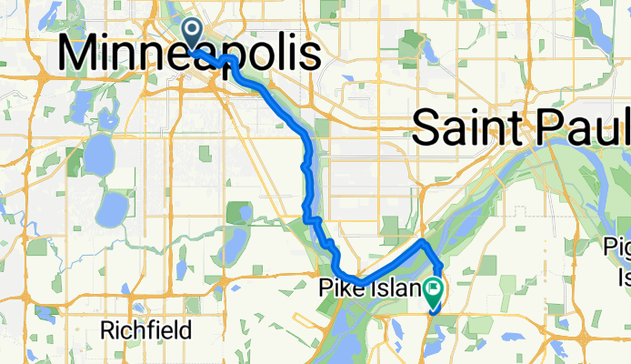
- 1 h 12 min
- Dauer
- 21,4 km
- Distanz
- 194 m
- Aufstieg
- 179 m
- Abstieg
- 17,9 km/h
- Ø-Tempo
- 275 m
- Max. Höhe
Community
Top-Mitglieder in dieser Region


Von unserer Community
Die besten Fahrradrouten von Minneapolis nach Mendota Heights

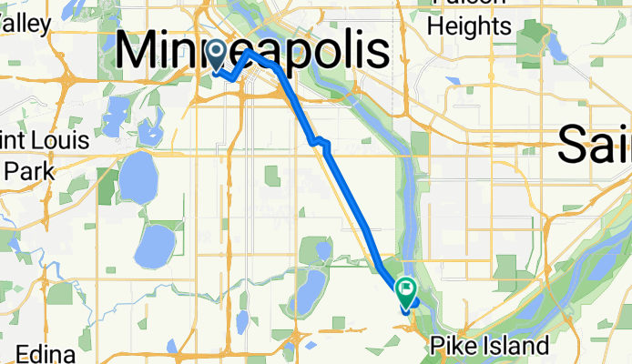
B2B00534 55407>55121 via Hiawatha Trl, Big Rivers Trl, Pilot Knob Rd
Fahrradtour in Minneapolis, Minnesota, Vereinigte Staaten
- 14,7 km
- Distanz
- 83 m
- Aufstieg
- 79 m
- Abstieg

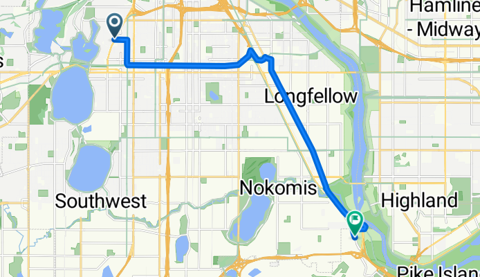
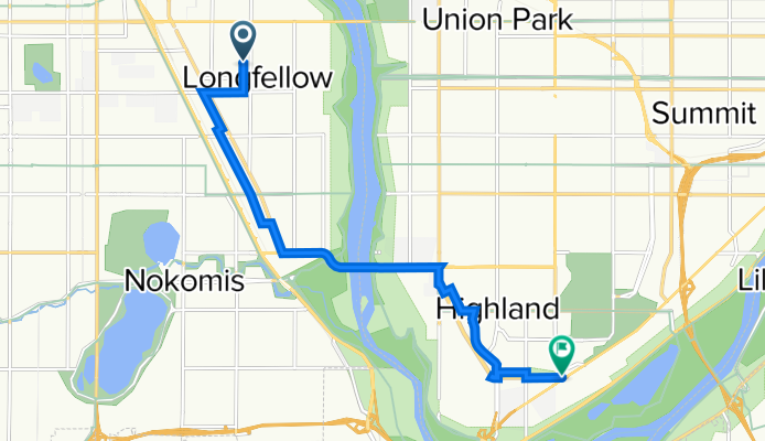
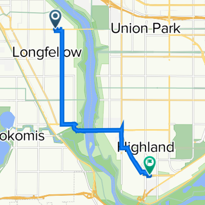
B2B00475 55406>55121 via 46th Ave S, Mendota Bridge, Pilot Knob, Lone Oak Rd
Fahrradtour in Minneapolis, Minnesota, Vereinigte Staaten
- 18,2 km
- Distanz
- 114 m
- Aufstieg
- 97 m
- Abstieg
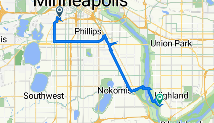
B2B00845 55405>55417 via Greenway, Minnehaha
Fahrradtour in Minneapolis, Minnesota, Vereinigte Staaten
- 12,7 km
- Distanz
- 0 m
- Aufstieg
- 17 m
- Abstieg
B2B00442 55403 > 55417 via DT Mpls, LRT Trail, Minnehaha
Fahrradtour in Minneapolis, Minnesota, Vereinigte Staaten
- 12,7 km
- Distanz
- 77 m
- Aufstieg
- 74 m
- Abstieg
Clifton Avenue 416, Minneapolis to Itasca Avenue 2086, Saint Paul
Fahrradtour in Minneapolis, Minnesota, Vereinigte Staaten
- 15,7 km
- Distanz
- 35 m
- Aufstieg
- 29 m
- Abstieg
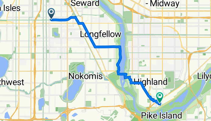
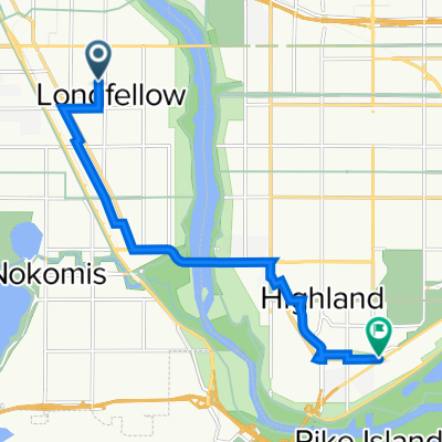
N First St, Minneapolis to Evergreen Knolls, Mendota Heights
Fahrradtour in Minneapolis, Minnesota, Vereinigte Staaten
- 22,5 km
- Distanz
- 144 m
- Aufstieg
- 118 m
- Abstieg
10th Avenue South 2830, Minneapolis to West Maynard Drive 1357W, Saint Paul
Fahrradtour in Minneapolis, Minnesota, Vereinigte Staaten
- 12,2 km
- Distanz
- 47 m
- Aufstieg
- 33 m
- Abstieg
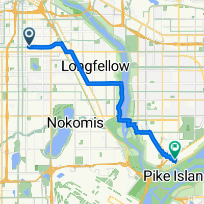
longfellow to bluff
Fahrradtour in Minneapolis, Minnesota, Vereinigte Staaten
- 3,2 km
- Distanz
- 7 m
- Aufstieg
- 13 m
- Abstieg
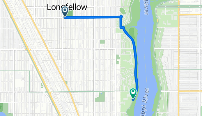
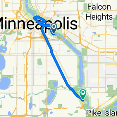
Fort Snelling
Fahrradtour in Minneapolis, Minnesota, Vereinigte Staaten
- 7,4 km
- Distanz
- 50 m
- Aufstieg
- 52 m
- Abstieg
Mpls - W River & 4th to Stone Arch Bridge and back to Minnehaha
Fahrradtour in Minneapolis, Minnesota, Vereinigte Staaten
- 15,9 km
- Distanz
- 105 m
- Aufstieg
- 96 m
- Abstieg
Mehr Routen entdecken
 Clifton Avenue 416, Minneapolis to Itasca Avenue 2086, Saint Paul
- Distanz
- 15,7 km
- Aufstieg
- 35 m
- Abstieg
- 29 m
- Standort
- Minneapolis, Minnesota, Vereinigte Staaten
 N First St, Minneapolis to Evergreen Knolls, Mendota Heights
- Distanz
- 22,5 km
- Aufstieg
- 144 m
- Abstieg
- 118 m
- Standort
- Minneapolis, Minnesota, Vereinigte Staaten
 testt
testt- Distanz
- 9,1 km
- Aufstieg
- 59 m
- Abstieg
- 65 m
- Standort
- Minneapolis, Minnesota, Vereinigte Staaten
 10th Avenue South 2830, Minneapolis to West Maynard Drive 1357W, Saint Paul
- Distanz
- 12,2 km
- Aufstieg
- 47 m
- Abstieg
- 33 m
- Standort
- Minneapolis, Minnesota, Vereinigte Staaten
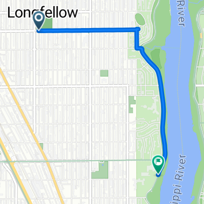 longfellow to bluff
- Distanz
- 3,2 km
- Aufstieg
- 7 m
- Abstieg
- 13 m
- Standort
- Minneapolis, Minnesota, Vereinigte Staaten
 Fort Snelling
- Distanz
- 7,4 km
- Aufstieg
- 50 m
- Abstieg
- 52 m
- Standort
- Minneapolis, Minnesota, Vereinigte Staaten
 test2
test2- Distanz
- 8,7 km
- Aufstieg
- 59 m
- Abstieg
- 64 m
- Standort
- Minneapolis, Minnesota, Vereinigte Staaten
 Mpls - W River & 4th to Stone Arch Bridge and back to Minnehaha
- Distanz
- 15,9 km
- Aufstieg
- 105 m
- Abstieg
- 96 m
- Standort
- Minneapolis, Minnesota, Vereinigte Staaten
Routen von Minneapolis
Tagesausflug mit dem Fahrrad von
Minneapolis nach Saint Paul
Tagesausflug mit dem Fahrrad von
Minneapolis nach Richfield
Kurze Fahrt mit dem Fahrrad von
Minneapolis nach Saint Louis Park
Kurze Fahrt mit dem Fahrrad von
Minneapolis nach Saint Anthony