

Day 8, 37 hilly miles from Lancaster to Tockholes
Eine Fahrradroute, die in Galgate, England, Vereinigtes Königreich beginnt.
Übersicht
Über diese Route
September 8, 2008. Today we started a half hour earlier than normal (8:00 instead of 8:30). It was a glorious day and we had not realized how pastorally "green and pleasant" is northern Lancashire just a few miles from the (former) dark satanic mills of Preston, Blackburn, Manchester, Liverpool and the dozens of factory towns in between. We turned east off the A6 at Galgate and took back roads through Oakenclough, Inglewhite, and Longridge (where we had coffee at a stylish cafe-wine bar internally integrated, we discovered on entering, with a hair salon. This was actually a short day of cycling - 37 miles in linear distance but about 4,000 feet in accumulated vertical assent. Half way to Blackburn we celebrated our "Everest moment" when the trip accumulated assent reached 29,028 feet. We began to wonder whether the line from the Beatles song was actually "there are 4,000 hills in Blackburn, Lancashire" but we eventually emerged into the rural road to Tockholes, where Charles I hid in a tree from Cromwell's army. Our cycling day ended with a relaxed late lunch at the canine-filled Royal Arms. Our hotel was The Lion, an old and quite large hotel on the High Street, of Shrewsbury.
- -:--
- Dauer
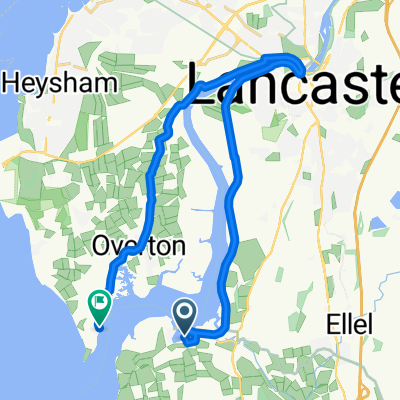
- 58,4 km
- Distanz
- 660 m
- Aufstieg
- 458 m
- Abstieg
- ---
- Ø-Tempo
- 258 m
- Max. Höhe

Fotos von der Route


Routenqualität
Wegtypen und Untergründe entlang der Route
Wegtypen
Straße
24,9 km
(43 %)
Vielbefahrene Straße
20,7 km
(35 %)
Untergründe
Befestigt
18,5 km
(32 %)
Asphalt
17,2 km
(30 %)
Befestigt (undefiniert)
1,2 km
(2 %)
Undefiniert
40 km
(68 %)
Weiter mit Bikemap
Diese Radroute verwenden, bearbeiten oder herunterladen
Du möchtest Day 8, 37 hilly miles from Lancaster to Tockholes fahren oder sie für deine eigene Reise anpassen? Folgendes kannst du mit dieser Bikemap-Route machen:
Gratis Funktionen
- Speichere diese Route als Favorit oder in einer Sammlung
- Kopiere & plane deine eigene Version dieser Route
- Synchronisiere deine Route mit Garmin oder Wahoo
Premium-Funktionen
Kostenlose Testversion für 3 Tage oder einmalige Zahlung. Mehr über Bikemap Premium.
- Navigiere diese Route auf iOS & Android
- Exportiere eine GPX / KML-Datei dieser Route
- Erstelle deinen individuellen Ausdruck (Jetzt kostenlos ausprobieren)
- Lade diese Route für die Offline-Navigation herunter
Entdecke weitere Premium-Funktionen.
Bikemap Premium aktivierenVon unserer Community
Galgate: Andere beliebte Routen, die hier beginnen
 Day 8, 37 hilly miles from Lancaster to Tockholes
- Distanz
- 58,4 km
- Aufstieg
- 660 m
- Abstieg
- 458 m
- Standort
- Galgate, England, Vereinigtes Königreich
 bowland off orad evening/weekend-henry
- Distanz
- 27,6 km
- Aufstieg
- 708 m
- Abstieg
- 713 m
- Standort
- Galgate, England, Vereinigtes Königreich
 38m Ride home via Silverdale and Arnside
- Distanz
- 61,8 km
- Aufstieg
- 562 m
- Abstieg
- 547 m
- Standort
- Galgate, England, Vereinigtes Königreich
 Glasson Marina to Sunderland Point
- Distanz
- 19,6 km
- Aufstieg
- 67 m
- Abstieg
- 65 m
- Standort
- Galgate, England, Vereinigtes Königreich
 caton short
- Distanz
- 25,4 km
- Aufstieg
- 178 m
- Abstieg
- 177 m
- Standort
- Galgate, England, Vereinigtes Königreich
 Glasson Gallimaufry
- Distanz
- 39,2 km
- Aufstieg
- 42 m
- Abstieg
- 41 m
- Standort
- Galgate, England, Vereinigtes Königreich
 Glasson Dock to Grasmere
- Distanz
- 83,6 km
- Aufstieg
- 465 m
- Abstieg
- 400 m
- Standort
- Galgate, England, Vereinigtes Königreich
 Jeremy Lane to Tithebarn Hill 2, Glasson Dock
- Distanz
- 1,2 km
- Aufstieg
- 0 m
- Abstieg
- 0 m
- Standort
- Galgate, England, Vereinigtes Königreich
In der App öffnen