

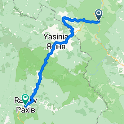
Сarpathian peaks. Route 2.
Eine Fahrradroute, die in Tatariv, Oblast Iwano-Frankiwsk, Ukraine beginnt.
Übersicht
Über diese Route
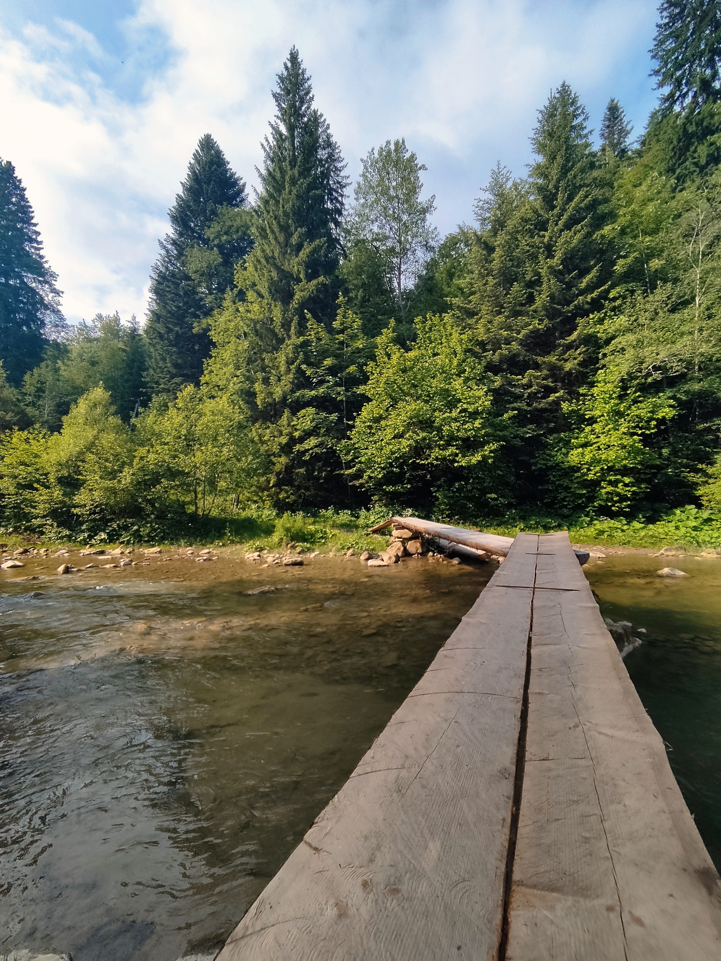
· Huk-Wasserfall. Fast jeder dritte Wasserfall in den Karpaten wird Huk genannt (das kann als "laut" übersetzt werden). Deshalb nennen wir diesen besonderen Wasserfall, der mehrere Kilometer von Mykulychyn entfernt liegt, Huk Zhenetskyi, da dieser turbulente, 15 m hohe Wasserfall am Fluss Zhenets liegt.
· Eisenbahn-Bogenbrücke (Viadukt). Eine der ältesten und längsten steinernen Bogenbrücken Europas befindet sich in Vorokhta (130 m), wobei die Länge eines der Bögen 65 m beträgt. Diese berühmte Eisenbahnbrücke wurde 1894 gebaut und bis 2000 betrieben. In Vorokhta befindet sich auch eine der ältesten hölzernen Kirchen des 17. Jahrhunderts – die Kirche der Geburt der Heiligen Jungfrau.
· Jablunyzkyj-Pass (Tatarsky-Pass) – 931 m über dem Meeresspiegel. Hier besuchen Sie den Souvenirmarkt, der nicht nur in den Karpaten, sondern in ganz Ukraine bekannt ist. In Tatariv halten wir am Denkmal aus der Zeit des Ersten Weltkriegs.
- -:--
- Dauer
- 60,1 km
- Distanz
- 621 m
- Aufstieg
- 621 m
- Abstieg
- ---
- Ø-Tempo
- ---
- Max. Höhe

Highlights der Route
POIs entlang der Route

Interessanter Ort nach 10,4 km
Waterfall Huk (may be translated as “loud”) is turbulent 15m-high waterfall situated on the Zhenets river at an altitude 900 m above sea level. Due to constant moisture and breezes from waterfall, vegetation here is very diverse.

Interessanter Ort nach 24,6 km
• Railway arched bridge (viaduct). One of the oldest and the longest stone arched bridges of Europe is situated in Vorokhta (130 m) and the length of one of the arches is 65 m. This famous railway bridge was built in 1894 and operated till 2000.

Interessanter Ort nach 37,5 km
Yablonitsky Pass is a pass through the Carpathian Mountains in Ukraine, located in the south-eastern part of Ivano-Frankivsk Oblast. It is one of several passes connecting Transcarpathia with the rest of the country. The headwaters of the Prut River are in the northern end of this pass, and its southern end is part of the Tisza River valley. Here you can visit the souvenir market known not only in the Carpathians but in the whole Ukraine.
Weiter mit Bikemap
Diese Radroute verwenden, bearbeiten oder herunterladen
Du möchtest Сarpathian peaks. Route 2. fahren oder sie für deine eigene Reise anpassen? Folgendes kannst du mit dieser Bikemap-Route machen:
Gratis Funktionen
- Speichere diese Route als Favorit oder in einer Sammlung
- Kopiere & plane deine eigene Version dieser Route
- Synchronisiere deine Route mit Garmin oder Wahoo
Premium-Funktionen
Kostenlose Testversion für 3 Tage oder einmalige Zahlung. Mehr über Bikemap Premium.
- Navigiere diese Route auf iOS & Android
- Exportiere eine GPX / KML-Datei dieser Route
- Erstelle deinen individuellen Ausdruck (Jetzt kostenlos ausprobieren)
- Lade diese Route für die Offline-Navigation herunter
Entdecke weitere Premium-Funktionen.
Bikemap Premium aktivierenVon unserer Community
Tatariv: Andere beliebte Routen, die hier beginnen
 Татарів - Микуличин - Космач - Шепіт - Білоберізка
- Distanz
- 86,2 km
- Aufstieg
- 1.640 m
- Abstieg
- 1.869 m
- Standort
- Tatariv, Oblast Iwano-Frankiwsk, Ukraine
 Khomiak by bike
- Distanz
- 38,6 km
- Aufstieg
- 1.778 m
- Abstieg
- 1.944 m
- Standort
- Tatariv, Oblast Iwano-Frankiwsk, Ukraine
 Carpathian peaks. Mt.Lisniv - Mykulychyn
- Distanz
- 41,7 km
- Aufstieg
- 855 m
- Abstieg
- 1.501 m
- Standort
- Tatariv, Oblast Iwano-Frankiwsk, Ukraine
 Сarpathian peaks. Route 2.
- Distanz
- 60,1 km
- Aufstieg
- 621 m
- Abstieg
- 621 m
- Standort
- Tatariv, Oblast Iwano-Frankiwsk, Ukraine
 Водопад Жанецкий Гук - Буковель
- Distanz
- 48,2 km
- Aufstieg
- 638 m
- Abstieg
- 636 m
- Standort
- Tatariv, Oblast Iwano-Frankiwsk, Ukraine
 Микуличин-Манява
- Distanz
- 57,9 km
- Aufstieg
- 1.675 m
- Abstieg
- 1.762 m
- Standort
- Tatariv, Oblast Iwano-Frankiwsk, Ukraine
 Татарів-Буковель-Рахів
- Distanz
- 68,5 km
- Aufstieg
- 508 m
- Abstieg
- 749 m
- Standort
- Tatariv, Oblast Iwano-Frankiwsk, Ukraine
 Carpathian Peaks. Route 1.
- Distanz
- 26,4 km
- Aufstieg
- 368 m
- Abstieg
- 369 m
- Standort
- Tatariv, Oblast Iwano-Frankiwsk, Ukraine
In der App öffnen