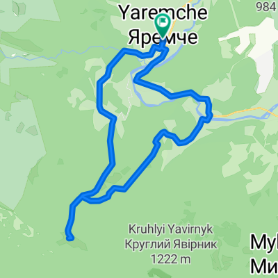
Carpathian peaks. Route 3. Rokyta-Makovytsia.
Eine Fahrradroute, die in Yaremche, Oblast Iwano-Frankiwsk, Ukraine beginnt.
Übersicht
Über diese Route
Die Route beginnt an der Brücke über den Prutets-Fluss, der durch seine Schönheit beeindruckt. Entlang des Flusscanyons fahren wir zu den Kostel-Felsen und steigen dann auf den Rokyta-Berg. Auf dem Gipfel machen wir beeindruckende Fotos und fahren über die Bergwiesen zum Makovytsia-Berg, dann geht es hinunter nach Yamna und zurück zu unserer Unterkunft.
- -:--
- Dauer
- 34,6 km
- Distanz
- 802 m
- Aufstieg
- 804 m
- Abstieg
- ---
- Ø-Tempo
- ---
- Max. Höhe
Weiter mit Bikemap
Diese Radroute verwenden, bearbeiten oder herunterladen
Du möchtest Carpathian peaks. Route 3. Rokyta-Makovytsia. fahren oder sie für deine eigene Reise anpassen? Folgendes kannst du mit dieser Bikemap-Route machen:
Gratis Funktionen
- Speichere diese Route als Favorit oder in einer Sammlung
- Kopiere & plane deine eigene Version dieser Route
- Synchronisiere deine Route mit Garmin oder Wahoo
Premium-Funktionen
Kostenlose Testversion für 3 Tage oder einmalige Zahlung. Mehr über Bikemap Premium.
- Navigiere diese Route auf iOS & Android
- Exportiere eine GPX / KML-Datei dieser Route
- Erstelle deinen individuellen Ausdruck (Jetzt kostenlos ausprobieren)
- Lade diese Route für die Offline-Navigation herunter
Entdecke weitere Premium-Funktionen.
Bikemap Premium aktivierenVon unserer Community
Yaremche: Andere beliebte Routen, die hier beginnen
 Маршрут 305 - Дівочі сльози
- Distanz
- 6 km
- Aufstieg
- 242 m
- Abstieg
- 239 m
- Standort
- Yaremche, Oblast Iwano-Frankiwsk, Ukraine
 Маршрут 304 - Оглядовий
- Distanz
- 6,2 km
- Aufstieg
- 164 m
- Abstieg
- 163 m
- Standort
- Yaremche, Oblast Iwano-Frankiwsk, Ukraine
 Маршрут 301 - Білий камінь
- Distanz
- 16 km
- Aufstieg
- 531 m
- Abstieg
- 528 m
- Standort
- Yaremche, Oblast Iwano-Frankiwsk, Ukraine
 Яремче-Явірник
- Distanz
- 17,6 km
- Aufstieg
- 699 m
- Abstieg
- 700 m
- Standort
- Yaremche, Oblast Iwano-Frankiwsk, Ukraine
 Дора-Яремче
- Distanz
- 40,3 km
- Aufstieg
- 1.375 m
- Abstieg
- 1.343 m
- Standort
- Yaremche, Oblast Iwano-Frankiwsk, Ukraine
 Carpathian peaks. Route 3. Rokyta-Makovytsia.
- Distanz
- 34,6 km
- Aufstieg
- 802 m
- Abstieg
- 804 m
- Standort
- Yaremche, Oblast Iwano-Frankiwsk, Ukraine
 2012-07-28 Дора-Синячка-Фр 80км
- Distanz
- 79,2 km
- Aufstieg
- 950 m
- Abstieg
- 1.169 m
- Standort
- Yaremche, Oblast Iwano-Frankiwsk, Ukraine
 Маршрут 303 - Легенда
- Distanz
- 11,5 km
- Aufstieg
- 162 m
- Abstieg
- 162 m
- Standort
- Yaremche, Oblast Iwano-Frankiwsk, Ukraine
In der App öffnen


