

b) 02 PR Anello Enza 3 Monticelli Terme- Mamiano -Montechiarugolo
Eine Fahrradroute, die in Monticelli Terme, Emilia-Romagna, Italy beginnt.
Übersicht
Über diese Route
Percorso a forma di 8 che unisce siti interessanti ma diversi per un anello facile in parte su ciclabile, in parte su viabilità minore e in parte su piste fluviali a bordo Enza in sponda sn. Dal centro termale di Monticelli raggiungiamo la Corte di Mamiano ora apprezzato centro di esposizioni d'arte "Magnani Rocca". Si passa successivamente per lo snodo di Basilicagoiano proseguendo verso nord e poi a destra per arrivare agli imponenti argini delle casse di espansione per la regolazione delle piene del fiume Enza, che risaliamo per circa 8 km su strada bianca incontrando la diga che ci collega a Montecchio, poi si passa sotto il primo arco del ponte della provinciale, si costeggia il galoppatoio arrivando alla bellissima vista del castello di Montechiarugolo dal lato fiume. A questo punto possiamo proseguire a bordo fiume oppure salire al castello e all'abitato di Montechiarugolo accorciando il nostro percorso di qualche km. possiamo però proseguire sulla pista ghiaiata fino all'abitato di Tortiano e non oltre perchè il torrente Masdone impedisce la ulteriore risalita dell'Enza. Da Tortiano una ciclabile ci porta a Montechiarugolo dive ritroviamo il castello da un'altra prospettiva porseguendo su ciclabile di nuovo a Basilicagioano e quindi Monticelli.
English
8-shaped cycle route that combines interesting but different sites for an easy loop partly on a cycle path, partly on a minor road network and partly on river track on the Enza side on the left bank. From the thermal center of Monticelli we reach the Corte di Mamiano, now a famous art exhibition center "Magnani Rocca". We then pass through the Basilicagoiano junction continuing north and then right to reach the imposing embankments of the expansion tanks for regulating the floods of the river Enza, which we follow up for about 8 km on a "white" road meeting the dam that eventually connects us to Montecchio, then you pass under the first arch of the bridge fo the main road, skirt the gallop reaching the beautiful view of the castle of Montechiarugolo from the river side. At this point we can continue along the river or go up to the castle and the village of Montechiarugolo, shortening our route by a few km. However, we can continue on the gravel track as far as the village of Tortiano and no further because the Masdone stream prevents the further ascent of the Enza. From Tortiano a cycle path takes us to Montechiarugolo where we find the castle from another perspective, taking the cycle path back to Basilicagioano and then Monticelli.
- -:--
- Dauer
- 36,8 km
- Distanz
- 174 m
- Aufstieg
- 177 m
- Abstieg
- ---
- Ø-Tempo
- 167 m
- Ø-Tempo

Fotos von der Route
 02 PR Anello Enza 3 Monticelli Terme- Mamiano -Montechiarugolo\"")
 02 PR Anello Enza 3 Monticelli Terme- Mamiano -Montechiarugolo\"")
Routenqualität
Wegtypen und Untergründe entlang der Route
Wegtypen
Ruhige Straße
17,3 km
(47 %)
Vielbefahrene Straße
5,5 km
(15 %)
Untergründe
Befestigt
12,4 km
(34 %)
Unbefestigt
6,5 km
(18 %)
Asphalt
11,8 km
(32 %)
Schotter
4 km
(11 %)
Highlights der Route
POIs entlang der Route
Interessanter Ort nach 16,1 km
Scorciatoia via Ballerino
Interessanter Ort nach 27 km
Salita al castello
Weiter mit Bikemap
Diese Radroute verwenden, bearbeiten oder herunterladen
Du möchtest b) 02 PR Anello Enza 3 Monticelli Terme- Mamiano -Montechiarugolo fahren oder sie für deine eigene Reise anpassen? Folgendes kannst du mit dieser Bikemap-Route machen:
Gratis Funktionen
- Speichere diese Route als Favorit oder in einer Sammlung
- Kopiere & plane deine eigene Version dieser Route
- Synchronisiere deine Route mit Garmin oder Wahoo
Premium-Funktionen
Kostenlose Testversion für 3 Tage oder einmalige Zahlung. Mehr über Bikemap Premium.
- Navigiere diese Route auf iOS & Android
- Exportiere eine GPX / KML-Datei dieser Route
- Erstelle deinen individuellen Ausdruck (Jetzt kostenlos ausprobieren)
- Lade diese Route für die Offline-Navigation herunter
Entdecke weitere Premium-Funktionen.
Bikemap Premium aktivierenVon unserer Community
Monticelli Terme: Andere beliebte Routen, die hier beginnen
 Da Via Ponticelle 31, Montechiarugolo a Strada Bassa Nuova 7, Parma
- Distanz
- 10,1 km
- Aufstieg
- 42 m
- Abstieg
- 115 m
- Standort
- Monticelli Terme, Emilia-Romagna, Italien
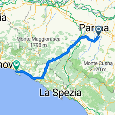
 Monticelli T Castelnuovo Monti
- Distanz
- 100,1 km
- Aufstieg
- 1.057 m
- Abstieg
- 1.074 m
- Standort
- Monticelli Terme, Emilia-Romagna, Italien
 Malandriano sivizzano
- Distanz
- 45,3 km
- Aufstieg
- 297 m
- Abstieg
- 297 m
- Standort
- Monticelli Terme, Emilia-Romagna, Italien
 Monticelli Terme Tour giorno 3
- Distanz
- 32,1 km
- Aufstieg
- 114 m
- Abstieg
- 154 m
- Standort
- Monticelli Terme, Emilia-Romagna, Italien
 Monticelli terme tour giorno 2
- Distanz
- 54,4 km
- Aufstieg
- 757 m
- Abstieg
- 752 m
- Standort
- Monticelli Terme, Emilia-Romagna, Italien
 Parma Yougo 1 Stage
- Distanz
- 218,2 km
- Aufstieg
- 13 m
- Abstieg
- 110 m
- Standort
- Monticelli Terme, Emilia-Romagna, Italien
 PR-NIZZA Stage 1
- Distanz
- 166,4 km
- Aufstieg
- 1.568 m
- Abstieg
- 1.644 m
- Standort
- Monticelli Terme, Emilia-Romagna, Italien
 Monticelli Scallucchia
- Distanz
- 143,7 km
- Aufstieg
- 1.786 m
- Abstieg
- 1.810 m
- Standort
- Monticelli Terme, Emilia-Romagna, Italien
In der App öffnen