

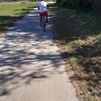
Résidence les Maisons de la Plage, Quend à Rue du Général de Gaulle, Fort-Mahon-Plage
Eine Fahrradroute, die in Fort-Mahon-Plage, Nord-Pas-de-Calais-Picardie, France beginnt.
Übersicht
Über diese Route
- 11 min
- Dauer
- 2,4 km
- Distanz
- 15 m
- Aufstieg
- 14 m
- Abstieg
- 13,7 km/h
- Ø-Tempo
- 23 m
- Ø-Tempo
Routenqualität
Wegtypen und Untergründe entlang der Route
Wegtypen
Pfad
1,8 km
(73 %)
Zufahrtsstraße
0,3 km
(12 %)
Untergründe
Befestigt
2 km
(84 %)
Unbefestigt
0 km
(<1 %)
Asphalt
2 km
(80 %)
Befestigt (undefiniert)
0,1 km
(4 %)
Weiter mit Bikemap
Diese Radroute verwenden, bearbeiten oder herunterladen
Du möchtest Résidence les Maisons de la Plage, Quend à Rue du Général de Gaulle, Fort-Mahon-Plage fahren oder sie für deine eigene Reise anpassen? Folgendes kannst du mit dieser Bikemap-Route machen:
Gratis Funktionen
- Speichere diese Route als Favorit oder in einer Sammlung
- Kopiere & plane deine eigene Version dieser Route
- Synchronisiere deine Route mit Garmin oder Wahoo
Premium-Funktionen
Kostenlose Testversion für 3 Tage oder einmalige Zahlung. Mehr über Bikemap Premium.
- Navigiere diese Route auf iOS & Android
- Exportiere eine GPX / KML-Datei dieser Route
- Erstelle deinen individuellen Ausdruck (Jetzt kostenlos ausprobieren)
- Lade diese Route für die Offline-Navigation herunter
Entdecke weitere Premium-Funktionen.
Bikemap Premium aktivierenVon unserer Community
Fort-Mahon-Plage: Andere beliebte Routen, die hier beginnen
 De Boulevard maritime Nord 55, Fort-Mahon-Plage à Camping Le Ridin, Le Crotoy
- Distanz
- 18,2 km
- Aufstieg
- 52 m
- Abstieg
- 56 m
- Standort
- Fort-Mahon-Plage, Nord-Pas-de-Calais-Picardie, Frankreich
 Fort-Mahon - Rambures (Saturday #1)
- Distanz
- 70,2 km
- Aufstieg
- 185 m
- Abstieg
- 48 m
- Standort
- Fort-Mahon-Plage, Nord-Pas-de-Calais-Picardie, Frankreich
 89 Rue Lavoisier, Fort-Mahon-Plage à 89 Rue Lavoisier, Fort-Mahon-Plage
- Distanz
- 24,4 km
- Aufstieg
- 197 m
- Abstieg
- 189 m
- Standort
- Fort-Mahon-Plage, Nord-Pas-de-Calais-Picardie, Frankreich
 Avenue des Pins 11, Quend nach Avenue des Pins 11, Quend
- Distanz
- 67,8 km
- Aufstieg
- 123 m
- Abstieg
- 123 m
- Standort
- Fort-Mahon-Plage, Nord-Pas-de-Calais-Picardie, Frankreich
 Fort-Mahon - Paris
- Distanz
- 301,8 km
- Aufstieg
- 422 m
- Abstieg
- 376 m
- Standort
- Fort-Mahon-Plage, Nord-Pas-de-Calais-Picardie, Frankreich
 Dag 8 : Fort-Mahon-Plage - Boulogne-sur-mer
- Distanz
- 61,3 km
- Aufstieg
- 157 m
- Abstieg
- 134 m
- Standort
- Fort-Mahon-Plage, Nord-Pas-de-Calais-Picardie, Frankreich
 Fort-Mahon à Deauville
- Distanz
- 308,2 km
- Aufstieg
- 757 m
- Abstieg
- 764 m
- Standort
- Fort-Mahon-Plage, Nord-Pas-de-Calais-Picardie, Frankreich
 De 2–6 Avenue Foch, Quend à 1–3 Rue de la Mairie, Wail
- Distanz
- 78 km
- Aufstieg
- 376 m
- Abstieg
- 352 m
- Standort
- Fort-Mahon-Plage, Nord-Pas-de-Calais-Picardie, Frankreich
In der App öffnen