
Danbury CT to Canaan CT
Eine Fahrradroute, die in Danbury, Connecticut, USA beginnt.
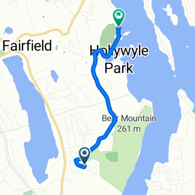
Übersicht
Über diese Route
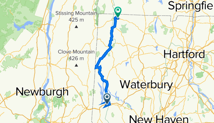
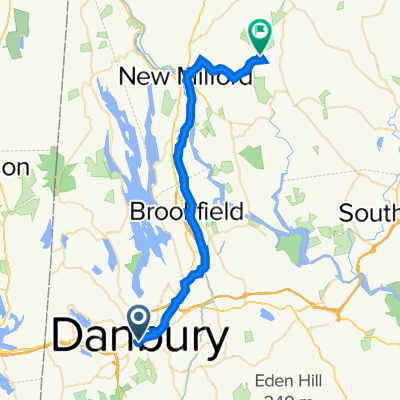
We followed the Western New England Greenway north from Danbury CT to Bulls Bridge. Along the way, in following the trail, we turned onto River Road, which was unpaved, though fortunately pretty hardpacked. This was important due to the heavy rain that had fallen yesterday and all night.
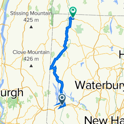
After the long climb to Bulls Bridge, I somehow misread the map and turned us onto US Highway 7, which runs along the east side of Housatonic River. The Western New England Greenway route followed the west side up to Kent, where it returned to the east side and followed US Highway 7 for most of the rest of the way to North Canaan. This was probably a blessing in disguise since I’m guessing that the west side route might well be more unpaved road. In addition, with our taking the much faster US Highway 7 from Bulls Bridge to Kent (and beyond), we probably saved an hour or so of time. As it was, we didn’t arrive at our B&B until about 7:10, which wouldn’t be too much before sunset.
Going through New Milford, we found a really charming village that should be a good place to stay and wander around.
- 8 h 22 min
- Dauer
- 93,4 km
- Distanz
- 1.269 m
- Aufstieg
- 1.139 m
- Abstieg
- 11,2 km/h
- Ø-Tempo
- 223 m
- Max. Höhe

Routenqualität
Wegtypen und Untergründe entlang der Route
Wegtypen
Vielbefahrene Straße
61,7 km
(66 %)
Ruhige Straße
20,3 km
(22 %)
Untergründe
Befestigt
22,9 km
(24 %)
Unbefestigt
5,6 km
(6 %)
Asphalt
18,4 km
(20 %)
Schotter
5,3 km
(6 %)
Weiter mit Bikemap
Diese Radroute verwenden, bearbeiten oder herunterladen
Du möchtest Danbury CT to Canaan CT fahren oder sie für deine eigene Reise anpassen? Folgendes kannst du mit dieser Bikemap-Route machen:
Gratis Funktionen
- Speichere diese Route als Favorit oder in einer Sammlung
- Kopiere & plane deine eigene Version dieser Route
- Teile sie in Etappen ein, um eine mehrtägige Tour zu erstellen
- Synchronisiere deine Route mit Garmin oder Wahoo
Premium-Funktionen
Kostenlose Testversion für 3 Tage oder einmalige Zahlung. Mehr über Bikemap Premium.
- Navigiere diese Route auf iOS & Android
- Exportiere eine GPX / KML-Datei dieser Route
- Erstelle deinen individuellen Ausdruck (Jetzt kostenlos ausprobieren)
- Lade diese Route für die Offline-Navigation herunter
Entdecke weitere Premium-Funktionen.
Bikemap Premium aktivierenVon unserer Community
Danbury: Andere beliebte Routen, die hier beginnen
 Anchor St, Danbury to 51 Walnut Hill Rd, Bethel
- Distanz
- 15,1 km
- Aufstieg
- 473 m
- Abstieg
- 471 m
- Standort
- Danbury, Connecticut, USA
 45 Grand St, Danbury to 55 Wood Creek Rd, New Fairfield
- Distanz
- 16,7 km
- Aufstieg
- 371 m
- Abstieg
- 349 m
- Standort
- Danbury, Connecticut, USA
 246 Franklin Street Ext, Danbury to 246 Franklin Street Ext, Danbury
- Distanz
- 29,2 km
- Aufstieg
- 318 m
- Abstieg
- 319 m
- Standort
- Danbury, Connecticut, USA
 31–33 Backus Ave, Danbury to 60 Beaver Brook Rd, Danbury
- Distanz
- 8 km
- Aufstieg
- 84 m
- Abstieg
- 127 m
- Standort
- Danbury, Connecticut, USA
 Danbury to Roxbury
- Distanz
- 33,2 km
- Aufstieg
- 371 m
- Abstieg
- 388 m
- Standort
- Danbury, Connecticut, USA
 Federal Road 761, Brookfield to Silvermine Road 65, Brookfield
- Distanz
- 3,7 km
- Aufstieg
- 18 m
- Abstieg
- 9 m
- Standort
- Danbury, Connecticut, USA
 Danbury CT to Canaan CT
- Distanz
- 93,4 km
- Aufstieg
- 1.269 m
- Abstieg
- 1.139 m
- Standort
- Danbury, Connecticut, USA
 Merit Badge 10 Mile 1
- Distanz
- 4 km
- Aufstieg
- 73 m
- Abstieg
- 111 m
- Standort
- Danbury, Connecticut, USA
In der App öffnen