

CYCLING THE RHINE: Route 12A
Eine Fahrradroute, die in Koblenz, Rheinland-Pfalz, Bundesrepublik Deutschland beginnt.
Übersicht
Über diese Route
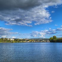
From Koblenz railway station to Bacharach railway station, following the Rhine river.
Please Note that the profile incorrectly shows some high points that do not exist, particularly at about the 5km and 40km marks.- -:--
- Dauer
- 49,7 km
- Distanz
- 179 m
- Aufstieg
- 152 m
- Abstieg
- ---
- Ø-Tempo
- ---
- Max. Höhe
Routenqualität
Wegtypen und Untergründe entlang der Route
Wegtypen
Pfad
18,1 km
(36 %)
Vielbefahrene Straße
9,7 km
(20 %)
Untergründe
Befestigt
40 km
(80 %)
Unbefestigt
0,9 km
(2 %)
Asphalt
27 km
(54 %)
Pflastersteine
7,7 km
(15 %)
Highlights der Route
POIs entlang der Route
Unterkunft nach 0,8 km
YOUTH HOSTEL: DJH Ehrenbreitstein This Youth Hostel is in the Ehrenbreitstein fortress, the second largest fortress in Europe.
Unterkunft nach 0,8 km
I have camped here and found the facilities to be excellent. The sounds of the passing river traffic is magical.
Interessanter Ort nach 6,4 km
Ferry
Unterkunft nach 8,7 km
Hotel Restaurant Roter Ochse, Hochstraße 27, 56321 RHENS. I have stayed here and highly recommend this family run establishment, both the accommodation and the cuisine. It is very cyclist-friendly too.
Interessanter Ort nach 16,2 km
Halfway point of the navigable length of the Rhine
Interessanter Ort nach 21,6 km
Ferry: Boppard - Filsen
Interessanter Ort nach 36,7 km
Ferry: St Goarhausen - St Goar
Unterkunft nach 46,7 km
YOUTH HOSTEL: DJH Kaub
Interessanter Ort nach 49,5 km
At this point the route leaves the Rhine Route, to terminate at Bacharach Railway Station.
Weiter mit Bikemap
Diese Radroute verwenden, bearbeiten oder herunterladen
Du möchtest CYCLING THE RHINE: Route 12A fahren oder sie für deine eigene Reise anpassen? Folgendes kannst du mit dieser Bikemap-Route machen:
Gratis Funktionen
- Speichere diese Route als Favorit oder in einer Sammlung
- Kopiere & plane deine eigene Version dieser Route
- Synchronisiere deine Route mit Garmin oder Wahoo
Premium-Funktionen
Kostenlose Testversion für 3 Tage oder einmalige Zahlung. Mehr über Bikemap Premium.
- Navigiere diese Route auf iOS & Android
- Exportiere eine GPX / KML-Datei dieser Route
- Erstelle deinen individuellen Ausdruck (Jetzt kostenlos ausprobieren)
- Lade diese Route für die Offline-Navigation herunter
Entdecke weitere Premium-Funktionen.
Bikemap Premium aktivierenVon unserer Community
Koblenz: Andere beliebte Routen, die hier beginnen
 mit dem Radel entlang der Mosel über Winningen nach Kobern-Gondorf
- Distanz
- 36,2 km
- Aufstieg
- 104 m
- Abstieg
- 114 m
- Standort
- Koblenz, Rheinland-Pfalz, Bundesrepublik Deutschland
 Mosel Thionville Mosel
- Distanz
- 267 km
- Aufstieg
- 1.060 m
- Abstieg
- 989 m
- Standort
- Koblenz, Rheinland-Pfalz, Bundesrepublik Deutschland
 Koblenz - Bad Ems
- Distanz
- 16,1 km
- Aufstieg
- 148 m
- Abstieg
- 139 m
- Standort
- Koblenz, Rheinland-Pfalz, Bundesrepublik Deutschland
 moseltour trier - koblenz
- Distanz
- 205,6 km
- Aufstieg
- 554 m
- Abstieg
- 483 m
- Standort
- Koblenz, Rheinland-Pfalz, Bundesrepublik Deutschland
 Koblenz -Biedenkopf auf dem Lahnradweg
- Distanz
- 223 km
- Aufstieg
- 573 m
- Abstieg
- 280 m
- Standort
- Koblenz, Rheinland-Pfalz, Bundesrepublik Deutschland
 CYCLING THE RHINE: Route 12A
- Distanz
- 49,7 km
- Aufstieg
- 179 m
- Abstieg
- 152 m
- Standort
- Koblenz, Rheinland-Pfalz, Bundesrepublik Deutschland
 Koblenz - Cochem
- Distanz
- 50,6 km
- Aufstieg
- 222 m
- Abstieg
- 209 m
- Standort
- Koblenz, Rheinland-Pfalz, Bundesrepublik Deutschland
 Ausflug Koblenz-Winningen und zurück, 22km
- Distanz
- 21,5 km
- Aufstieg
- 88 m
- Abstieg
- 90 m
- Standort
- Koblenz, Rheinland-Pfalz, Bundesrepublik Deutschland
In der App öffnen