

North East PA to Conneaut OH
Eine Fahrradroute, die in North East, Pennsylvania, United States of America beginnt.
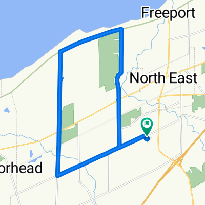
Übersicht
Über diese Route
Today was a wonderful day with some actual tailwind...rather than the daily gale force headwinds that we've been having regularly in our east to west journey. Unfortunately, my guess is that this tailwind might be the reason that the weather forecast for tomorrow includes thunderstorms.
The first part of the ride was on very low-traficked roads going thorugh vinehards and some residential areas. Nice. Then, getting onto State Rt 5/PA Bicycle Rt 517, we had good shoulder with relatively light traffic, except for when we were approaching Erie PA, when there was increased traffic. Through the worst of the trafficked areas, there was some bicycle/pedestrian path, so it wasn't bad.
Upon getting into OH, the nice road shoulder immediately disappeared. This was on US Rt 20, which had light traffic.
- 4 h 59 min
- Dauer
- 77,7 km
- Distanz
- 411 m
- Aufstieg
- 475 m
- Abstieg
- 15,6 km/h
- Ø-Tempo
- 318 m
- Ø-Tempo

Fotos von der Route


Routenqualität
Wegtypen und Untergründe entlang der Route
Wegtypen
Vielbefahrene Straße
48,3 km
(62 %)
Straße
9,1 km
(12 %)
Untergründe
Befestigt
64,7 km
(83 %)
Unbefestigt
1,5 km
(2 %)
Asphalt
61,4 km
(79 %)
Befestigt (undefiniert)
1,9 km
(2 %)
Weiter mit Bikemap
Diese Radroute verwenden, bearbeiten oder herunterladen
Du möchtest North East PA to Conneaut OH fahren oder sie für deine eigene Reise anpassen? Folgendes kannst du mit dieser Bikemap-Route machen:
Gratis Funktionen
- Speichere diese Route als Favorit oder in einer Sammlung
- Kopiere & plane deine eigene Version dieser Route
- Synchronisiere deine Route mit Garmin oder Wahoo
Premium-Funktionen
Kostenlose Testversion für 3 Tage oder einmalige Zahlung. Mehr über Bikemap Premium.
- Navigiere diese Route auf iOS & Android
- Exportiere eine GPX / KML-Datei dieser Route
- Erstelle deinen individuellen Ausdruck (Jetzt kostenlos ausprobieren)
- Lade diese Route für die Offline-Navigation herunter
Entdecke weitere Premium-Funktionen.
Bikemap Premium aktivierenVon unserer Community
North East: Andere beliebte Routen, die hier beginnen
 Recorded via Apple Watch at Aug 18 at 19:23
- Distanz
- 16,2 km
- Aufstieg
- 60 m
- Abstieg
- 60 m
- Standort
- North East, Pennsylvania, USA
 To buffalo
- Distanz
- 236,6 km
- Aufstieg
- 1.378 m
- Abstieg
- 1.414 m
- Standort
- North East, Pennsylvania, USA
 Recorded via Apple Watch at Jul 05 at 19:46
- Distanz
- 6,8 km
- Aufstieg
- 51 m
- Abstieg
- 61 m
- Standort
- North East, Pennsylvania, USA
 Recorded via Apple Watch at Aug 08 at 19:22
- Distanz
- 13,2 km
- Aufstieg
- 61 m
- Abstieg
- 63 m
- Standort
- North East, Pennsylvania, USA
 Recorded via Apple Watch at Aug 13 at 15:41
- Distanz
- 10,6 km
- Aufstieg
- 42 m
- Abstieg
- 45 m
- Standort
- North East, Pennsylvania, USA
 Sidehill Long Ride
- Distanz
- 24,4 km
- Aufstieg
- 100 m
- Abstieg
- 99 m
- Standort
- North East, Pennsylvania, USA
 Recorded via Apple Watch at Jul 27 at 19:18
- Distanz
- 19,4 km
- Aufstieg
- 77 m
- Abstieg
- 75 m
- Standort
- North East, Pennsylvania, USA
 New York
- Distanz
- 749 km
- Aufstieg
- 960 m
- Abstieg
- 1.082 m
- Standort
- North East, Pennsylvania, USA
In der App öffnen