

CYCLING THE RHINE: Route Approach B
Eine Fahrradroute, die in Hoek van Holland, Südholland, Niederlande beginnt.
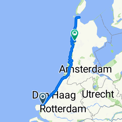
Übersicht
Über diese Route
Europoort-Fährterminal zu
1. Fährterminal Hoek van Holland (przez prom Maassluis)
2. Fährterminal Scheveningen (Haga / Den Haag)
3. Katwijk aan Zee (Stary Zamek Renu)
To jest trasa podejścia do punktu startowego szlaku Renu, w Katwijk aan Zee, jak opisano w przewodniku rowerowym "CYCLING THE RHINE ROUTE" autorstwa Johna Powella.
UWAGA: Jest prom z Europoortu do Hoek van Holland. Opisana trasa prowadzi przez prom Maassluis, przez park dzikich zwierząt, obok bunkrów z okresu wojen, wzdłuż prawego brzegu Nowej Wody.
- -:--
- Dauer
- 64,1 km
- Distanz
- 58 m
- Aufstieg
- 59 m
- Abstieg
- ---
- Ø-Tempo
- ---
- Max. Höhe
Highlights der Route
POIs entlang der Route
Interessanter Ort nach 11,4 km
Route signs (LF1b and Maassluis ferry) may persuade you to turn right here. You can safely follow the signs; you'll be taken around the houses, but end up at the Maassluis ferry all the same.
Weiter mit Bikemap
Diese Radroute verwenden, bearbeiten oder herunterladen
Du möchtest CYCLING THE RHINE: Route Approach B fahren oder sie für deine eigene Reise anpassen? Folgendes kannst du mit dieser Bikemap-Route machen:
Gratis Funktionen
- Speichere diese Route als Favorit oder in einer Sammlung
- Kopiere & plane deine eigene Version dieser Route
- Synchronisiere deine Route mit Garmin oder Wahoo
Premium-Funktionen
Kostenlose Testversion für 3 Tage oder einmalige Zahlung. Mehr über Bikemap Premium.
- Navigiere diese Route auf iOS & Android
- Exportiere eine GPX / KML-Datei dieser Route
- Erstelle deinen individuellen Ausdruck (Jetzt kostenlos ausprobieren)
- Lade diese Route für die Offline-Navigation herunter
Entdecke weitere Premium-Funktionen.
Bikemap Premium aktivierenVon unserer Community
Hoek van Holland: Andere beliebte Routen, die hier beginnen
 Route to Delft
- Distanz
- 21,8 km
- Aufstieg
- 11 m
- Abstieg
- 11 m
- Standort
- Hoek van Holland, Südholland, Niederlande
 Easter Cycling
- Distanz
- 201,4 km
- Aufstieg
- 639 m
- Abstieg
- 627 m
- Standort
- Hoek van Holland, Südholland, Niederlande
 Eurovelo 15 Rhine route
- Distanz
- 1.449,6 km
- Aufstieg
- 6.996 m
- Abstieg
- 5.560 m
- Standort
- Hoek van Holland, Südholland, Niederlande
 Periple 11 / 32
- Distanz
- 161,8 km
- Aufstieg
- 98 m
- Abstieg
- 60 m
- Standort
- Hoek van Holland, Südholland, Niederlande
 CYCLING THE RHINE: Route Approach D
- Distanz
- 115,8 km
- Aufstieg
- 12 m
- Abstieg
- 13 m
- Standort
- Hoek van Holland, Südholland, Niederlande
 Europort - Alkmaar -1
- Distanz
- 127,6 km
- Aufstieg
- 301 m
- Abstieg
- 304 m
- Standort
- Hoek van Holland, Südholland, Niederlande
 Hook to Amsterdam
- Distanz
- 87,3 km
- Aufstieg
- 22 m
- Abstieg
- 21 m
- Standort
- Hoek van Holland, Südholland, Niederlande
 Van Hoek van Holland langs de Nieuwe Waterweg naar Maassluis
- Distanz
- 29,2 km
- Aufstieg
- 15 m
- Abstieg
- 13 m
- Standort
- Hoek van Holland, Südholland, Niederlande
In der App öffnen