

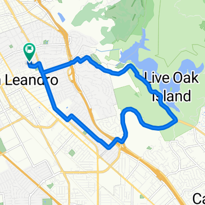
San Leandro, CA to Point Arena to San Francisco Ferry Bldg Circuit
Eine Fahrradroute, die in San Leandro, Kalifornien, Vereinigte Staaten beginnt.
Übersicht
Über diese Route
Eine akzeptable Route mit einem Terrain, das von flach über hügelig bis steil variiert. Das Segment von Orinda nach Pinole ist angenehm, mit wenig Verkehr (das wurde an einem Wochentag gemacht), anders als das Segment von Pinole nach Cloverdale. Von Cloverdale nach Point Arena werden die Hügel progressiv schlimmer – und noch schlimmer, wenn die Hitze steigt – mit zwei langen Anstiegen mit 16 % Steigung auf der engen Straße zwischen Boonville und Point Arena. Bringen Sie genügend Wasser mit. (Ich habe sechs Liter verbraucht). Eine Alternative ist, auf der Hwy 128 an Boonville vorbei zur Hwy 1 an der Küste zu fahren, direkt unterhalb von Mendocino; dies wird etwa 15 Meilen zur Route hinzufügen. Sie werden immer noch einige herausfordernde Hügel zwischen Cloverdale und Boonville (sowie zwischen Boonville und Hwy 1) haben, aber Sie werden die 16 %-Steigungen (und die enge Straße) westlich von Boonville vermeiden. Das Küstensegment ist vorhersehbar schön, und der Rückenwind erfrischt und fördert zugleich.
- -:--
- Dauer
- 613,1 km
- Distanz
- 1.308 m
- Aufstieg
- 1.308 m
- Abstieg
- ---
- Ø-Tempo
- ---
- Max. Höhe

Routenqualität
Wegtypen und Untergründe entlang der Route
Wegtypen
Radweg
73,6 km
(12 %)
Ruhige Straße
67,4 km
(11 %)
Untergründe
Befestigt
257,5 km
(42 %)
Asphalt
233 km
(38 %)
Beton
18,4 km
(3 %)
Weiter mit Bikemap
Diese Radroute verwenden, bearbeiten oder herunterladen
Du möchtest San Leandro, CA to Point Arena to San Francisco Ferry Bldg Circuit fahren oder sie für deine eigene Reise anpassen? Folgendes kannst du mit dieser Bikemap-Route machen:
Gratis Funktionen
- Speichere diese Route als Favorit oder in einer Sammlung
- Kopiere & plane deine eigene Version dieser Route
- Teile sie in Etappen ein, um eine mehrtägige Tour zu erstellen
- Synchronisiere deine Route mit Garmin oder Wahoo
Premium-Funktionen
Kostenlose Testversion für 3 Tage oder einmalige Zahlung. Mehr über Bikemap Premium.
- Navigiere diese Route auf iOS & Android
- Exportiere eine GPX / KML-Datei dieser Route
- Erstelle deinen individuellen Ausdruck (Jetzt kostenlos ausprobieren)
- Lade diese Route für die Offline-Navigation herunter
Entdecke weitere Premium-Funktionen.
Bikemap Premium aktivierenVon unserer Community
San Leandro: Andere beliebte Routen, die hier beginnen
 San Leandro - Alameda Loop
- Distanz
- 43 km
- Aufstieg
- 45 m
- Abstieg
- 48 m
- Standort
- San Leandro, Kalifornien, Vereinigte Staaten
 Chabot Loop 1
- Distanz
- 13 km
- Aufstieg
- 226 m
- Abstieg
- 227 m
- Standort
- San Leandro, Kalifornien, Vereinigte Staaten
 San Leandro - Lake Chabot - Palomares Road - Niles Canyon Circuit
- Distanz
- 58,9 km
- Aufstieg
- 525 m
- Abstieg
- 525 m
- Standort
- San Leandro, Kalifornien, Vereinigte Staaten
 Davis Street 1919, San Leandro to Post Street 711, San Francisco
- Distanz
- 36,8 km
- Aufstieg
- 145 m
- Abstieg
- 83 m
- Standort
- San Leandro, Kalifornien, Vereinigte Staaten
 Lake Chabot Circuit
- Distanz
- 12,8 km
- Aufstieg
- 237 m
- Abstieg
- 237 m
- Standort
- San Leandro, Kalifornien, Vereinigte Staaten
 The Grand Cru: Tour de Biere 2013
- Distanz
- 31,4 km
- Aufstieg
- 30 m
- Abstieg
- 30 m
- Standort
- San Leandro, Kalifornien, Vereinigte Staaten
 San Leandro, CA to Point Arena to San Francisco Ferry Bldg Circuit
- Distanz
- 613,1 km
- Aufstieg
- 1.308 m
- Abstieg
- 1.308 m
- Standort
- San Leandro, Kalifornien, Vereinigte Staaten
 Enhanced commute
- Distanz
- 18 km
- Aufstieg
- 32 m
- Abstieg
- 29 m
- Standort
- San Leandro, Kalifornien, Vereinigte Staaten
In der App öffnen