

Alpine Gravel - Lago di Celentino
Eine Fahrradroute, die in Ossana, Trentino-Alto Adige, Italy beginnt.
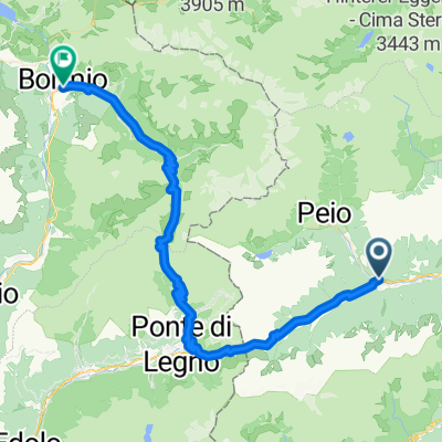
Übersicht
Über diese Route
First a steep ascent, then an excellent climb on a well-maintained forest road to Malga Campo (Strudel!!!). To get to Lake Celentino technical flat section on forest trail with possible portage. Breathtaking Lago Celentino viewpoint and then technical trail in beautiful alpine surroundings to the hut. From here onwards rough or very rough dirt road downhill with considerable gradients. Ascent from Malga Stabli on an excellent forest road to a private alpine hut. From there, descend first on rough forest road, then very smooth and fast to reach the tarmac road. Once at the bottom of the valley, continue along the Val di Sole cycle path to Ossana.
Water supplies possible along the entire route, Malga Campo and Malga Satabli with gastronomic offerings.
We recommend a minimum tyre width of 45 mm, tubeless.
- -:--
- Dauer
- 41,5 km
- Distanz
- 1.656 m
- Aufstieg
- 1.645 m
- Abstieg
- ---
- Ø-Tempo
- 2.136 m
- Ø-Tempo

Fotos von der Route


Routenqualität
Wegtypen und Untergründe entlang der Route
Wegtypen
Forst- / Feldweg
20,8 km
(50 %)
Pfad
9 km
(22 %)
Untergründe
Befestigt
8,7 km
(21 %)
Unbefestigt
21,3 km
(51 %)
Asphalt
8,3 km
(20 %)
Loser Schotter
7,5 km
(18 %)
Weiter mit Bikemap
Diese Radroute verwenden, bearbeiten oder herunterladen
Du möchtest Alpine Gravel - Lago di Celentino fahren oder sie für deine eigene Reise anpassen? Folgendes kannst du mit dieser Bikemap-Route machen:
Gratis Funktionen
- Speichere diese Route als Favorit oder in einer Sammlung
- Kopiere & plane deine eigene Version dieser Route
- Synchronisiere deine Route mit Garmin oder Wahoo
Premium-Funktionen
Kostenlose Testversion für 3 Tage oder einmalige Zahlung. Mehr über Bikemap Premium.
- Navigiere diese Route auf iOS & Android
- Exportiere eine GPX / KML-Datei dieser Route
- Erstelle deinen individuellen Ausdruck (Jetzt kostenlos ausprobieren)
- Lade diese Route für die Offline-Navigation herunter
Entdecke weitere Premium-Funktionen.
Bikemap Premium aktivierenVon unserer Community
Ossana: Andere beliebte Routen, die hier beginnen
 Ossana - Tonalle - Gavia - Bormio
- Distanz
- 67,2 km
- Aufstieg
- 2.268 m
- Abstieg
- 2.024 m
- Standort
- Ossana, Trentino - Südtirol, Italien
 Val di Sole Ossana - Caldes A-R
- Distanz
- 44,7 km
- Aufstieg
- 402 m
- Abstieg
- 401 m
- Standort
- Ossana, Trentino - Südtirol, Italien
 Epic Trail Grande Guerra - MowiBike
- Distanz
- 59,4 km
- Aufstieg
- 0 m
- Abstieg
- 0 m
- Standort
- Ossana, Trentino - Südtirol, Italien
 Ossana - Caldes
- Distanz
- 42,2 km
- Aufstieg
- 588 m
- Abstieg
- 593 m
- Standort
- Ossana, Trentino - Südtirol, Italien
 Abzweig Osanna-Begflanke-Merilleva-Madonna
- Distanz
- 39,5 km
- Aufstieg
- 2.434 m
- Abstieg
- 1.875 m
- Standort
- Ossana, Trentino - Südtirol, Italien
 Dag 3
Dag 3- Distanz
- 70,5 km
- Aufstieg
- 2.007 m
- Abstieg
- 2.330 m
- Standort
- Ossana, Trentino - Südtirol, Italien
 Pejo - La strada militare
- Distanz
- 38,3 km
- Aufstieg
- 1.037 m
- Abstieg
- 1.038 m
- Standort
- Ossana, Trentino - Südtirol, Italien
 Val di Sole Ossana - Caldes
- Distanz
- 41,7 km
- Aufstieg
- 385 m
- Abstieg
- 389 m
- Standort
- Ossana, Trentino - Südtirol, Italien
In der App öffnen